Buthidaung
| Buthidaung ဘူးသီးတောင်မြို့ | |
|---|---|
 Buthidaung Location in Myanmar (Burma) | |
| Coordinates: 20°52′00″N 92°32′00″E / 20.86667°N 92.53333°E | |
| Country |
|
| Division | Rakhine State |
| District | Maungdaw District |
| Township | Buthidaung Township |
| Population (2014) | |
| • Total | 55,545[1] |
| • Ethnicities |
93% Rohingya 6% Rakhine <1% Others |
| • Religions | Islam, Buddhism |
| Time zone | MMT (UTC+6.30) |
| Area code(s) | 42, 43 |
Buthidaung (Burmese: ဘူးသီးတောင်မြို့; MLCTS: bu:si:taung mrui., pronounced: [búðídàʊɴ mjo̰]) is a town in Rakhine State, in the westernmost part of Myanmar (Burma). It is the administrative seat of the Buthidaung Township. Buthidaung lies on the west bank of the Mayu river, and experienced severe flooding in June 2010 and July 2011.[2] Buthidaung is 16 miles away from Maungdaw. The two towns are connected by two tunnels through the Mayu mountains that were built in 1918.
References
- ↑ "Buthidaung (Township, Myanmar) - Population Statistics and Location in Maps and Charts". www.citypopulation.de. Retrieved 27 September 2016.
- ↑ mizzima.com/news/inside-burma/5650-seven-townships-in-arakan-state-flooded-by-record-heavy-rain.html
External links
Capital: Sittwe | ||
| Kyaukpyu District |  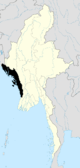 | |
| Maungdaw District | ||
| Sittwe District | ||
| Thandwe District |
| |
| Mrauk-U District | ||
| Main cities and towns | ||
Coordinates: 20°52′N 92°32′E / 20.867°N 92.533°E
This article is issued from Wikipedia - version of the 9/30/2016. The text is available under the Creative Commons Attribution/Share Alike but additional terms may apply for the media files.