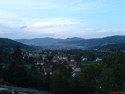
Busovača
| Busovača Бусовача | |
|---|---|
| Municipality and town | |
 | |
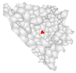 Location of Busovača within Bosnia and Herzegovina. | |
 Busovača Location of Busovača | |
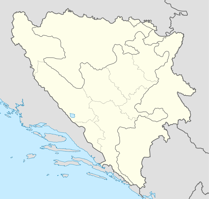
| Coordinates: 44°06′N 17°53′E / 44.100°N 17.883°E | |
| Country |
|
| Entity | Federation of Bosnia and Herzegovina |
| Canton | Central Bosnia Canton |
| Government | |
| • Municipality president | Asim Mekić (SDA) |
| Area | |
| • Total | 158 km2 (61 sq mi) |
| Population (2013 census) | |
| • Total | 18,488 |
| • Density | 119/km2 (310/sq mi) |
| Time zone | CET (UTC+1) |
| • Summer (DST) | CEST (UTC+2) |
| Area code(s) | +387 30 |
| Website | www.busovaca.net |
Busovača is a small town and municipality in Bosnia and Herzegovina. It is 60 km (37 mi) from Sarajevo, 21 km (13 mi) from Zenica, and 30 km (19 mi) from Travnik.
History
During the Croat–Bosniak War, the city saw heavy fighting between the Army of the Republic of Bosnia and Herzegovina and the Croatian Defence Council. Today, Busovača is recovering from the war and with its small economy and infrastructure it is becoming an important crossroad between bigger cities.
Demographics
1971
14.428 total
- Croats - 7.646 (52,99%)
- Bosniaks (i.e. Bosnian Muslims) - 5.896 (40,86%)
- Serbs - 735 (5,09%)
- Yugoslavs - 60 (0,41%)
- others - 91 (0,65%)
1991
18.879 total
- Croats - 9.093 (48,16%)
- Bosniaks - 8.451 (44,76%)
- Serbs - 623 (3,29%)
- Yugoslavs - 510 (2,70%)
- Others - 202 (1,06%)
Source: http://www.hdmagazine.com/bosnia/census/cens-c.html
Settlements
• Bare • Bukovci • Buselji • Busovača • Carica • Dobraljevo • Dolac • Donja Rovna • Gornja Rovna • Grablje • Granice • Gusti Grab • Hozanovići • Hrasno • Javor • Jazvine • Jelinak • Kaćuni • Kaonik • Katići • Kovačevac • Krčevine • Krvavičići • Kula • Kupres • Lončari • Mehurići • Merdani • Mihaljevići • Milavice • Nezirovići • Očehnići • Oselište • Podbare • Podjele • Podstijena • Polje • Prosje • Putiš • Ravan • Skradno • Solakovići • Strane • Stubica • Šudine • Turići i Zarače.
References
External links
| Wikimedia Commons has media related to Busovača. |
Municipalities of the Central Bosnia Canton | ||
|---|---|---|
Coordinates: 44°06′N 17°53′E / 44.100°N 17.883°E