Bushnell, Nebraska
| Bushnell, Nebraska | |
|---|---|
| Village | |
|
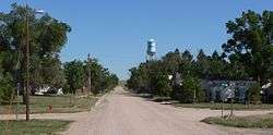
Bushnell, looking north along Birch Street | |
 Location of Bushnell, Nebraska | |
| Coordinates: 41°13′56″N 103°53′33″W / 41.23222°N 103.89250°WCoordinates: 41°13′56″N 103°53′33″W / 41.23222°N 103.89250°W | |
| Country | United States |
| State | Nebraska |
| County | Kimball |
| Area[1] | |
| • Total | 0.23 sq mi (0.60 km2) |
| • Land | 0.23 sq mi (0.60 km2) |
| • Water | 0 sq mi (0 km2) |
| Elevation | 4,872 ft (1,485 m) |
| Population (2010)[2] | |
| • Total | 124 |
| • Estimate (2012[3]) | 124 |
| • Density | 539.1/sq mi (208.1/km2) |
| Time zone | Mountain (MST) (UTC-7) |
| • Summer (DST) | MDT (UTC-6) |
| ZIP code | 69128 |
| Area code(s) | 308 |
| FIPS code | 31-07415 |
| GNIS feature ID | 0827814[4] |
Bushnell is a village in Kimball County, Nebraska, United States. The population was 124 at the 2010 census.
Geography
Bushnell is located at 41°13′56″N 103°53′33″W / 41.23222°N 103.89250°W (41.232230, −103.892377).[5]
According to the United States Census Bureau, the village has a total area of 0.23 square miles (0.60 km2), all of it land.[1]
History
Bushnell was founded in 1867.[6] The village is named after Cornelius Scranton Bushnell, a major figure in the development of the ironclads in the American Civil War.[7]
Demographics
| Historical population | |||
|---|---|---|---|
| Census | Pop. | %± | |
| 1920 | 321 | — | |
| 1930 | 341 | 6.2% | |
| 1940 | 252 | −26.1% | |
| 1950 | 225 | −10.7% | |
| 1960 | 266 | 18.2% | |
| 1970 | 211 | −20.7% | |
| 1980 | 187 | −11.4% | |
| 1990 | 119 | −36.4% | |
| 2000 | 162 | 36.1% | |
| 2010 | 124 | −23.5% | |
| Est. 2015 | 121 | [8] | −2.4% |
| U.S. Decennial Census[9] 2012 Estimate[10] | |||
2010 census
As of the census[2] of 2010, there were 124 people, 60 households, and 39 families residing in the village. The population density was 539.1 inhabitants per square mile (208.1/km2). There were 88 housing units at an average density of 382.6 per square mile (147.7/km2). The racial makeup of the village was 96.8% White, 0.8% African American, and 2.4% from two or more races. Hispanic or Latino of any race were 3.2% of the population.
There were 60 households of which 16.7% had children under the age of 18 living with them, 56.7% were married couples living together, 3.3% had a female householder with no husband present, 5.0% had a male householder with no wife present, and 35.0% were non-families. 31.7% of all households were made up of individuals and 18.3% had someone living alone who was 65 years of age or older. The average household size was 2.07 and the average family size was 2.56.
The median age in the village was 54.5 years. 12.9% of residents were under the age of 18; 3.9% were between the ages of 18 and 24; 13.6% were from 25 to 44; 39.6% were from 45 to 64; and 29.8% were 65 years of age or older. The gender makeup of the village was 46.8% male and 53.2% female.
2000 census
As of the census of 2000, there were 162 people, 70 households, and 44 families residing in the village. The population density was 769.7 people per square mile (297.9/km²). There were 86 housing units at an average density of 408.6 per square mile (158.1/km²). The racial makeup of the village was 99.38% White and 0.62% Pacific Islander. Hispanic or Latino of any race were 6.79% of the population.
There were 70 households out of which 20.0% had children under the age of 18 living with them, 61.4% were married couples living together, 1.4% had a female householder with no husband present, and 37.1% were non-families. 28.6% of all households were made up of individuals and 14.3% had someone living alone who was 65 years of age or older. The average household size was 2.31 and the average family size was 2.91.
In the village the population was spread out with 21.6% under the age of 18, 5.6% from 18 to 24, 18.5% from 25 to 44, 30.9% from 45 to 64, and 23.5% who were 65 years of age or older. The median age was 48 years. For every 100 females there were 97.6 males. For every 100 females age 18 and over, there were 108.2 males.
As of 2000 the median income for a household in the village was $26,750, and the median income for a family was $30,750. Males had a median income of $26,250 versus $16,406 for females. The per capita income for the village was $13,024. About 8.5% of families and 7.2% of the population were below the poverty line, including none of those under the age of eighteen and 12.8% of those sixty five or over.
Culture
The annual Bushnell Day parade and festivities are held on the third Saturday in August.
Notable people
- Ken Sailors - professional basketball player
| Wikimedia Commons has media related to Bushnell, Nebraska. |
References
- 1 2 "US Gazetteer files 2010". United States Census Bureau. Archived from the original on January 24, 2012. Retrieved 2012-06-24.
- 1 2 "American FactFinder". United States Census Bureau. Retrieved 2012-06-24.
- ↑ "Population Estimates". United States Census Bureau. Archived from the original on June 17, 2013. Retrieved 2013-05-29.
- ↑ "US Board on Geographic Names". United States Geological Survey. 2007-10-25. Retrieved 2008-01-31.
- ↑ "US Gazetteer files: 2010, 2000, and 1990". United States Census Bureau. 2011-02-12. Retrieved 2011-04-23.
- ↑ "History of Bushnell". Village of Bushnell. Retrieved 2012-09-18.
- ↑ Exploring Nebraska Highways: Trip Trivia. Exploring America's Highway. 2007. p. 58. ISBN 978-0-9744358-7-9.
- ↑ "Annual Estimates of the Resident Population for Incorporated Places: April 1, 2010 to July 1, 2015". Retrieved July 2, 2016.
- ↑ United States Census Bureau. "Census of Population and Housing". Archived from the original on May 11, 2015. Retrieved October 19, 2013.
- ↑ "Annual Estimates of the Resident Population: April 1, 2010 to July 1, 2012". Retrieved October 19, 2013.
Municipalities and communities of Kimball County, Nebraska, United States | ||
|---|---|---|
| City | ||
| Villages | ||
| Unincorporated communities | ||