Burr's Ferry Bridge
| Burr's Ferry Bridge | |
|---|---|
 | |
| Coordinates | |
|
Burr's Ferry Bridge | |
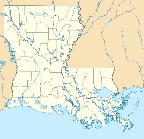  | |
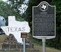
| Location | Spans Sabine River where LA 8 in Burr Ferry, Louisiana and Texas highway 63 meet in Newton County |
| Coordinates | 31°3′52″N 93°31′22″W / 31.06444°N 93.52278°WCoordinates: 31°3′52″N 93°31′22″W / 31.06444°N 93.52278°W |
| Built | 1937 |
| Architect | Louisiana Highway Commission |
| MPS | Historic Bridges of Louisiana TR |
| NRHP Reference # | 98000563[1] |
| Added to NRHP | May 18, 1998 |
| Carries |
|
| Crosses | Sabine River |
| Locale | Burr Ferry, Louisiana and Newton County, Texas |
| Maintained by | Louisiana Department of Transportation |
| ID number | NW0214-04-005 (Texas) |
| Characteristics | |
| Clearance above | 12 feet 8 inches (4 m) |
| History | |
| Opened | circa 1925 |
Burr's Ferry Bridge is a bridge on the Sabine River where LA 8 meets Texas State Highway 63 at the Louisiana and Texas state lines.
See also
Sabine River (Texas–Louisiana)
References
- ↑ National Park Service (2009-03-13). "National Register Information System". National Register of Historic Places. National Park Service.
External links
- Sabine River from the Handbook of Texas Online
- U.S. Geological Survey Geographic Names Information System: Sabine River
- Sabine River Authority of Texas
- Sabine River History: Newton County, Texas
Gallery
This article is issued from Wikipedia - version of the 11/28/2016. The text is available under the Creative Commons Attribution/Share Alike but additional terms may apply for the media files.