Burnhope Seat
| Burnhope Seat | |
|---|---|
 Burnhope Seat Summit | |
| Highest point | |
| Elevation | 747 m (2,451 ft) |
| Prominence | 190 m (620 ft) |
| Parent peak | Cross Fell |
| Listing | Hewitt, Marilyn, Nuttall |
| Geography | |
| Location | Cumbria and County Durham, England |
| Parent range | North Pennines |
| OS grid | NY785375 |
| Topo map | OS Landranger 91 |
Burnhope Seat is a moor in the North Pennines of England. It lies between the heads of the Rivers Tees, South Tyne and Wear. The summit is crossed by the boundary between County Durham and Cumbria (historically Cumberland). It is the highest point in historic County Durham.
The B6277 road between Alston and Middleton-in-Teesdale passes within 2 km of the summit, thus providing the easiest route of ascent. The hill may also be climbed from Weardale as part of high-level circuit of Burnhope Reservoir. The highest point of the hill lies in Cumbria, some 200 m west of a trig point on the border.
There are some ski-tows on the northwest slopes of the hill - this forms the Yad Moss ski facility,[1] which has recently been upgraded by Sport England.
The entire area is designated "access land" under the terms of the Countryside and Rights of Way Act 2000.
Coordinates: 54°43′55″N 2°20′07″W / 54.73202°N 2.33539°W
Marilyns of Northern England | ||
|---|---|---|
| 1. Northumberland | 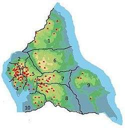 | |
| 2. Northern Lakeland | ||
| 3. Western Lakeland | ||
| 4. Central and Southern Lakeland | ||
| 5. Eastern Lakeland | ||
| 6. North Pennines and Durham | ||
| 7. Northern Yorkshire Dales | ||
| 8. Southern Yorkshire Dales | ||
| 9. North York Moors to the Humber | ||
| 10. Forest of Bowland | ||