Burney, California
| Burney | |
|---|---|
| census-designated place | |
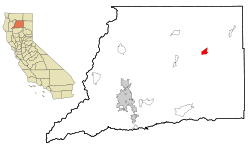 Location in Shasta County and the state of California | |
| Coordinates: 40°52′50″N 121°40′0″W / 40.88056°N 121.66667°WCoordinates: 40°52′50″N 121°40′0″W / 40.88056°N 121.66667°W | |
| Country |
|
| State |
|
| County | Shasta |
| Area[1] | |
| • Total | 5.201 sq mi (13.470 km2) |
| • Land | 5.196 sq mi (13.457 km2) |
| • Water | 0.005 sq mi (0.013 km2) 0.09% |
| Elevation | 3,195 ft (952 m) |
| Population (2010) | |
| • Total | 3,154 |
| • Density | 610/sq mi (230/km2) |
| Time zone | Pacific (PST) (UTC-8) |
| • Summer (DST) | PDT (UTC-7) |
| ZIP code | 96013 |
| Area code(s) | 530 |
| FIPS code | 06-09122 |
| GNIS feature ID | 0277481 |
| Website | City of Burney Website |
Burney is an unincorporated town and census-designated place (CDP) in Shasta County, California, United States. The population was 3,154 at the 2010 census, down from 3,217 at the 2000 census. Burney is located on State Route 299, about 4 miles west of its junction with State Route 89.

Burney has several areas for fly fishing, with wild brown and native rainbow trout in many nearby rivers and streams, including Burney Creek. Other attractions in the area include McArthur-Burney Falls Memorial State Park, home to the Burney Falls.
Burney was named after Samuel Burney, a settler in the area in the 1850s. Burney was found dead in the valley in 1857, which came to be called "the valley where Burney died," and finally just "Burney".
The town of Burney sits at the base of an extinct volcano called Burney Mountain. The peak is 7,863 ft tall (2,397 m).
Demographics
2010
The 2010 United States Census[2] reported that Burney had a population of 3,154. The population density was 606.5 people per square mile (234.2/km²). The racial makeup of Burney was 2,685 (85.1%) White, 13 (0.4%) African American, 233 (7.4%) Native American, 7 (0.2%) Asian, 2 (0.1%) Pacific Islander, 61 (1.9%) from other races, and 153 (4.9%) from two or more races. Hispanic or Latino of any race were 265 persons (8.4%).
The Census reported that 3,035 people (96.2% of the population) lived in households, 119 (3.8%) lived in non-institutionalized group quarters, and 0 (0%) were institutionalized.
There were 1,262 households, out of which 371 (29.4%) had children under the age of 18 living in them, 638 (50.6%) were opposite-sex married couples living together, 155 (12.3%) had a female householder with no husband present, 70 (5.5%) had a male householder with no wife present. There were 74 (5.9%) unmarried opposite-sex partnerships, and 5 (0.4%) same-sex married couples or partnerships. 344 households (27.3%) were made up of individuals and 150 (11.9%) had someone living alone who was 65 years of age or older. The average household size was 2.40. There were 863 families (68.4% of all households); the average family size was 2.87.
The population was spread out with 751 people (23.8%) under the age of 18, 240 people (7.6%) aged 18 to 24, 681 people (21.6%) aged 25 to 44, 949 people (30.1%) aged 45 to 64, and 533 people (16.9%) who were 65 years of age or older. The median age was 42.5 years. For every 100 females there were 95.8 males. For every 100 females age 18 and over, there were 91.2 males.
There were 1,446 housing units at an average density of 278.0 per square mile (107.4/km²), of which 797 (63.2%) were owner-occupied, and 465 (36.8%) were occupied by renters. The homeowner vacancy rate was 2.2%; the rental vacancy rate was 7.4%. 1,833 people (58.1% of the population) lived in owner-occupied housing units and 1,202 people (38.1%) lived in rental housing units.
2000
As of the census[3] of 2000, there were 3,217 people, 1,311 households, and 912 families residing in the CDP. The population density was 622.4 people per square mile (240.2/km²). There were 1,420 housing units at an average density of 274.7 per square mile (106.0/km²). The racial makeup of the CDP was 87.97% White, 0.09% African American, 6.87% Native American, 0.65% Asian, 0.06% Pacific Islander, 2.14% from other races, and 2.21% from two or more races. Hispanic or Latino of any race were 5.97% of the population.
There were 1,311 households out of which 33.5% had children under the age of 18 living with them, 54.4% were married couples living together, 11.7% had a female householder with no husband present, and 30.4% were non-families. 26.2% of all households were made up of individuals and 13.7% had someone living alone who was 65 years of age or older. The average household size was 2.45 and the average family size was 2.96.
In the CDP the population was spread out with 27.7% under the age of 18, 6.2% from 18 to 24, 23.9% from 25 to 44, 27.1% from 45 to 64, and 15.0% who were 65 years of age or older. The median age was 40 years. For every 100 females there were 93.8 males. For every 100 females age 18 and over, there were 89.2 males.
The median income for a household in the CDP was $30,510, and the median income for a family was $37,682. Males had a median income of $42,314 versus $25,139 for females. The per capita income for the CDP was $17,060. About 14.8% of families and 18.0% of the population were below the poverty line, including 18.0% of those under age 18 and 11.1% of those age 65 or over.
Politics
In the state legislature Burney is located in the 1st Senate District, represented by Republican Ted Gaines,[4] and the 1st Assembly District, represented by Republican Brian Dahle.[5]
Federally, Burney is in California's 1st congressional district, represented by Republican Doug LaMalfa.[6]
Popular Culture
Parts of the 1980s film Stand by Me were filmed within the vicinity of Burney and Fall River Mills, California. The scene where the boys outrace a locomotive across a trestle was filmed at Lake Britton on the McCloud River Railroad, near McArthur-Burney Falls Memorial State Park, California.[7]
Jonathan Schmierer, Burney High School graduate, appeared on the Price Is Right during one of Bob Barker's final showings. He lost a game of Tic-Tac-Toe for a trip to the Ramada Inn in Ireland.[8][9]
Climate
This region experiences warm (but not hot) and dry summers, with no average monthly temperatures above 71.6 °F. According to the Köppen Climate Classification system, Burney has a warm-summer Mediterranean climate, abbreviated "Csb" on climate maps.[10]
| Climate data for Burney (1948-2012) | |||||||||||||
|---|---|---|---|---|---|---|---|---|---|---|---|---|---|
| Month | Jan | Feb | Mar | Apr | May | Jun | Jul | Aug | Sep | Oct | Nov | Dec | Year |
| Record high °F (°C) | 68 (20) |
74 (23) |
80 (27) |
89 (32) |
96 (36) |
103 (39) |
108 (42) |
108 (42) |
105 (41) |
94 (34) |
82 (28) |
65 (18) |
108 (42) |
| Average high °F (°C) | 43.6 (6.4) |
49.4 (9.7) |
54.3 (12.4) |
61.5 (16.4) |
70.5 (21.4) |
79.1 (26.2) |
88 (31) |
86.7 (30.4) |
81 (27) |
69 (21) |
53.1 (11.7) |
44.2 (6.8) |
65 (18) |
| Average low °F (°C) | 19.1 (−7.2) |
22.9 (−5.1) |
25.8 (−3.4) |
29.4 (−1.4) |
35.4 (1.9) |
41.2 (5.1) |
44.4 (6.9) |
41.6 (5.3) |
35.9 (2.2) |
29 (−2) |
24.8 (−4) |
20.4 (−6.4) |
30.8 (−0.7) |
| Record low °F (°C) | −20 (−29) |
−18 (−28) |
1 (−17) |
12 (−11) |
17 (−8) |
21 (−6) |
25 (−4) |
24 (−4) |
17 (−8) |
10 (−12) |
−3 (−19) |
−26 (−32) |
−26 (−32) |
| Average precipitation inches (mm) | 4.63 (117.6) |
4.09 (103.9) |
3.55 (90.2) |
2.03 (51.6) |
1.49 (37.8) |
0.79 (20.1) |
0.16 (4.1) |
0.33 (8.4) |
0.7 (18) |
1.78 (45.2) |
3.46 (87.9) |
4.84 (122.9) |
27.86 (707.6) |
| Average snowfall inches (cm) | 12 (30) |
6.2 (15.7) |
5.8 (14.7) |
2.9 (7.4) |
0.3 (0.8) |
0 (0) |
0 (0) |
0 (0) |
0 (0) |
0.1 (0.3) |
3.1 (7.9) |
10.6 (26.9) |
41 (104) |
| Average precipitation days | 12 | 11 | 12 | 9 | 7 | 4 | 1 | 2 | 3 | 6 | 10 | 12 | 89 |
| Source: WRCC[11] | |||||||||||||
References
- ↑ U.S. Census Archived 2012-01-24 at WebCite
- ↑ "2010 Census Interactive Population Search: CA - Burney CDP". U.S. Census Bureau. Retrieved July 12, 2014.
- ↑ "American FactFinder". United States Census Bureau. Archived from the original on 2013-09-11. Retrieved 2008-01-31.
- ↑ "Senators". State of California. Retrieved March 10, 2013.
- ↑ "Members Assembly". State of California. Retrieved March 2, 2013.
- ↑ "California's 1st Congressional District - Representatives & District Map". Civic Impulse, LLC. Retrieved March 1, 2013.
- ↑ "Along the Line Bartle-Burney". McCloud Rails. McCloud Rails. Retrieved 15 March 2014.
- ↑ "Jonathan on TV". Intermountain News. Intermountain News. Retrieved May 12, 2015.
- ↑ "Archived copy" (PDF). Archived from the original (PDF) on 2016-03-04. Retrieved 2015-05-13.
- ↑ Climate Summary for Burney, California
- ↑ "BURNEY, CA (041214)". Western Regional Climate Center. Retrieved November 29, 2015.
External links
Municipalities and communities of Shasta County, California, United States | ||
|---|---|---|
| Cities | 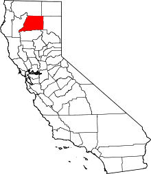 | |
| CDPs | ||
| Unincorporated communities |
| |
| Indian reservations | ||
| Ghost town |
| |