Bryn Mawr-Skyway, Washington
| Bryn Mawr-Skyway, Washington | |
|---|---|
| CDP | |
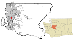 Location of Bryn Mawr-Skyway, Washington | |
| Coordinates: 47°29′40″N 122°14′12″W / 47.49444°N 122.23667°WCoordinates: 47°29′40″N 122°14′12″W / 47.49444°N 122.23667°W | |
| Country | United States |
| State | Washington |
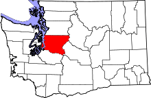
| County | King |
| Area | |
| • Total | 3.3 sq mi (8.7 km2) |
| • Land | 3.2 sq mi (8.2 km2) |
| • Water | 0.2 sq mi (0.4 km2) |
| Population (2010) | |
| • Total | 15,645 |
| • Density | 4,408.1/sq mi (1,702.0/km2) |
| Time zone | Pacific (PST) (UTC-8) |
| • Summer (DST) | PDT (UTC-7) |
| ZIP code | 98178 |
| FIPS code | 53-08552[1] |
| GNIS feature ID | 2407916[2] |
Bryn Mawr-Skyway (pronounced /ˌbrɪnˈmɑːr/ from Welsh for "big hill") is a census-designated place (CDP) in King County, Washington, United States. The population was 15,645 at the 2010 census.
Bryn Mawr-Skyway is the only CDP in the Seattle metropolitan area to have reported a majority-minority population in the 2000 Census. Since that time, the area has grown even more diverse. As of the 2010 census, the cultural makeup of the Skyway area is almost evenly balanced between White, Black or African American, and Asian community members.
Geography
Skyway lies in an "unincorporated island"[3] roughly between the cities of Seattle, Tukwila and Renton, Washington.[4] Though it is surrounded by major municipalities, its limited infrastructure and low-income demographics have made it an unattractive area to incorporate. It is frequently along the shortest route of travel for commuters using local streets to enter Seattle from the southeast. The neighborhood was mostly developed just after World War II as affordable housing for returning veterans. The area remains an affordable area close to the high employment areas of Renton and Seattle. The name "Skyway" may be derived from the area's correspondence with a high ridge in western Washington's hilly terrain, a name that echoes the Welsh “Bryn Mawr” (also the denomination used for a village and several other places), which means "big hill"[5]
Skyway's main business districts lie along Renton Avenue South, with one center between 68th Avenue South and 74th Avenue South, including a small casino and a bowling alley, and another between 75th Avenue South and 78th Avenue South, including a bank branch, the fire station, and the public library (a branch of the King County Library System). There is also a small business district centered at Martin Luther King Way South (State Route 900) around South 129th Street. Skyway Park, with baseball fields, a creek and wetlands, and picnic areas, is located near the center of Skyway.
The Bryn Mawr-Skyway CDP is made up of many neighborhoods, including Lakeridge, Campbell Hill and Earlington, in addition to the neighborhoods of Skyway and Bryn Mawr. The community is sometimes called "West Hill".[4]
Bryn Mawr-Skyway is located at 47°29′40″N 122°14′12″W / 47.494571°N 122.236557°W (47.494571, -122.236557).[6]
According to the United States Census Bureau, the CDP has a total area of 3.3 square miles (8.5 km2), of which 3.2 square miles (8.3 km2) is land and 0.2 square miles (0.52 km2) (5.09%) is water.
Demographics
| Historical population | |||
|---|---|---|---|
| Census | Pop. | %± | |
| 2000 | 13,977 | — | |
| 2010 | 15,645 | 11.9% | |
| U.S. Decennial Census | |||
2010 Census
As of the census of 2010,[1] there were 15,645 people, 5,772 households, and 3,742 families residing in the greater Skyway area. The population density was 4,935.3 people per square mile (1,905.5/km2). There were 6,189 housing units at an average density of 1,952.4/sq mi (753.8/km2). The racial makeup of the area was 29.6% White, 31.4% Black or African American, 0.8% Native American, 27.1% Asian, 0.8% Pacific Islander, 2.9% from other races, and 7.2% from two or more races. Hispanic or Latino of any race were 7.7% of the population.
2000 Census
As of the census of 2000,[1] there were 13,977 people, 5,574 households, and 3,578 families residing in the greater Skyway area. The population density was 4,408.1 people per square mile (1,702.4/km2). There were 5,785 housing units at an average density of 1,824.5/sq mi (704.6/km2). The racial makeup of the area was 44.24% White, 25.33% African American, 0.81% Native American, 21.82% Asian, 0.51% Pacific Islander, 2.19% from other races, and 5.10% from two or more races. Hispanic or Latino of any race were 4.54% of the population.
There were 5,574 households recorded in 2000, out of which 28.2% had children under the age of 18 living with them, 45.6% were married couples living together, 13.7% had a female householder with no husband present, and 35.8% were non-families. 27.9% of all households were made up of individuals and 9.3% had someone living alone who was 65 years of age or older. The average household size was 2.50 and the average family size was 3.08.
In the area, the age categories recorded in 2000 were 22.8% under the age of 18, 7.9% from 18 to 24, 31.0% from 25 to 44, 24.4% from 45 to 64, and 13.9% who were 65 years of age or older. The median age was 38 years. For every 100 females there were 97.6 males. For every 100 females age 18 and over, there were 95.3 males.
The median income for a household in the greater Skyway area in 2000 was $47,385, and the median income for a family was $55,927. Males had a median income of $38,821 versus $31,443 for females. The per capita income in Skyway was $23,294. About 6.4% of families and 7.7% of the population were below the poverty line, including 9.3% of those under age 18 and 6.4% of those age 65 or over.
Politics
Like most inner suburbs of Seattle, Bryn Mawr-Skyway is dominated by the Democratic Party in national elections. In 2004, Democrat John Kerry received over 70 percent of the vote, and Republican George W. Bush received just over 25 percent.
Neighborhoods
The Skyway/West Hill community is made up of nine neighborhoods:
- Black River
- Bryn Mawr
- Campbell Hill
- Earlington (also extends into the City of Renton)
- Hill Top
- Lakeridge (also extends into the City of Seattle's Rainier Beach neighborhood)
- Panorama View
- Skycrest
- Skyway
Points of interest
- Bryn Mawr Park
- Lakeridge Park/Deadhorse Canyon
- Skyway Park
Education
School Districts
- Renton School District
- Secondary Learning Center
- Dimmitt Middle School
- Bryn Mawr Elementary School
- Campbell Hill Elementary School
- Lakeridge Elementary School
References
- 1 2 3 "American FactFinder". United States Census Bureau. Archived from the original on 2013-09-11. Retrieved 2008-01-31.
- ↑ "Bryn Mawr-Skyway Census Designated Place". Geographic Names Information System. United States Geological Survey.
- ↑ West Hill
- 1 2 Bill Virgin and Tricia Duryee (July 17, 1999), People try to overcome their 'identity problem', Seattle Post-Intelligencer, retrieved 2010-11-09
- ↑ Geiriadur Cymraeg - Yr iaith fain: Welsh-English / English-Welsh On-line Dictionary
- ↑ "US Gazetteer files: 2010, 2000, and 1990". United States Census Bureau. 2011-02-12. Retrieved 2011-04-23.
External links
Municipalities and communities of King County, Washington, United States | ||
|---|---|---|
| Cities |
|  |
| Towns | ||
| CDPs |
| |
| Unincorporated communities | ||
| Indian reservation | ||
| Ghost towns | ||
| Footnotes | ‡This populated place also has portions in an adjacent county or counties | |