Brye
| Brye Briye | |
|---|---|
| Village | |
|
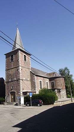
The church of Saint-Pierre, à Brye. | |
 Brye | |
| Coordinates: 50°31′26.78″N 4°33′23.96″E / 50.5241056°N 4.5566556°ECoordinates: 50°31′26.78″N 4°33′23.96″E / 50.5241056°N 4.5566556°E | |
| Country |
|
| Province | Namur |
| Municipality | Fleurus] |
| Time zone | CET (UTC+1) |
Brye (Walloon: Briye) is a village that is part of the municipality of Fleurus, Belgium. Fleurus is located in the Arrondissement of Charleroi in Hainaut province. The Brye post code is 6222 and the telephone zone code is 071.
Brye was its own municipality until the fusion of the Belgian municipalities in 1977 when it merged with Fleurus.
History
On 16 June 1815 Brye and the heights nearby, along with a sting of other villages, were occupied by the Prussian army commanded by Gebhard von Blücher and defended against the French Army of the North commanded by Napoleon Bonaparte at the Battle of Ligny. On the heights—the highest point of the whole position—stood the Windmill of Buss which was used by Blücher and his staff as an observation point.[lower-alpha 1]It was here at around about 13:00 that Blücher, Wellington and their staffs held their conference. After the centre of the Prussian lines were broken by the French, a Prussians rearguard put up a stout resistance in Brye.[2]
Notes
- ↑ The windmill of Bussy, also called the windmill of Brye, was located just to the south of the cross roads of Rue Joseph Scohy, Rue de Sombreffe and Rue de Tige at 50°31′17.78″N 4°33′44.72″E / 50.5216056°N 4.5624222°E[1]
- ↑ Haweis 1908, facing page 150.
- ↑ Siborne 1848, pp. 200–202, 135–136, 247–249.
References
- Haweis, James Walter (1908), "Plan of the Battlefelds of Ligny and Quatre Bras", The campaign of 1815, chiefly in Flanders, Edinburgh: William Blackwood and Sons, facing page 150
- Siborne, William (1848), The Waterloo Campaign, 1815 (4th ed.), Westminster: A. Constable