Bryant, Alabama
| Bryant, Alabama | |
|---|---|
| Unincorporated community | |
|
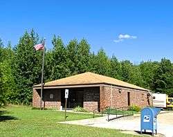
Bryant post office | |
 Bryant, Alabama Location in Alabama. | |
| Coordinates: 34°56′37″N 85°37′56″W / 34.94361°N 85.63222°W | |
| Country | United States |
| State | Alabama |
| County | Jackson |
| Area | |
| • Land | 19.296 sq mi (49.977 km2) |
| • Water | 0.002 sq mi (0.004 km2) |
| Elevation | 1,631 ft (497 m) |
| Population (2010) | |
| • Total | 3,582 |
| Time zone | Central (CST) (UTC-6) |
| • Summer (DST) | CDT (UTC-5) |
| ZIP code | 35958 |
| Area code(s) | 256 |
| GNIS feature ID | 115080[1] |
Bryant is an unincorporated community in Jackson County, Alabama, United States. At the 2000 census the population was 3,295.[2]
Geography
Bryant covers a land area of 49.977 square miles (129.44 km2) and a water area of 0.004 square miles (0.010 km2).
Demographics
As of the census of 2010, there were 3,582 people. The population density was 65.9 persons per square mile. The racial makeup of the town was 95.6% White, 0.3% Black, 1.5% American Indian and Alaska Native, and 1.9% from two or more races. 1.3% of the population were Hispanic or Latino of any race.[3]
In Bryant the population was spread out with 23.2% under the age of 18 and 15.6% who were 64 years of age or older. Marriage status: 16.9% never married, 67.1% now married, 5.8% widowed, and 10.2% divorced.
The per capita income for Bryant was $20,113. About 13.7% of the population were below the poverty line.
Education
Bryant is home to Bryant Elementary School, which is part of the Jackson County School System.[4]
Bryant is also home to Mountain View Christian Academy, a private Christian school with Pre-school through 12th grade.[5]
Media
Bryant is the community of license for one radio station, WWFC-LP (99.9 FM).
References
- ↑ "Bryant". Geographic Names Information System. United States Geological Survey.
- ↑
- Garoogian, David ed. (2003). Profiles of America: Facts, Figures & Statistics for Every Populated Place in the United States. Second edition. Volume 1. Millerton, NY: Grey House Publishing. ISBN 1-59237-013-6
- ↑ "American FactFinder". United States Census Bureau. Archived from the original on 2013-09-11. Retrieved 2014-08-02.
- ↑ "Bryant Elementary". Bryantschool.net. 2013-03-01. Retrieved 2014-08-02.
- ↑ "Mountain View Christian Academy". Mvcaschool.com. Retrieved 2014-08-02.
External links
 Media related to Bryant, Alabama at Wikimedia Commons
Municipalities and communities of Jackson County, Alabama, United States | ||
|---|---|---|
| Cities |  | |
| Towns | ||
| Unincorporated communities | ||
| Ghost towns | ||
Coordinates: 34°56′37″N 85°37′56″W / 34.94361°N 85.63222°W