Bruin, Pennsylvania
| Bruin, Pennsylvania | |
| Borough | |
 Buildings on Main Street | |
| Official name: Borough of Bruin | |
| Country | United States |
|---|---|
| State | Pennsylvania |
| County | Butler County |
| Township | Parker Township |
| Coordinates | 41°3′26″N 79°43′48″W / 41.05722°N 79.73000°WCoordinates: 41°3′26″N 79°43′48″W / 41.05722°N 79.73000°W |
| Area | 4.7 km2 (1.8 sq mi) |
| - land | 4.7 km2 (2 sq mi) |
| - water | 0.0 km2 (0 sq mi) |
| Population | 524 (2010) |
| Density | 110.8/km2 (287.0/sq mi) |
| Settled | 1901 |
| Timezone | EST (UTC-5) |
| - summer (DST) | EDT (UTC-4) |
| Area code | 724 |
| School District | Karns City Area School District |
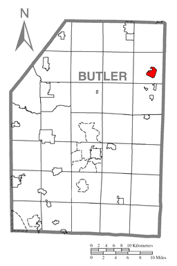 Location of Bruin in Butler County
| |
 Location of Bruin in Pennsylvania
| |
 Location of Pennsylvania in the United States
| |
Bruin is a borough in Butler County, Pennsylvania, United States. The population was 524 at the 2010 census.[1]
Geography
Bruin is located in northeastern Butler County at 41°3′26″N 79°43′48″W / 41.05722°N 79.73000°W (41.057142, -79.730051),[2] in the valley of Bear Creek, a tributary of the Allegheny River. It is approximately 53 miles (85 km) north of Pittsburgh. The borough is surrounded by Parker Township but is separate from it. Pennsylvania Route 268 passes through the center of town, leading northeast 4 miles (6 km) to the city of Parker and south 3 miles (5 km) to Petrolia.
According to the United States Census Bureau, the borough of Bruin has a total area of 1.8 square miles (4.7 km2), all of it land.[1]
Demographics
| Historical population | |||
|---|---|---|---|
| Census | Pop. | %± | |
| 1910 | 539 | — | |
| 1920 | 720 | 33.6% | |
| 1930 | 622 | −13.6% | |
| 1940 | 663 | 6.6% | |
| 1950 | 717 | 8.1% | |
| 1960 | 706 | −1.5% | |
| 1970 | 673 | −4.7% | |
| 1980 | 722 | 7.3% | |
| 1990 | 646 | −10.5% | |
| 2000 | 534 | −17.3% | |
| 2010 | 524 | −1.9% | |
| Est. 2015 | 505 | [3] | −3.6% |
| Sources:[4][5][6] | |||
As of the census[5] of 2000, there were 534 people, 204 households, and 151 families residing in the borough. The population density was 308.8 people per square mile (119.2/km²). There were 228 housing units at an average density of 131.8 per square mile (50.9/km²). The racial makeup of the borough was 98.69% White, and 1.31% from two or more races. Hispanic or Latino of any race were 0.56% of the population.
There were 204 households, out of which 37.3% had children under the age of 18 living with them, 63.2% were married couples living together, 7.4% had a female householder with no husband present, and 25.5% were non-families. 17.2% of all households were made up of individuals, and 8.8% had someone living alone who was 65 years of age or older. The average household size was 2.62 and the average family size was 2.97.
In the borough the population was spread out, with 26.4% under the age of 18, 8.4% from 18 to 24, 28.8% from 25 to 44, 22.8% from 45 to 64, and 13.5% who were 65 years of age or older. The median age was 39 years. For every 100 females there were 95.6 males. For every 100 females age 18 and over, there were 92.6 males.
The median income for a household in the borough was $29,554, and the median income for a family was $32,500. Males had a median income of $30,192 versus $20,000 for females. The per capita income for the borough was $13,136. About 13.1% of families and 12.9% of the population were below the poverty line, including 14.2% of those under age 18 and 14.6% of those age 65 or over.
Education
- Karns City Area School District - public school
- Karns City High School
Lagoon
The Bruin Lagoon Site covers approximately 6 acres (2.4 ha) in the borough. The site began operating during the 1930s as a disposal site for petroleum refining wastes. Until the 1970s, Bruin Lagoon was used for the disposal of wastes from mineral oil production, motor oil reclamation, crude storage tanks, and spent bauxite from mineral oil infiltration. The primary contaminants at the site were sulfuric acid, hydrogen sulfide, sulfur dioxide, and heavy metals.
In 1968, the lagoon overflowed, spilling approximately 3,000 gallons of acidic sludge into Bear Creek which borders the east side of the site. The spill killed more than three million fish in Bear Creek and the Allegheny and Ohio rivers.
References
- 1 2 "Geographic Identifiers: 2010 Demographic Profile Data (G001): Bruin borough, Pennsylvania". U.S. Census Bureau, American Factfinder. Retrieved March 21, 2014.
- ↑ "US Gazetteer files: 2010, 2000, and 1990". United States Census Bureau. 2011-02-12. Retrieved 2011-04-23.
- ↑ "Annual Estimates of the Resident Population for Incorporated Places: April 1, 2010 to July 1, 2015". Retrieved July 2, 2016.
- ↑ "Census of Population and Housing". U.S. Census Bureau. Archived from the original on 11 May 2015. Retrieved 11 December 2013.
- 1 2 "American FactFinder". United States Census Bureau. Archived from the original on 2013-09-11. Retrieved 2008-01-31.
- ↑ "Incorporated Places and Minor Civil Divisions Datasets: Subcounty Resident Population Estimates: April 1, 2010 to July 1, 2012". Population Estimates. U.S. Census Bureau. Archived from the original on 17 June 2013. Retrieved 11 December 2013.
| Counties |  Map of the Pittsburgh Tri-State with green counties in the metropolitan area and yellow counties in the combined area. | |
|---|---|---|
| Major cities | ||
| Cities and towns 15k-50k (in 2010) | ||
| Airports | ||
| Topics | ||
| ||
Municipalities and communities of Butler County, Pennsylvania, United States | ||
|---|---|---|
| City | 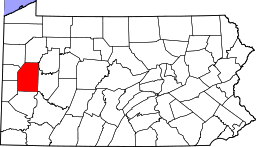 | |
| Boroughs | ||
| Townships | ||
| CDPs | ||
| Unincorporated communities | ||
| Footnotes | ‡This populated place also has portions in an adjacent county or counties | |