Bruce, South Dakota
| Bruce, South Dakota | |
|---|---|
| City | |
 Location in Brookings County and the state of South Dakota | |
| Coordinates: 44°26′16″N 96°53′29″W / 44.43778°N 96.89139°WCoordinates: 44°26′16″N 96°53′29″W / 44.43778°N 96.89139°W | |
| Country | United States |
| State | South Dakota |
| County | Brookings |
| Area[1] | |
| • Total | 0.38 sq mi (0.98 km2) |
| • Land | 0.37 sq mi (0.96 km2) |
| • Water | 0.01 sq mi (0.03 km2) |
| Elevation | 1,627 ft (496 m) |
| Population (2010)[2] | |
| • Total | 204 |
| • Estimate (2012[3]) | 205 |
| • Density | 551.4/sq mi (212.9/km2) |
| Time zone | Central (CST) (UTC-6) |
| • Summer (DST) | CDT (UTC-5) |
| ZIP code | 57220 |
| Area code(s) | 605 |
| FIPS code | 46-07740[4] |
| GNIS feature ID | 1254084[5] |
Bruce is a city in Brookings County, South Dakota, United States. The population was 204 at the 2010 census.
History
Bruce was originally called Lee, and under the latter name was founded in 1881. It was renamed in 1883, but the namesake is unclear. Some hold Bruce was named for the son one of the early North Western railroad officials, while others believe it was named for Blanche K. Bruce, an African-American statesman and friend of Roscoe Conkling, U.S. Senator from New York at the time.[6]
Geography
Bruce is located at 44°26′16″N 96°53′29″W / 44.43778°N 96.89139°W (44.437896, -96.891374),[7] along the Big Sioux River.[8]
According to the United States Census Bureau, the city has a total area of 0.38 square miles (0.98 km2), of which, 0.37 square miles (0.96 km2) is land and 0.01 square miles (0.03 km2) is water.[1]
Bruce has been assigned the ZIP code 57220 and the FIPS place code 07740.
Demographics
| Historical population | |||
|---|---|---|---|
| Census | Pop. | %± | |
| 1910 | 262 | — | |
| 1920 | 342 | 30.5% | |
| 1930 | 371 | 8.5% | |
| 1940 | 394 | 6.2% | |
| 1950 | 305 | −22.6% | |
| 1960 | 272 | −10.8% | |
| 1970 | 217 | −20.2% | |
| 1980 | 254 | 17.1% | |
| 1990 | 235 | −7.5% | |
| 2000 | 272 | 15.7% | |
| 2010 | 204 | −25.0% | |
| Est. 2015 | 208 | [9] | 2.0% |
2010 census
As of the census[2] of 2010, there were 204 people, 95 households, and 58 families residing in the city. The population density was 551.4 inhabitants per square mile (212.9/km2). There were 111 housing units at an average density of 300.0 per square mile (115.8/km2). The racial makeup of the city was 95.6% White, 1.5% Native American, 0.5% Asian, 0.5% Pacific Islander, and 2.0% from two or more races. Hispanic or Latino of any race were 0.5% of the population.
There were 95 households of which 29.5% had children under the age of 18 living with them, 52.6% were married couples living together, 4.2% had a female householder with no husband present, 4.2% had a male householder with no wife present, and 38.9% were non-families. 34.7% of all households were made up of individuals and 11.6% had someone living alone who was 65 years of age or older. The average household size was 2.15 and the average family size was 2.78.
The median age in the city was 43 years. 24.5% of residents were under the age of 18; 3.1% were between the ages of 18 and 24; 27.5% were from 25 to 44; 29.5% were from 45 to 64; and 15.7% were 65 years of age or older. The gender makeup of the city was 49.0% male and 51.0% female.
2000 census
As of the census[4] of 2000, there were 272 people, 105 households, and 72 families residing in the city. The population density was 761.8 people per square mile (291.7/km²). There were 117 housing units at an average density of 327.7 per square mile (125.5/km²). The racial makeup of the city was 99.26% White, 0.37% Asian, and 0.37% from two or more races. Hispanic or Latino of any race were 1.47% of the population.
There were 105 households out of which 39.0% had children under the age of 18 living with them, 61.9% were married couples living together, 4.8% had a female householder with no husband present, and 30.5% were non-families. 29.5% of all households were made up of individuals and 9.5% had someone living alone who was 65 years of age or older. The average household size was 2.59 and the average family size was 3.21.
In the city the population was spread out with 31.3% under the age of 18, 4.4% from 18 to 24, 30.1% from 25 to 44, 20.2% from 45 to 64, and 14.0% who were 65 years of age or older. The median age was 34 years. For every 100 females there were 100.0 males. For every 100 females age 18 and over, there were 107.8 males.
The median income for a household in the city was $37,188, and the median income for a family was $46,786. Males had a median income of $31,071 versus $23,750 for females. The per capita income for the city was $16,282. About 4.1% of families and 7.3% of the population were below the poverty line, including 9.3% of those under the age of eighteen and none of those sixty five or over.
Honey Days Festival
During the last week of July, Bruce celebrates Honey Days, its town holiday. The name and theme of Honey Days is inspired by the company Adee Honey Farms which originated and is based in Bruce. Adee Honey farms is the largest producer of honey in the world and is a large employer in the small town.[11] The festival features many activities such as a street dance, bingo, barbecue feed, pancake breakfast,an outdoor church service, and many recreational tournaments such as softball, horseshoes, volleyball, and beanbags.[12] The festival is also highlighted by the Saturday night dance off, home to the famed Marcus Goodfellow, the 6 time grooviest moves award winner. Honey Days also displays a large parade on its main street.
References
- 1 2 "US Gazetteer files 2010". United States Census Bureau. Archived from the original on 2012-07-14. Retrieved 2012-06-21.
- 1 2 "American FactFinder". United States Census Bureau. Retrieved 2012-06-21.
- ↑ "Population Estimates". United States Census Bureau. Archived from the original on 2013-06-17. Retrieved 2013-05-29.
- 1 2 "American FactFinder". United States Census Bureau. Archived from the original on 2013-09-11. Retrieved 2008-01-31.
- ↑ "US Board on Geographic Names". United States Geological Survey. 2007-10-25. Retrieved 2008-01-31.
- ↑ "Profile for Bruce, South Dakota". ePodunk. Retrieved 4 June 2014.
- ↑ "US Gazetteer files: 2010, 2000, and 1990". United States Census Bureau. 2011-02-12. Retrieved 2011-04-23.
- ↑ DeLorme (2001). South Dakota Atlas & Gazetteer. Yarmouth, Maine: DeLorme. ISBN 0-89933-330-3
- ↑ "Annual Estimates of the Resident Population for Incorporated Places: April 1, 2010 to July 1, 2015". Retrieved July 2, 2016.
- ↑ "Census of Population and Housing". Census.gov. Archived from the original on May 11, 2015. Retrieved June 4, 2015.
- ↑ Argusleader
- ↑ City of Bruce
http://www.cityofbruce.net/festivals.php https://web.archive.org/web/20150131135615/http://archive.argusleader.com:80/VideoNetwork/2527291486001/Adee-Honey-Farms
Municipalities and communities of Brookings County, South Dakota, United States | ||
|---|---|---|
| Cities | 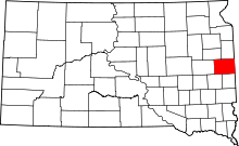 | |
| Towns | ||
| CDP | ||
| Other unincorporated communities | ||
| Townships |
| |
| Footnotes | ‡This populated place also has portions in an adjacent county or counties | |