Broxburn, East Lothian
- This article is about Broxburn in East Lothian. See also Broxburn, West Lothian
| Broxburn | |
.jpg) Entering Broxburn on the A1087 road |
|
 Broxburn |
|
| OS grid reference | NT692772 |
|---|---|
| Civil parish | Dunbar |
| Council area | East Lothian |
| Lieutenancy area | East Lothian |
| Country | Scotland |
| Sovereign state | United Kingdom |
| Post town | DUNBAR |
| Postcode district | EH42 |
| Dialling code | 01368 |
| Police | Scottish |
| Fire | Scottish |
| Ambulance | Scottish |
| EU Parliament | Scotland |
| UK Parliament | East Lothian |
| Scottish Parliament | East Lothian |
Coordinates: 55°59′17″N 2°29′35″W / 55.988°N 2.493°W
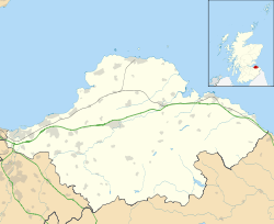
Broxburn is a hamlet consisting of a handful of scattered houses which serve the Broxmouth estate in East Lothian, Scotland. It is named after the creek upon which it stands, the Brox Burn. It lies about 1.5 miles (2.4 km) south-east of Dunbar. On the Brox Burn is Brand's Mill, dating from mediaeval times. The Battle of Dunbar, on 3 September 1650, took place on the foothills directly south, halfway between Brand's Mill and the hamlet of Little Pinkerton.
See also
External links
| Wikimedia Commons has media related to Broxburn, East Lothian. |
This article is issued from Wikipedia - version of the 1/24/2016. The text is available under the Creative Commons Attribution/Share Alike but additional terms may apply for the media files.