Brownsville, Tennessee
| Brownsville, Tennessee | |
|---|---|
| City | |
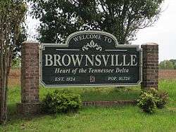 | |
| Motto: Heart of the Tennessee Delta | |
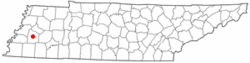 Location of Brownsville, Tennessee | |
| Coordinates: 35°35′26″N 89°15′39″W / 35.59056°N 89.26083°W | |
| Country | United States |
| State | Tennessee |
| County | Haywood |
| Government | |
| • Mayor | Bill Rawls |
| Area | |
| • Total | 9.1 sq mi (23.6 km2) |
| • Land | 9.1 sq mi (23.6 km2) |
| • Water | 0.0 sq mi (0.0 km2) |
| Elevation | 390 ft (119 m) |
| Population (2010) | |
| • Total | 10,292 |
| • Density | 1,178.1/sq mi (454.9/km2) |
| Time zone | Central (CST) (UTC-6) |
| • Summer (DST) | CDT (UTC-5) |
| ZIP code | 38012 |
| Area code(s) | 731 |
| FIPS code | 47-08920[1] |
| GNIS feature ID | 1278634[2] |
| Website |
brownsvilletn |
Brownsville is a city in Haywood County, Tennessee. It is the county seat of Haywood County.[3] Its population as of the 2010 census is 10,292.[4]
The city is named after General Jacob Jennings Brown, an officer of The War of 1812.[5]
History
Brownsville's history is strongly connected with agriculture in the Mid-South. The town is notable for its many well-preserved antebellum homes and multi-generational family owned farms.
Tabernacle Campground, home to the yearly "camp-meeting" for descendants of the Rev. Howell Taylor, was established in 1826, soon after Brownsville was founded.
Brownsville's synagogue, Temple Adas Israel, was built in 1882 and is listed on the National Register of Historic Places. The building is believed to be the oldest synagogue in Tennessee,[6] and is a rare example of a synagogue built in the Gothic Revival style.[7]
Geography
According to the United States Census Bureau, Brownsville has a total area of 9.1 square miles (24 km2), all land.
Brownsville is situated on the southeastern edge of the New Madrid Seismic Zone, an area with a high earthquake risk.
The Hatchie River runs through Brownsville. It is the longest free-flowing tributary of the lower Mississippi, and contains the largest forested floodplain in Tennessee. The river is home to hundreds of species of fish, including 11 species of catfish, and the alligator snapping turtle. The Hatchie River was named by the Nature Conservancy as one of the "great places" to save. The Hatchie is also designated as a "scenic river" under the Tennessee Wild and Scenic Rivers Act.[8]
Demographics
| Historical population | |||
|---|---|---|---|
| Census | Pop. | %± | |
| 1850 | 971 | — | |
| 1860 | 1,137 | 17.1% | |
| 1870 | 2,457 | 116.1% | |
| 1890 | 2,516 | — | |
| 1900 | 2,645 | 5.1% | |
| 1910 | 2,882 | 9.0% | |
| 1920 | 3,062 | 6.2% | |
| 1930 | 3,204 | 4.6% | |
| 1940 | 4,012 | 25.2% | |
| 1950 | 4,711 | 17.4% | |
| 1960 | 5,424 | 15.1% | |
| 1970 | 7,011 | 29.3% | |
| 1980 | 9,307 | 32.7% | |
| 1990 | 10,019 | 7.7% | |
| 2000 | 10,748 | 7.3% | |
| 2010 | 10,292 | −4.2% | |
| Est. 2015 | 9,876 | [9] | −4.0% |
| Sources:[10][11] | |||
As of the census[1] of 2000, there were 10,748 people, 4,105 households, and 2,865 families residing in the city. The population density was 1,178.1 people per square mile (455.0/km²). There were 4,372 housing units at an average density of 479.2 per square mile (185.1/km²). The racial makeup of the city was 36.52% White, 60.72% African American, 0.14% Native American, 0.10% Asian, 0.07% Pacific Islander, 1.83% from other races, and 0.61% from two or more races. Hispanic or Latino of any race were 3.61% of the population.
There were 4,105 households out of which 35.4% had children under the age of 18 living with them, 38.8% were married couples living together, 27.3% had a female householder with no husband present, and 30.2% were non-families. 27.0% of all households were made up of individuals and 11.8% had someone living alone who was 65 years of age or older. The average household size was 2.58 and the average family size was 3.11.
In the city the population was spread out with 29.5% under the age of 18, 10.4% from 18 to 24, 27.1% from 25 to 44, 19.4% from 45 to 64, and 13.6% who were 65 years of age or older. The median age was 33 years. For every 100 females there were 80.2 males. For every 100 females age 18 and over, there were 73.3 males.
The median income for a household in the city was $27,276, and the median income for a family was $33,782. Males had a median income of $30,313 versus $22,030 for females. The per capita income for the city was $15,217. About 18.0% of families and 21.3% of the population were below the poverty line, including 26.3% of those under age 18 and 27.0% of those age 65 or over.
Arts
Pioneer musicians
Blues singer and guitarist Sleepy John Estes was born in Ripley (Nutbush) and later moved to Brownsville in 1915.[12][13]
Yank Rachell, blues artist and mandolin player, was born in Brownsville in the early 1900s. He recorded, toured Europe, Japan and shortly before his death in 1997 returned to Brownsville to perform Jug Band recordings with John Sebastian and the J-Band.[14]
Contemporary music
In the song "Delta Dawn" (recorded by Tanya Tucker and others), the lyric "All the folks around Brownsville say she's crazy" is a reference to Brownsville, Tennessee. Credit for the writing of the song is given to songwriter Alex Harvey and former child rockabilly star Larry Collins.
Tina Turner
According to a 1990s interview with singer Tina Turner's mother, Zelma Bullock, the singer was born Anna Mae Bullock in a sharecroppers' cabin in Nutbush on November 26, 1939. Her father was farm overseer and she spent her childhood in the Knoxville area, Nutbush, Ripley and Brownsville.[14][15]
The Mindfield
| Wikimedia Commons has media related to The Mindfield. |
"The Mindfield" is the creation and life’s work of Brownsville artist Billy Tripp. The structure was begun in 1989 and will continue to evolve until Tripp's death, at which point it will become the site of his interment. Included in the network of steel are individual pieces representing various events and periods of Tripp's life, especially the death of his father, Rev. Charles Tripp, in 2002. One of the latest additions, a water tower salvaged from a defunct factory in Western Kentucky, was dismantled, transported to Brownsville, and reconstructed single-handedly by the artist. It now stands as a memorial to Tripp’s parents as well as a testimonial to his current life, his belief in the inherent beauty of our world, and the importance of tolerance in our communities and governmental systems.
Tripp’s book, The Mindfield Years, is a further representation of his life told through the voices of three main characters and their efforts to find meaning, purpose, and contentment in the existence to which they were born. Written in stream of consciousness style, the novel contains elements of short story, poetry, philosophy, and psychology intermingled into a multi-layered yet deceptively simple tale. Tripp is currently at work on volume two of this series, his Goodbye, and volume three, which is yet to be titled.
Notable people
- Son Bonds, musician
- Paul Burlison, rockabilly pioneer, guitarist, member of The Rock and Roll Trio
- Tony Delk of the Boston Celtics graduated from Haywood High School
- Joseph Folk (1869–1923), Circuit Attorney of the City of St. Louis, later 31st Governor of Missouri
- Alfred Alexander Freeman (1838–1926), politician and judge, candidate for governor in 1872
- Richard Halliburton, adventurer and author
- Brett Scallions, leader of the band Fuel
- Jim Thaxton, football player
- Billy Tripp, author, artist
- Jarvis Varnado (born 1988), basketball player for Hapoel Jerusalem B.C.
Climate
The climate in this area is characterized by hot, humid summers and generally mild to cool winters. According to the Köppen Climate Classification system, Brownsville has a humid subtropical climate, abbreviated "Cfa" on climate maps.[16]
References
- 1 2 "American FactFinder". United States Census Bureau. Archived from the original on 2013-09-11. Retrieved 2008-01-31.
- ↑ "US Board on Geographic Names". United States Geological Survey. 2007-10-25. Retrieved 2008-01-31.
- ↑ "Find a County". National Association of Counties. Archived from the original on 2011-05-31. Retrieved 2011-06-07.
- ↑ Tennessee Department of Economic and Community Development, Certified Population of Tennessee Incorporated Municipalities and Counties, State of Tennessee official website, 14 July 2011. Retrieved: 6 December 2013.
- ↑ "Brownsville, Tennessee City Information". ePodunk.com. US-TN. 2007-10-20. Retrieved 2016-08-10.
- ↑ Carroll Van West, Temple Adas Israel, Tennessee Encyclopedia of History and Culture, 2009. Retrieved: 15 February 2013.
- ↑ America's Religious Architecture: Sacred Places for Every Community, By Marilyn Joyce Segal Chiat, John Wiley and Sons, 1997, p 296
- ↑ "West Tennessee Delta Heritage Center - An Authentic Southern Experience in the Tennessee Delta :: Visitor Information Center:: Brownsville, Tennessee :: Interstate 40 @ Exit 56". Westtnheritage.com. Retrieved 2016-08-10.
- ↑ "Annual Estimates of the Resident Population for Incorporated Places: April 1, 2010 to July 1, 2015". Retrieved July 2, 2016.
- ↑ "Census of Population and Housing: Decennial Censuses". United States Census Bureau. Retrieved 2012-03-04.
- ↑ "Incorporated Places and Minor Civil Divisions Datasets: Subcounty Resident Population Estimates: April 1, 2010 to July 1, 2012". Population Estimates. U.S. Census Bureau. Archived from the original on 17 June 2013. Retrieved 11 December 2013.
- ↑ The Tennessee Encyclopedia of History and Culture, Rutledge Press
- ↑ A History of Tennessee Arts, University of Tennessee Press
- 1 2 Norris, Sharon, Black America Series: Haywood County Tennessee, Arcadia Publishing
- ↑ "Archived copy". Archived from the original on 2006-08-03. Retrieved 2006-08-05.
- ↑ "Brownsville, Tennessee Köppen Climate Classification". Weatherbase.com. Retrieved 2016-08-10.
Further reading
- West, Carroll Van & Duncan Binnicker, Margaret (2004). A History of Tennessee Arts. Knoxville, TN: The University of Tennessee Press. ISBN 1-57233-239-5.
- Norris, Sharon (2000). Black America Series: Haywood County Tennessee. Mount Pleasant, SC: Arcadia Publishing. ISBN 0-7385-0605-2.
External links
| Wikimedia Commons has media related to Brownsville, Tennessee. |
- Official website
- City charter
- Things to do and see in Brownsville and Haywood County, Tennessee
- WTJS-AM1390
- West Tennessee Delta Heritage Museum
Municipalities and communities of Haywood County, Tennessee, United States | ||
|---|---|---|
| City | ||
| Town | ||
| Unincorporated community | ||
Coordinates: 35°35′26″N 89°15′39″W / 35.590558°N 89.260902°W