Brownsville, Oregon
| Brownsville, Oregon | |
|---|---|
| City | |
|
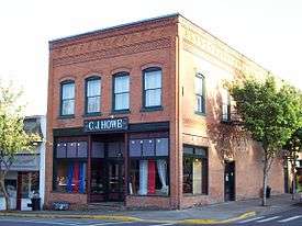
C. J. Howe Building in downtown | |
 Location in Oregon | |
| Coordinates: 44°23′36″N 122°59′1″W / 44.39333°N 122.98361°WCoordinates: 44°23′36″N 122°59′1″W / 44.39333°N 122.98361°W | |
| Country | United States |
| State | Oregon |
| County | Linn |
| Incorporated | 1876 |
| Government | |
| • Mayor | Don Ware |
| Area[1] | |
| • Total | 1.34 sq mi (3.47 km2) |
| • Land | 1.34 sq mi (3.47 km2) |
| • Water | 0 sq mi (0 km2) |
| Elevation | 265 ft (81 m) |
| Population (2010)[2] | |
| • Total | 1,668 |
| • Estimate (2012[3]) | 1,684 |
| • Density | 1,244.8/sq mi (480.6/km2) |
| U.S. Census | |
| Time zone | Pacific (UTC-8) |
| • Summer (DST) | Pacific (UTC-7) |
| ZIP code | 97327 |
| Area code(s) | 541 |
| FIPS code | 41-09050[2] |
| GNIS feature ID | 1118140[4] |
| Website | www.ci.brownsville.or.us |
Brownsville is a city in Linn County, Oregon, United States. As of the 2010 census the population was 1,668.[2] It is the setting for the fictional Castle Rock, Oregon in the film Stand by Me.
History
Establishment
Brownsville was originally known as "Calapooya" after the area's original inhabitants, the Kalapuya Indians, or "Kirk's Ferry", after the ferry operated across the Calapooia River by early settlers Alexander and Sarah Kirk.[5] When Linn County was created from the southern portion of Champoeg County on December 28, 1847, the Provisional Legislature named Calapooia as the county seat.[6] The Spaulding School in Brownsville served as the original county courthouse.[6] Brownsville was named in honor of Hugh L. Brown, who settled there in 1846 and opened the first store.[7]
In 1851, the Territorial Legislature passed an act establishing Albany as the county seat.[6] A special election in 1856 reaffirmed Albany as the county seat.
Stand By Me
In the mid 1980s Brownsville assumed a modicum of international notoriety as the location set for the film Stand by Me, directed by Rob Reiner.[8] The film was shot in and around the community in June and July 1985, with theatrical release made in August 1986.[8] About 100 local residents were used as extras in the film and the event was memorialized in 2007 with the first community celebration of Stand By Me Day on July 23 of that year.[8]
The date for Stand By Me Day was chosen by local resident and expert on the film Linda McCormick, who recalled in a 2016 interview that the day had been picked as one that did not interfere with other regional events and which "wasn't too close to the start of the school year."[8] About 2,000 visitors made the pilgrimage to Brownsville for the 2007 event.[8] The 2016 iteration, honoring the 30th anniversary of the cinematic release, introduced the first "Ray Brower Memorial 5K Walk/Run," named in honor of the dead body around which the film's plot revolved.[8]
Geography
According to the United States Census Bureau, the city has a total area of 1.34 square miles (3.47 km2), all land.[1]
Demographics
| Historical population | |||
|---|---|---|---|
| Census | Pop. | %± | |
| 1880 | 143 | — | |
| 1890 | 580 | 305.6% | |
| 1900 | 698 | 20.3% | |
| 1910 | 919 | 31.7% | |
| 1920 | 763 | −17.0% | |
| 1930 | 746 | −2.2% | |
| 1940 | 784 | 5.1% | |
| 1950 | 1,175 | 49.9% | |
| 1960 | 875 | −25.5% | |
| 1970 | 1,034 | 18.2% | |
| 1980 | 1,261 | 22.0% | |
| 1990 | 1,281 | 1.6% | |
| 2000 | 1,449 | 13.1% | |
| 2010 | 1,668 | 15.1% | |
| Est. 2015 | 1,738 | [9] | 4.2% |
2010 census
As of the census of 2010, there were 1,668 people, 639 households, and 461 families residing in the city. The population density was 1,244.8 inhabitants per square mile (480.6/km2). There were 685 housing units at an average density of 511.2 per square mile (197.4/km2). The racial makeup of the city was 93.8% White, 0.3% African American, 1.2% Native American, 0.5% Asian, 0.8% from other races, and 3.3% from two or more races. Hispanic or Latino of any race were 4.1% of the population.[2]
There were 639 households of which 33.6% had children under the age of 18 living with them, 55.7% were married couples living together, 11.6% had a female householder with no husband present, 4.9% had a male householder with no wife present, and 27.9% were non-families. 20.2% of all households were made up of individuals and 7.4% had someone living alone who was 65 years of age or older. The average household size was 2.61 and the average family size was 3.02.[2]
The median age in the city was 39.6 years. 25.2% of residents were under the age of 18; 7.3% were between the ages of 18 and 24; 24.8% were from 25 to 44; 29.3% were from 45 to 64; and 13.4% were 65 years of age or older. The gender makeup of the city was 47.6% male and 52.4% female.[2]
2000 census

As of the census of 2000, there were 1,449 people, 535 households, and 411 families residing in the city. The population density was 1,116.2 people per square mile (430.4/km²). There were 579 housing units at an average density of 446.0 per square mile (172.0/km²). The racial makeup of the city was 93.65% White, 0.35% African American, 1.66% Native American, 0.14% Asian, 0.55% from other races, and 3.66% from two or more races. Hispanic or Latino of any race were 2.07% of the population.[2]
There were 535 households out of which 35.5% had children under the age of 18 living with them, 60.4% were married couples living together, 10.8% had a female householder with no husband present, and 23.0% were non-families. 19.4% of all households were made up of individuals and 8.8% had someone living alone who was 65 years of age or older. The average household size was 2.71 and the average family size was 3.07.[2]
In the city the population was spread out with 27.5% under the age of 18, 7.5% from 18 to 24, 26.4% from 25 to 44, 27.0% from 45 to 64, and 11.6% who were 65 years of age or older. The median age was 37 years. For every 100 females there were 102.1 males. For every 100 females age 18 and over, there were 98.9 males.[2]
The median income for a household in the city was $35,486, and the median income for a family was $39,671. Males had a median income of $37,400 versus $24,643 for females. The per capita income for the city was $15,272. About 5.6% of families and 8.8% of the population were below the poverty line, including 11.0% of those under age 18 and 7.4% of those age 65 or over.[2]
Footnotes
- 1 2 "US Gazetteer files 2010". United States Census Bureau. Archived from the original on 2012-07-14. Retrieved 2012-12-21.
- 1 2 3 4 5 6 7 8 9 10 "American FactFinder". United States Census Bureau. Retrieved 2012-12-21.
- ↑ "Population Estimates". United States Census Bureau. Archived from the original on 2013-06-17. Retrieved 2013-06-02.
- ↑ "US Board on Geographic Names". United States Geological Survey. 2007-10-25. Retrieved 2008-01-31.
- ↑ "A Brief History of Brownsville". City of Brownsville. Archived from the original on September 3, 2009. Retrieved 2009-09-28.
- 1 2 3 http://arcweb.sos.state.or.us/pages/records/local/county/linn/hist.html
- ↑ Lewis A. McArthur and Lewis L. McArthur, Oregon Geographic Names. Portland: Oregon Historical Society Press, 2003; pg. 118.
- 1 2 3 4 5 6 Alex Paul, "The Resident Expert: Linda McCormick Can Tell You All About the Film 'Stand by Me,'" Albany Democrat-Herald, July 20, 2016; special section, pg. S2.
- ↑ "Annual Estimates of the Resident Population for Incorporated Places: April 1, 2010 to July 1, 2015". Retrieved July 2, 2016.
- ↑ "Census of Population and Housing". Census.gov. Archived from the original on May 11, 2015. Retrieved June 4, 2015.
Further reading
- Carey, Margaret Standish and Patricia Hoy Hainline, Brownsville: Linn County's Oldest Town. Brownsville, OR: Calapooia Publications, 1976.
External links
 Media related to Brownsville, Oregon at Wikimedia Commons
- Entry for Brownsville in the Oregon Blue Book
- Brownsville Chamber of Commerce
Municipalities and communities of Linn County, Oregon, United States | ||
|---|---|---|
| Cities | 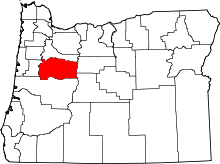 | |
| CDPs | ||
| Other unincorporated communities | ||
| Ghost towns | ||
| Footnotes | ‡This populated place also has portions in an adjacent county or counties | |