Browning, Missouri
| Browning, Missouri | |
|---|---|
| City | |
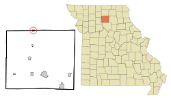 Location of Browning, Missouri | |
| Coordinates: 40°2′6″N 93°9′38″W / 40.03500°N 93.16056°WCoordinates: 40°2′6″N 93°9′38″W / 40.03500°N 93.16056°W | |
| Country | United States |
| State | Missouri |
| Counties | Linn, Sullivan |
| Area[1] | |
| • Total | 0.52 sq mi (1.35 km2) |
| • Land | 0.52 sq mi (1.35 km2) |
| • Water | 0 sq mi (0 km2) |
| Elevation | 758 ft (231 m) |
| Population (2010)[2] | |
| • Total | 265 |
| • Estimate (2012[3]) | 260 |
| • Density | 509.6/sq mi (196.8/km2) |
| Time zone | Central (CST) (UTC-6) |
| • Summer (DST) | CDT (UTC-5) |
| ZIP code | 64630 |
| Area code(s) | 660 |
| FIPS code | 29-08884[4] |
| GNIS feature ID | 0714793[5] |
Browning is a city in Linn and Sullivan counties in the U.S. state of Missouri. The population was 265 at the 2010 census.
History
Browning was laid out and platted in 1872.[6] The community was named in honor of the family of J. A. Browning, a railroad employee.[7] A post office called Browning has been in operation since 1873.[8]
Geography
Browning is located at 40°2′6″N 93°9′38″W / 40.03500°N 93.16056°W (40.034934, -93.160443).[9]
According to the United States Census Bureau, the city has a total area of 0.52 square miles (1.35 km2), all of it land.[1]
Demographics
| Historical population | |||
|---|---|---|---|
| Census | Pop. | %± | |
| 1880 | 187 | — | |
| 1890 | 527 | 181.8% | |
| 1900 | 726 | 37.8% | |
| 1910 | 629 | −13.4% | |
| 1920 | 694 | 10.3% | |
| 1930 | 590 | −15.0% | |
| 1940 | 531 | −10.0% | |
| 1950 | 492 | −7.3% | |
| 1960 | 412 | −16.3% | |
| 1970 | 412 | 0.0% | |
| 1980 | 368 | −10.7% | |
| 1990 | 331 | −10.1% | |
| 2000 | 317 | −4.2% | |
| 2010 | 265 | −16.4% | |
| Est. 2015 | 256 | [10] | −3.4% |
2010 census
As of the census[2] of 2010, there were 265 people, 110 households, and 72 families residing in the city. The population density was 509.6 inhabitants per square mile (196.8/km2). There were 144 housing units at an average density of 276.9 per square mile (106.9/km2). The racial makeup of the city was 96.2% White, 0.4% African American, 0.4% Native American, 0.4% from other races, and 2.6% from two or more races. Hispanic or Latino of any race were 6.8% of the population.
There were 110 households of which 31.8% had children under the age of 18 living with them, 40.9% were married couples living together, 14.5% had a female householder with no husband present, 10.0% had a male householder with no wife present, and 34.5% were non-families. 31.8% of all households were made up of individuals and 10.9% had someone living alone who was 65 years of age or older. The average household size was 2.41 and the average family size was 2.99.
The median age in the city was 38.7 years. 26.4% of residents were under the age of 18; 5.3% were between the ages of 18 and 24; 27.2% were from 25 to 44; 24.9% were from 45 to 64; and 16.2% were 65 years of age or older. The gender makeup of the city was 50.2% male and 49.8% female.
2000 census
As of the census[4] of 2000, there were 317 people, 143 households, and 80 families residing in the city. The population density was 604.5 people per square mile (235.4/km²). There were 177 housing units at an average density of 337.5 per square mile (131.4/km²). The racial makeup of the city was 98.42% White, 0.32% Native American, and 1.26% from two or more races. Hispanic or Latino of any race were 0.95% of the population.
There were 143 households out of which 20.3% had children under the age of 18 living with them, 44.1% were married couples living together, 9.1% had a female householder with no husband present, and 43.4% were non-families. 35.0% of all households were made up of individuals and 20.3% had someone living alone who was 65 years of age or older. The average household size was 2.22 and the average family size was 2.77.
In the city the population was spread out with 18.6% under the age of 18, 9.1% from 18 to 24, 24.9% from 25 to 44, 21.8% from 45 to 64, and 25.6% who were 65 years of age or older. The median age was 43 years. For every 100 females there were 83.2 males. For every 100 females age 18 and over, there were 84.3 males.
The median income for a household in the city was $19,167, and the median income for a family was $30,625. Males had a median income of $21,250 versus $17,500 for females. The per capita income for the city was $11,266. About 17.0% of families and 26.9% of the population were below the poverty line, including 50.0% of those under age 18 and 13.0% of those age 65 or over.
Notable residents
- Gene Bartow - Hall of Fame college basketball coach and NBA executive. Born and raised in the Browning area.
References
- 1 2 "US Gazetteer files 2010". United States Census Bureau. Archived from the original on 2012-07-14. Retrieved 2012-07-08.
- 1 2 "American FactFinder". United States Census Bureau. Retrieved 2012-07-08.
- ↑ "Population Estimates". United States Census Bureau. Archived from the original on 2013-06-17. Retrieved 2013-05-30.
- 1 2 "American FactFinder". United States Census Bureau. Archived from the original on 2013-09-11. Retrieved 2008-01-31.
- ↑ "US Board on Geographic Names". United States Geological Survey. 2007-10-25. Retrieved 2008-01-31.
- ↑ Eaton, David Wolfe (1916). How Missouri Counties, Towns and Streams Were Named. The State Historical Society of Missouri. p. 188.
- ↑ "Linn County Place Names, 1928–1945". The State Historical Society of Missouri. Archived from the original on June 24, 2016. Retrieved October 29, 2016.
- ↑ "Post Offices". Jim Forte Postal History. Retrieved 29 October 2016.
- ↑ "US Gazetteer files: 2010, 2000, and 1990". United States Census Bureau. 2011-02-12. Retrieved 2011-04-23.
- ↑ "Annual Estimates of the Resident Population for Incorporated Places: April 1, 2010 to July 1, 2015". Retrieved July 2, 2016.
- ↑ "Census of Population and Housing". Census.gov. Archived from the original on May 11, 2015. Retrieved June 4, 2015.
External links
- Historic maps of Browning in the Sanborn Maps of Missouri Collection at the University of Missouri
Municipalities and communities of Linn County, Missouri, United States | ||
|---|---|---|
| Cities |  | |
| Townships | ||
| Unincorporated communities | ||
| Footnotes | ‡This populated place also has portions in an adjacent county or counties | |
Municipalities and communities of Sullivan County, Missouri, United States | ||
|---|---|---|
| Cities | 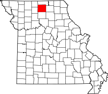 | |
| Villages | ||
| CDP | ||
| Unincorporated communities | ||
| Footnotes | ‡This populated place also has portions in an adjacent county or counties | |