Brown County, Minnesota
| Brown County, Minnesota | |
|---|---|
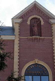 Brown County Courthouse | |
 Location in the U.S. state of Minnesota | |
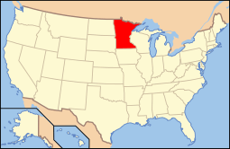 Minnesota's location in the U.S. | |
| Founded |
February 20, 1855 (created) 1856 (organized)[1] |
| Named for | Joseph Renshaw Brown |
| Seat | New Ulm |
| Largest city | New Ulm |
| Area | |
| • Total | 618 sq mi (1,601 km2) |
| • Land | 611 sq mi (1,582 km2) |
| • Water | 7.4 sq mi (19 km2), 1.2% |
| Population (est.) | |
| • (2015) | 25,313 |
| • Density | 42/sq mi (16/km²) |
| Congressional district | 1st |
| Time zone | Central: UTC-6/-5 |
| Website |
www |
Brown County is a county located in the U.S. state of Minnesota. As of the 2010 census, the population was 25,893.[2] Its county seat is New Ulm.[3] The county was formed in 1855 and organized in 1856.
Brown County comprises the New Ulm, MN Metropolitan Statistical Area and is included in the Mankato-New Ulm-North Mankato, MN Combined Statistical Area.
History
Brown County was founded in 1855. It was named for Joseph Renshaw Brown, a member of the Governor's Council of Minnesota in 1855.[4]
Geography
According to the U.S. Census Bureau, the county has a total area of 618 square miles (1,600 km2), of which 611 square miles (1,580 km2) is land and 7.4 square miles (19 km2) (1.2%) is water.[5]
The Minnesota River flows along the county's northern boundary; two of its tributaries, the Cottonwood and Little Cottonwood Rivers, flow eastwardly through the county.[7]
Lakes
- Altermatt Lake: almost entirely in Leavenworth Township, but the southern shore extends into Mulligan Township
- Bachelor Lake: in Stark Township
- Boise Lake: in Burnstown Township
- Clear Lake: in Sigel Township
- Gilman Lake: in Stark Township
- Horseshoe Lake: in Milford Township
- Juni Lake: in Sigel Township
- Lake Cottonwood: in Cottonwood Township
- Lake Hanska: eastern half is in Lake Hanska Township; western half is in Albin Township
- Linden Lake: in Linden Township
- Lone Tree Lake: in Eden Township
- Omsrud Lake: in Lake Hanska Township
- School Lake: in Sigel Township
- Sleepy Eye Lake: in Home Township
- Zanders Lake: mostly in Stark Township, but the eastern fifth is in Sigel Township
Major highways
 U.S. Highway 14
 Minnesota State Highway 4
 Minnesota State Highway 15
 Minnesota State Highway 68
 Minnesota State Highway 257
Adjacent counties
- Nicollet County (northeast)
- Blue Earth County (southeast)
- Watonwan County (south)
- Cottonwood County (southwest)
- Redwood County (west)
- Renville County (northwest)
Climate and weather
| New Ulm, Minnesota | ||||||||||||||||||||||||||||||||||||||||||||||||||||||||||||
|---|---|---|---|---|---|---|---|---|---|---|---|---|---|---|---|---|---|---|---|---|---|---|---|---|---|---|---|---|---|---|---|---|---|---|---|---|---|---|---|---|---|---|---|---|---|---|---|---|---|---|---|---|---|---|---|---|---|---|---|---|
| Climate chart (explanation) | ||||||||||||||||||||||||||||||||||||||||||||||||||||||||||||
| ||||||||||||||||||||||||||||||||||||||||||||||||||||||||||||
| ||||||||||||||||||||||||||||||||||||||||||||||||||||||||||||
In recent years, average temperatures in the county seat of New Ulm have ranged from a low of 6 °F (−14 °C) in January to a high of 83 °F (28 °C) in July, although a record low of −37 °F (−38 °C) was recorded in January 1984 and a record high of 105 °F (41 °C) was recorded in July 1988. Average monthly precipitation ranged from 0.64 inches (16 mm) in January to 4.82 inches (122 mm) in June.[8]
Demographics
| Historical population | |||
|---|---|---|---|
| Census | Pop. | %± | |
| 1860 | 2,339 | — | |
| 1870 | 6,396 | 173.5% | |
| 1880 | 12,018 | 87.9% | |
| 1890 | 15,817 | 31.6% | |
| 1900 | 19,787 | 25.1% | |
| 1910 | 20,134 | 1.8% | |
| 1920 | 22,421 | 11.4% | |
| 1930 | 23,428 | 4.5% | |
| 1940 | 25,544 | 9.0% | |
| 1950 | 25,895 | 1.4% | |
| 1960 | 27,676 | 6.9% | |
| 1970 | 28,887 | 4.4% | |
| 1980 | 28,645 | −0.8% | |
| 1990 | 26,984 | −5.8% | |
| 2000 | 26,911 | −0.3% | |
| 2010 | 25,893 | −3.8% | |
| Est. 2015 | 25,313 | [9] | −2.2% |
| U.S. Decennial Census[10] 1790-1960[11] 1900-1990[12] 1990-2000[13] 2010-2015[2] | |||
As of the census of 2000,[14] there were 26,911 people, 10,598 households, and 7,164 families residing in the county. The population density was 44 people per square mile (17/km²). There were 11,163 housing units at an average density of 18 per square mile (7/km²). The racial makeup of the county was 97.82% White, 0.10% Black or African American, 0.12% Native American, 0.41% Asian, 0.01% Pacific Islander, 0.91% from other races, and 0.63% from two or more races. 2.03% of the population were Hispanic or Latino of any race. 67.1% were of German and 9.6% Norwegian ancestry.
There were 10,598 households out of which 31.50% had children under the age of 18 living with them, 57.30% were married couples living together, 6.90% had a female householder with no husband present, and 32.40% were non-families. 29.00% of all households were made up of individuals and 14.30% had someone living alone who was 65 years of age or older. The average household size was 2.43 and the average family size was 3.00.
In the county the population was spread out with 25.30% under the age of 18, 9.70% from 18 to 24, 25.60% from 25 to 44, 21.90% from 45 to 64, and 17.50% who were 65 years of age or older. The median age was 38 years. For every 100 females there were 98.20 males. For every 100 females age 18 and over, there were 95.90 males.
The median income for a household in the county was $39,800, and the median income for a family was $49,811. Males had a median income of $32,347 versus $23,918 for females. The per capita income for the county was $19,535. About 4.40% of families and 6.40% of the population were below the poverty line, including 7.00% of those under age 18 and 9.80% of those age 65 or over.
Communities
Cities
- Cobden
- Comfrey (partial)
- Evan
- Hanska
- New Ulm (county seat)
- Sleepy Eye
- Springfield
Townships
Unincorporated communities
See also
| Wikinews has related news: |
Footnotes
- ↑ "Minnesota Place Names". Minnesota Historical Society. Retrieved March 17, 2014.
- 1 2 "State & County QuickFacts". United States Census Bureau. Retrieved August 31, 2013.
- ↑ "Find a County". National Association of Counties. Archived from the original on 2011-05-31. Retrieved 2011-06-07.
- ↑ History of the Origin of the Place Names in Nine Northwestern States. 1908. p. 12.
- ↑ "2010 Census Gazetteer Files". United States Census Bureau. August 22, 2012. Archived from the original on October 6, 2014. Retrieved October 5, 2014.
- ↑ Nelson, Steven (2011). Savanna Soils of Minnesota. Minnesota: Self. pp. 65 - 67. ISBN 978-0-615-50320-2.
- ↑ Minnesota Atlas & Gazetteer. Yarmouth, Me.: DeLorme. 1994. pp. 21–22, 30–31. ISBN 0-89933-222-6.
- 1 2 "Monthly Averages for New Ulm, Minnesota". The Weather Channel. Retrieved 2011-11-06.
- ↑ "County Totals Dataset: Population, Population Change and Estimated Components of Population Change: April 1, 2010 to July 1, 2015". Retrieved July 2, 2016.
- ↑ "U.S. Decennial Census". United States Census Bureau. Archived from the original on May 11, 2015. Retrieved October 5, 2014.
- ↑ "Historical Census Browser". University of Virginia Library. Retrieved October 5, 2014.
- ↑ "Population of Counties by Decennial Census: 1900 to 1990". United States Census Bureau. Retrieved October 5, 2014.
- ↑ "Census 2000 PHC-T-4. Ranking Tables for Counties: 1990 and 2000" (PDF). United States Census Bureau. Retrieved October 5, 2014.
- ↑ "American FactFinder". United States Census Bureau. Archived from the original on 2013-09-11. Retrieved 2008-01-31.
Further reading
- Louis Albert Fritsche, History of Brown County, Minnesota: Its People, Industries and Institutions. In Two Volumes. Indianapolis, IN: B.F. Bowen and Co., 1916.
External links
 |
Renville County | Nicollet County | | |
| Redwood County | |
|||
| ||||
| | ||||
| Cottonwood County | Watonwan County | Blue Earth County |
Municipalities and communities of Brown County, Minnesota, United States | ||
|---|---|---|
| Cities | | |
| Townships | ||
| CDP | ||
| Unincorporated communities | ||
| Footnotes | ‡This populated place also has portions in an adjacent county or counties | |
Coordinates: 44°14′N 94°43′W / 44.23°N 94.72°W