Brown County, Indiana
| Brown County, Indiana | |
|---|---|
|
The Brown County Courthouse in Nashville | |
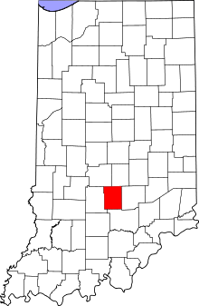 Location in the U.S. state of Indiana | |
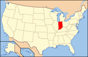 Indiana's location in the U.S. | |
| Founded | 1836 |
| Named for | Jacob Brown |
| Seat | Nashville |
| Largest city | Nashville |
| Area | |
| • Total | 316.63 sq mi (820 km2) |
| • Land | 311.98 sq mi (808 km2) |
| • Water | 4.65 sq mi (12 km2), 1.47% |
| Population | |
| • (2010) | 15,242 |
| • Density | 49/sq mi (18.85/km²) |
| Congressional district | 9th |
| Time zone | Eastern: UTC-5/-4 |
| Website | http://browncounty-in.gov/Home.aspx |
|
Footnotes:
| |

Brown County is a county located in the U.S. state of Indiana. As of 2010, the population is 15,242.[1] The county seat is Nashville.[2]
History
The United States acquired the land from the Native Americans, part of which forms the southwest section of what is now Brown County, in the 1809 treaty of Fort Wayne. By the treaty of St. Mary's in 1818 considerably more territory became property of the government and this included Brown County Land. No settler was allowed in the area until the government survey was completed in 1820. The first white man known to arrive was a German, Johann Schoonover, who lived for a short time on the creek later named for him to trade with the Native Americans, about 1820. In that same year William Elkins, the first pioneer, built a log cabin and cleared land in what became Johnson Township.[3]
The earliest pioneers came from Kentucky, Tennessee, Virginia, and the Carolinas. They crossed the Ohio River and traveled north on narrow Indian trails through dense hardwood forest with wagons drawn by oxen. Many made their way to Bloomington, then east to hilly country, or they reached Jackson County and came north into future Brown County on the Sparks Ferry Road, or west from Columbus in Bartholomew County. Pioneers who had settled on lowland near Columbus came to the hills to escape malaria. Others deliberately chose the hills having lived in mountains before they made the trip to Indiana in search of new land. By 1830 an estimated 150 settlers had arrived; the United States census of 1840 reported 2,364 people.

By 1828 the Indiana State Legislature had divided the land of present-day Brown County between Monroe, Jackson, and Bartholomew counties. In 1835 settlers presented a petition to the Legislature requesting a new county. On February 4, 1836, both the House and Senate passed a bill providing for the formation from western Bartholomew, eastern Monroe, and northern Jackson counties of a county to be named for Gen. Jacob Brown, who defeated the British at the Battle of Sackett's Harbor in the War of 1812.[4] The county has 320 square miles (830 km2), 16 miles (26 km) from east to west and 20 miles (32 km) from north to south.
In August 1836, the land was divided into five townships of Jackson, Hamblen, Washington, Johnson, and Van Buren. Nashville, then known as Jacksonburg, was chosen as the county seat. Banner C. Brummett was appointed County Agent to lay out Nashville in lots to be sold at auction.[3] It was expected that money from the sale would help pay expenses of the county government. The lots sold very slowly, for pioneers had little money, and funds were very short for a number of years. In 1837 a log court house was built, and the first log jail. They were built on the same lots on which the present court house and log jail stand. Nashville, at that time, consisted of a cluster of log cabins and 75 people.
The country was very wild in 1836. Bears, panthers, and wolves were plentiful. The wolves were so numerous and destructive to livestock that the Commissioners paid $1 for every wolf pelt brought to them.[3] Settlers lived a rugged pioneer type of life for many years. Their cabins and small settlements were mere niches in the great forest that covered hills and valleys. The men hunted deer, rabbits, squirrels, wild turkeys and pigeons for food. As soon as enough land was cleared they planted corn, potatoes, wheat, hops for yeast, flax, and tobacco. Women made quilts, wove wool and flax into cloth, made the family clothes, carried water from a well or stream, cooked food in open fireplaces, raised the children, and nursed them when they were sick.
By the time Nashville was incorporated in 1872, water powered grist mills and sawmills were scattered over the county. Each village served its own locality with at least one general store, a blacksmith shop, a church and a post office. A doctor, sometimes more than one, lived in almost every village. In 1881 there were 20 doctors in the county, and 37 churches - Methodist, United Brethren, Baptist, Christian, Presbyterian, and New Light. Money continued to be scarce and much business was conducted by the barter system. The first schools were built of logs, but by 1872 one-room frame school houses dotted the county; in 1900 there were 73.
People farmed but they depended on forest products for cash. Lumber was taken to Indianapolis, also tan bark, cross ties, hoop poles, and barrel staves. The trees were cut recklessly and this led to deep trouble. Since there was not enough farm land on the ridge tops and in the creek bottoms, trees were eliminated on the sides of hills. Wheat and other crops were planted, and erosion began in earnest. By 1900, soil was so completely washed from hillsides and creek bottoms that crops could not be grown. Poverty was widespread and people began to leave the county in droves. Cabins all over the hills and valleys stood empty. In 1890, 10,308 people lived in Brown County. By 1930 only 5,168 remained. Not until 1980 did the population exceed the 1890 figure.
In 1900, villages were still the centers of Brown County life. Travel by horseback, wagon, or carriage was exceedingly limited due to deeply rutted, rocky roads. There were people in remote areas who never made a trip to Nashville their entire lives. Many a family's only contact with the outside world was the huckster's weekly visit with his horse and wagon. As a result, the pioneer way of life continued long after other counties had adopted a new pattern of living.
In 1905 the Illinois Central Railroad built a line from Indianapolis to Effingham, Illinois. The line ran from Morgantown across the southwest corner of Jackson Township. Helmsburg was the main station. Two trains a day from Indianapolis, and two from Effingham, brought freight, mail, and passengers. Horse drawn hacks took people and wagons transported mail and freight from the station to Nashville.
The first cars appeared in Nashville in 1913. Their use was strictly limited because of the very bad roads and because of the widespread belief, peculiar to Brown County, that cars were both autonomous and maleficent. By necessity as the number of cars increased county roads were gradually improved. By 1934 State Road 135 north from Nashville to Morgantown had been built and in that year was hardsurfaced. State Road 46 between Bloomington and Nashville was worked on extensively until it was considered one of the best gravel roads in the state. Some years later it was hard surfaced.
In 1907, artist T. C. Steele built a studio near Belmont in rural Brown County and Adolph Shulz came to Nashville and thus began the Brown County Art Colony. Will Vawter, V.J. Cariani, Marie Goth, C. Curry Bohn, Dale Bessire and others moved to Nashville. The Brown County Art Gallery was opened in 1926. In 1954 a larger gallery was built on East Main Street, and an Art Guild established a gallery in the old Minor House on Van Buren Street. Nashville continues to be an art center and tourist attraction.
Brown County State Park opened in 1931 offering many advantages: a lodge, cabins for rent, picnic areas, a swimming pool, and miles of trails. And at present there is Yellowwood State Forest, the Hoosier National Forest, Lake Monroe and Lake Lemon.
Geography
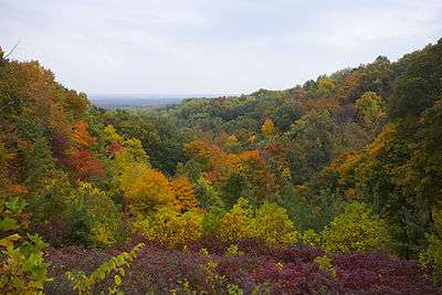
According to the 2010 census, the county has a total area of 316.63 square miles (820.1 km2), of which 311.98 square miles (808.0 km2) (or 98.53%) is land and 4.65 square miles (12.0 km2) (or 1.47%) is water.[5] Brown County is tied with Benton County as the least densely populated county in Indiana. However, Brown County has by far the highest concentration of forested land of any of Indiana's 92 counties with nearly 90% coverage and almost no large farms at all.
Adjacent counties
- Johnson County (northeast)
- Bartholomew County (east)
- Jackson County (south)
- Monroe County (west)
- Morgan County (northwest)
Cities and towns
Unincorporated communities
Extinct towns
- Beck
- Beveridge
- Buffalo
- Cleona
- Cooper
- Gent
- Kelp
- Lock
- Marble
- Marshall
- Ramelton
- Sherman
- Youno
Townships
Major highways
National protected area
- Hoosier National Forest (part)
Points of interest
- Brown County State Park
- CYO Camp Rancho Framasa in Nashville
- eXplore Brown County for adventure, camping, family and group activities.
- Foxfire Park Foxfire Park is located downtown Nashville, and is home to the annual Fall Fine Arts Festival showcasing over 200 Art
- Bill Monroe Music Park & Campground -One of southern Indiana’s largest campgrounds, 55-acre tract, in Bean Blossom, Indiana. General camping, rustic log cabin rentals, and fishing lake. Historic music park boasting over 55 years of music, home of the Bill Monroe Bluegrass Hall of Fame & Museum, Known as the Mecca of Bluegrass, the Bill Monroe Music Park & Campground hosts the oldest, continuous running bluegrass festival in the world.
Exhibitors from all over the Midwest.
- Lake Lemon
- Lake Monroe
- T. C. Steele State Historic Site
- Cordry Sweetwater Conservancy District
Climate and weather
| Nashville, Indiana | ||||||||||||||||||||||||||||||||||||||||||||||||||||||||||||
|---|---|---|---|---|---|---|---|---|---|---|---|---|---|---|---|---|---|---|---|---|---|---|---|---|---|---|---|---|---|---|---|---|---|---|---|---|---|---|---|---|---|---|---|---|---|---|---|---|---|---|---|---|---|---|---|---|---|---|---|---|
| Climate chart (explanation) | ||||||||||||||||||||||||||||||||||||||||||||||||||||||||||||
| ||||||||||||||||||||||||||||||||||||||||||||||||||||||||||||
| ||||||||||||||||||||||||||||||||||||||||||||||||||||||||||||
In recent years, average temperatures in Nashville have ranged from a low of 19 °F (−7 °C) in January to a high of 86 °F (30 °C) in July, although a record low of −21 °F (−29 °C) was recorded in January 1985 and a record high of 110 °F (43 °C) was recorded in July 1936. Average monthly precipitation ranged from 2.66 inches (68 mm) in January to 5.12 inches (130 mm) in May.[9]
Government
The county government is a constitutional body, and is granted specific powers by the Constitution of Indiana, and by the Indiana Code.
County Council: The county council is the legislative branch of the county government and controls all the spending and revenue collection in the county. Representatives are elected from county districts. The council members serve four-year terms. They are responsible for setting salaries, the annual budget, and special spending. The council also has limited authority to impose local taxes, in the form of an income and property tax that is subject to state level approval, excise taxes, and service taxes.[10][11]
Board of Commissioners: The executive body of the county is made of a board of commissioners. The commissioners are elected county-wide, in staggered terms, and each serves a four-year term. One of the commissioners, typically the most senior, serves as president. The commissioners are charged with executing the acts legislated by the council, collecting revenue, and managing the day-to-day functions of the county government.[10][11]
Court: The county maintains a circuit court with jurisdiction to hear all civil and criminal cases. The judge on the court is elected to a term of six years and must be an attorney licensed to practice in Indiana. The judge is assisted by a magistrate who is hired by the circuit court judge, not elected.
County Officials: The county has several other elected offices, including sheriff, coroner, auditor, treasurer, recorder, surveyor, and circuit court clerk. Each of these elected officers serves a term of four years and oversees a different part of county government.
Brown County is part of Indiana's 9th congressional district, Indiana Senate district 40[12] and Indiana House of Representatives districts 60 and 65.[13]
Demographics
| Historical population | |||
|---|---|---|---|
| Census | Pop. | %± | |
| 1840 | 2,364 | — | |
| 1850 | 4,846 | 105.0% | |
| 1860 | 6,507 | 34.3% | |
| 1870 | 8,681 | 33.4% | |
| 1880 | 10,264 | 18.2% | |
| 1890 | 10,308 | 0.4% | |
| 1900 | 9,727 | −5.6% | |
| 1910 | 7,975 | −18.0% | |
| 1920 | 7,019 | −12.0% | |
| 1930 | 5,168 | −26.4% | |
| 1940 | 6,189 | 19.8% | |
| 1950 | 6,209 | 0.3% | |
| 1960 | 7,024 | 13.1% | |
| 1970 | 9,057 | 28.9% | |
| 1980 | 12,377 | 36.7% | |
| 1990 | 14,080 | 13.8% | |
| 2000 | 14,957 | 6.2% | |
| 2010 | 15,242 | 1.9% | |
| Est. 2015 | 14,977 | [14] | −1.7% |
| U.S. Decennial Census[15] 1790-1960[16] 1900-1990[17] 1990-2000[18] 2010-2013[1] | |||
As of the 2010 United States Census, there were 15,242 people, 6,199 households, and 4,444 families residing in the county.[19] The population density was 48.9 inhabitants per square mile (18.9/km2). There were 8,285 housing units at an average density of 26.6 per square mile (10.3/km2).[5] The racial makeup of the county was 97.6% white, 0.3% Asian, 0.3% American Indian, 0.3% black or African American, 0.3% from other races, and 1.1% from two or more races. Those of Hispanic or Latino origin made up 1.2% of the population.[19] In terms of ancestry, 27.2% were German, 13.1% were Irish, 11.6% were English, and 11.3% were American.[20] Those citing "American" ancestry in Brown County are of overwhelmingly English extraction, however most English Americans identify simply as having American ancestry because their roots have been in North America for so long, in some cases since the 1600s.[21][22][23][24][25]
Of the 6,199 households, 26.8% had children under the age of 18 living with them, 60.2% were married couples living together, 7.2% had a female householder with no husband present, 28.3% were non-families, and 23.6% of all households were made up of individuals. The average household size was 2.43 and the average family size was 2.85. The median age was 46.7 years.[19]
The median income for a household in the county was $47,697 and the median income for a family was $56,911. Males had a median income of $42,269 versus $30,175 for females. The per capita income for the county was $24,312. About 9.0% of families and 10.8% of the population were below the poverty line, including 17.2% of those under age 18 and 6.5% of those age 65 or over.[26]
See also
References
- 1 2 "Brown County QuickFacts". United States Census Bureau. Retrieved 2011-09-17.
- ↑ "Find a County". National Association of Counties. Archived from the original on 2011-05-31. Retrieved 2011-06-07.
- 1 2 3 Blanchard, Charles (1884). Counties of Morgan, Monroe and Brown, Indiana: Historical and Biographical. Chicago: F.A. Battey & Co.
- ↑ De Witt Clinton Goodrich & Charles Richard Tuttle (1875). An Illustrated History of the State of Indiana. Indiana: R. S. Peale & co. p. 552.
- 1 2 "Population, Housing Units, Area, and Density: 2010 - County". United States Census Bureau. Retrieved 2015-07-10.
- ↑ Elkinsville, IN Quadrangle N3900 W8615 /7.5 Field Check 1947
- ↑ Drainage Map of Brown County, Department of Conservation, State of Indiana, Engineering Dept 1933 Official Map
- ↑ General Highway and Transportation Map Brown County Prepared by State Highway Commission of Indiana and USDA 1937
- 1 2 "Monthly Averages for Nashville, Indiana". The Weather Channel. Retrieved 2011-01-27.
- 1 2 Indiana Code. "Title 36, Article 2, Section 3". IN.gov. Retrieved 2008-09-16.
- 1 2 Indiana Code. "Title 2, Article 10, Section 2" (PDF). IN.gov. Retrieved 2008-09-16.
- ↑ "Indiana Senate Districts". State of Indiana. Retrieved 2011-01-23.
- ↑ "Indiana House Districts". State of Indiana. Retrieved 2011-01-23.
- ↑ "County Totals Dataset: Population, Population Change and Estimated Components of Population Change: April 1, 2010 to July 1, 2015". Retrieved July 2, 2016.
- ↑ "U.S. Decennial Census". United States Census Bureau. Archived from the original on May 11, 2015. Retrieved July 10, 2014.
- ↑ "Historical Census Browser". University of Virginia Library. Retrieved July 10, 2014.
- ↑ "Population of Counties by Decennial Census: 1900 to 1990". United States Census Bureau. Retrieved July 10, 2014.
- ↑ "Census 2000 PHC-T-4. Ranking Tables for Counties: 1990 and 2000" (PDF). United States Census Bureau. Retrieved July 10, 2014.
- 1 2 3 "DP-1 Profile of General Population and Housing Characteristics: 2010 Demographic Profile Data". United States Census Bureau. Retrieved 2015-07-10.
- ↑ "DP02 SELECTED SOCIAL CHARACTERISTICS IN THE UNITED STATES – 2006-2010 American Community Survey 5-Year Estimates". United States Census Bureau. Retrieved 2015-07-10.
- ↑ "Ancestry of the Population by State: 1980 - Table 3" (PDF). Retrieved 2012-02-10.
- ↑ Sharing the Dream: White Males in a Multicultural America By Dominic J. Pulera.
- ↑ Reynolds Farley, 'The New Census Question about Ancestry: What Did It Tell Us?', Demography, Vol. 28, No. 3 (August 1991), pp. 414, 421.
- ↑ Stanley Lieberson and Lawrence Santi, 'The Use of Nativity Data to Estimate Ethnic Characteristics and Patterns', Social Science Research, Vol. 14, No. 1 (1985), pp. 44-6.
- ↑ Stanley Lieberson and Mary C. Waters, 'Ethnic Groups in Flux: The Changing Ethnic Responses of American Whites', Annals of the American Academy of Political and Social Science, Vol. 487, No. 79 (September 1986), pp. 82-86.
- ↑ "DP03 SELECTED ECONOMIC CHARACTERISTICS – 2006-2010 American Community Survey 5-Year Estimates". United States Census Bureau. Retrieved 2015-07-10.
- Bailey, Dorothy B. (1985). History of Brown County. Brown County Historical Society.
- Inman, N. Carol (1991). The Origins of 1001 Towns In Indiana. Indiana State Historical Association.
- Forstall, Richard L. (editor) (1996). Population of states and counties of the United States: 1790 to 1990 : from the twenty-one decennial censuses. United States Department of Commerce, Bureau of the Census, Population Division. ISBN 0-934213-48-8.
External links
- Annual Brown County Studio Tour 2012
- Brown County Democrat newspaper
- Brown County Convention & Visitors Bureau
- Brown County Chamber of Commerce
- Brown County, Indiana: A Beautiful Place to Live, Work or Visit (Free visitors guide)
- eXplore Brown County
- Foxfire Park Foxfire Park is located downtown Nashville, and is home to the annual Fall Fine Arts Festival showcasing over 200 Art Exhibitors from all over the Midwest.
- Town of Nashville
- The Artists of Brown County
- The Hohenberger Photograph Collection consists of about 15,000 photographs and negatives of Brown County, Indiana, by photographer Frank Michael Hohenberger, 1876-1963.
 |
Morgan County | Johnson County | | |
| Monroe County | |
Bartholomew County | ||
| ||||
| | ||||
| Jackson County |
Municipalities and communities of Brown County, Indiana, United States | ||
|---|---|---|
| Town | ||
| Townships | ||
| CDP | ||
| Other unincorporated communities |
| |
| Footnotes | ‡This populated place also has portions in an adjacent county or counties | |

Coordinates: 39°12′N 86°14′W / 39.20°N 86.23°W