Brooks, Maine
| Brooks, Maine | |
|---|---|
| Town | |
 Location of Brooks (in yellow) in Waldo County and the state of Maine | |
| Coordinates: 44°32′17″N 69°7′26″W / 44.53806°N 69.12389°W | |
| Country | United States |
| State | Maine |
| County | Waldo |
| Area[1] | |
| • Total | 25.37 sq mi (65.71 km2) |
| • Land | 24.67 sq mi (63.90 km2) |
| • Water | 0.70 sq mi (1.81 km2) |
| Elevation | 741 ft (226 m) |
| Population (2010)[2] | |
| • Total | 1,078 |
| • Estimate (2012[3]) | 1,077 |
| • Density | 43.7/sq mi (16.9/km2) |
| Time zone | Eastern (EST) (UTC-5) |
| • Summer (DST) | EDT (UTC-4) |
| ZIP code | 04921 |
| Area code(s) | 207 |
| FIPS code | 23-07870 |
| GNIS feature ID | 0582371 |
Brooks is a town in Waldo County, Maine, United States. The population was 1,078 at the 2010 census.
The town was named after John Brooks, the Federalist candidate for Governor of Massachusetts in 1815-1816, when the town incorporated. The town of Dexter, which incorporated the same year, was named after the opposing candidate Samuel Dexter. It was during Gov. Brooks' administration that Maine ceased to be a territory of Massachusetts and became a state.
Geography
According to the United States Census Bureau, the town has a total area of 25.37 square miles (65.71 km2), of which, 24.67 square miles (63.90 km2) of it is land and 0.70 square miles (1.81 km2) is water.[1]
Demographics
| Historical population | |||
|---|---|---|---|
| Census | Pop. | %± | |
| 1820 | 318 | — | |
| 1830 | 601 | 89.0% | |
| 1840 | 910 | 51.4% | |
| 1850 | 1,021 | 12.2% | |
| 1860 | 988 | −3.2% | |
| 1870 | 868 | −12.1% | |
| 1880 | 877 | 1.0% | |
| 1890 | 730 | −16.8% | |
| 1900 | 669 | −8.4% | |
| 1910 | 704 | 5.2% | |
| 1920 | 691 | −1.8% | |
| 1930 | 729 | 5.5% | |
| 1940 | 744 | 2.1% | |
| 1950 | 747 | 0.4% | |
| 1960 | 758 | 1.5% | |
| 1970 | 751 | −0.9% | |
| 1980 | 804 | 7.1% | |
| 1990 | 900 | 11.9% | |
| 2000 | 1,022 | 13.6% | |
| 2010 | 1,078 | 5.5% | |
| Est. 2014 | 1,086 | [4] | 0.7% |
2010 census
As of the census[2] of 2010, there were 1,078 people, 446 households, and 285 families residing in the town. The population density was 43.7 inhabitants per square mile (16.9/km2). There were 562 housing units at an average density of 22.8 per square mile (8.8/km2). The racial makeup of the town was 96.7% White, 0.4% African American, 0.8% Native American, 0.4% Asian, 0.1% from other races, and 1.7% from two or more races. Hispanic or Latino of any race were 0.6% of the population.
There were 446 households of which 30.9% had children under the age of 18 living with them, 48.0% were married couples living together, 11.0% had a female householder with no husband present, 4.9% had a male householder with no wife present, and 36.1% were non-families. 28.9% of all households were made up of individuals and 12.8% had someone living alone who was 65 years of age or older. The average household size was 2.42 and the average family size was 2.97.
The median age in the town was 40.2 years. 23.6% of residents were under the age of 18; 7.2% were between the ages of 18 and 24; 25.7% were from 25 to 44; 27.7% were from 45 to 64; and 15.8% were 65 years of age or older. The gender makeup of the town was 51.4% male and 48.6% female.
2000 census
As of the census[6] of 2000, there were 1,022 people, 410 households, and 275 families residing in the town. The population density was 41.8 people per square mile (16.1/km²). There were 522 housing units at an average density of 21.4 per square mile (8.2/km²). The racial makeup of the town was 98.83% White, 0.10% African American, 0.20% Native American, 0.10% Asian, 0.10% from other races, and 0.68% from two or more races. Hispanic or Latino of any race were 0.88% of the population.
There were 410 households out of which 31.2% had children under the age of 18 living with them, 55.9% were married couples living together, 6.6% had a female householder with no husband present, and 32.7% were non-families. 27.6% of all households were made up of individuals and 11.2% had someone living alone who was 65 years of age or older. The average household size was 2.47 and the average family size was 2.98.
In the town the population was spread out with 26.3% under the age of 18, 6.8% from 18 to 24, 28.4% from 25 to 44, 24.6% from 45 to 64, and 14.0% who were 65 years of age or older. The median age was 38 years. For every 100 females there were 97.3 males. For every 100 females age 18 and over, there were 90.2 males.
The median income for a household in the town was $30,104, and the median income for a family was $38,393. Males had a median income of $25,833 versus $18,977 for females. The per capita income for the town was $14,446. About 14.2% of families and 19.5% of the population were below the poverty line, including 24.9% of those under age 18 and 27.8% of those age 65 or over.
References
- 1 2 "US Gazetteer files 2010". United States Census Bureau. Retrieved 2012-12-16.
- 1 2 "American FactFinder". United States Census Bureau. Retrieved 2012-12-16.
- ↑ "Population Estimates". United States Census Bureau. Archived from the original on 2013-06-17. Retrieved 2013-07-06.
- ↑ "Annual Estimates of the Resident Population for Incorporated Places: April 1, 2010 to July 1, 2014". Retrieved June 4, 2015.
- ↑ "Census of Population and Housing". Census.gov. Archived from the original on May 11, 2015. Retrieved June 4, 2015.
- ↑ "American FactFinder". United States Census Bureau. Archived from the original on 2013-09-11. Retrieved 2008-01-31.
External links
Municipalities and communities of Waldo County, Maine, United States | ||
|---|---|---|
| City | 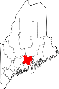 | |
| Towns | ||
| CDPs | ||
| Other villages | ||
Coordinates: 44°33′01″N 69°07′15″W / 44.55028°N 69.12083°W