Brogden, North Carolina
| Brogden, North Carolina | |
|---|---|
| CDP | |
 Brogden, North Carolina Location within the state of North Carolina | |
| Coordinates: 35°17′51″N 78°1′40″W / 35.29750°N 78.02778°WCoordinates: 35°17′51″N 78°1′40″W / 35.29750°N 78.02778°W | |
| Country | United States |
| State | North Carolina |
| County | Wayne |
| Area | |
| • Total | 2.2 sq mi (5.7 km2) |
| • Land | 2.2 sq mi (5.6 km2) |
| • Water | 0.0 sq mi (0.1 km2) |
| Elevation | 174 ft (53 m) |
| Population (2007) | |
| • Total | 2,914 |
| • Density | 1,346.1/sq mi (519.7/km2) |
| Time zone | Eastern (EST) (UTC-5) |
| • Summer (DST) | EDT (UTC-4) |
| FIPS code | 37-08110[1] |
| GNIS feature ID | 1019314[2] |
Brogden is a census-designated place (CDP) in Wayne County, North Carolina, United States. The population was 2,914 at the 2007 census. It is included in the Goldsboro, North Carolina Metropolitan Statistical Area.
History
Shiloh Primitive Baptist Church was listed on the National Register of Historic Places in 2008.[3]
Geography
Brogden is located at 35°17′51″N 78°1′40″W / 35.29750°N 78.02778°W (35.297594, -78.027817).[4]
According to the United States Census Bureau, the CDP has a total area of 2.2 square miles (5.7 km2), of which, 2.2 square miles (5.7 km2) of it is land and 0.04 square miles (0.10 km2) of it (1.82%) is water.
Brogden's elevations are on average 175 feet above sea level. The area is underlain by unconsolidated beds of sand, clay and gravel. Most of these beds were deposited in seawater as the sea advanced and retreated during the geologic development of the Atlantic Coastal Plain. To a much lesser extent, streams deposited layers of sediment which mixed with that deposited on the sea floor.
The climate in Brogden is characterized by warm summers and moderate winters. The average temperature is about 62 degrees. Annual precipitation is about 50 inches of rainfall per year, with the major portion occurring in the late spring and summer.[5]
Brogden also is the name of a farming community in neighboring Johnston County, where Hollywood actress Ava Gardner was born.
Demographics
As of the census[1] of 2000, there were 2,907 people, 1,030 households, and 784 families residing in the CDP. The population density was 1,346.1 people per square mile (519.6/km²). There were 1,157 housing units at an average density of 535.8 per square mile (206.8/km²). The racial makeup of the CDP was 36.29% White, 56.90% African American, 0.52% Native American, 0.34% Asian, 4.27% from other races, and 1.69% from two or more races. Hispanic or Latino of any race were 6.67% of the population.
There were 1,030 households out of which 35.9% had children under the age of 18 living with them, 49.6% were married couples living together, 21.8% had a female householder with no husband present, and 23.8% were non-families. 18.0% of all households were made up of individuals and 5.0% had someone living alone who was 65 years of age or older. The average household size was 2.82 and the average family size was 3.17.
In the CDP the population was spread out with 28.1% under the age of 18, 9.7% from 18 to 24, 28.8% from 25 to 44, 25.2% from 45 to 64, and 8.2% who were 65 years of age or older. The median age was 35 years. For every 100 females there were 93.9 males. For every 100 females age 18 and over, there were 88.5 males.
The median income for a household in the CDP was $32,875, and the median income for a family was $35,804. Males had a median income of $25,545 versus $19,828 for females. The per capita income for the CDP was $15,293. About 13.6% of families and 15.1% of the population were below the poverty line, including 23.5% of those under age 18 and 29.4% of those age 65 or over.
Education
Education in Brogden is administered by the Wayne County Public School system with children attending schools in nearby townships. Higher education is offered through Wayne Community College in Goldsboro and Mount Olive College in Mount Olive.
Transportation
Passenger
- Air: Brogden is served through nearby Kinston Regional Jetport (IATA: ISO, ICAO: KISO) with service to Orlando, Florida. Raleigh-Durham International Airport is the closest major airport with service to more than 45 domestic and international destinations. Goldsboro-Wayne Municipal Airport is an airport located nearby, but is only used for general aviation.
- Interstate Highway: I-795 is the closest Interstate to Brogden, which is located 7 miles north in Goldsboro.
- Brogden is not served directly by passenger trains. The closest Amtrak station is located in Selma.
- Bus: The area is served by Greyhound with a location in nearby Goldsboro.
Roads
- The main highway in Brogden is US 117.
Notes
- 1 2 "American FactFinder". United States Census Bureau. Archived from the original on 2013-09-11. Retrieved 2008-01-31.
- ↑ "US Board on Geographic Names". United States Geological Survey. 2007-10-25. Retrieved 2008-01-31.
- ↑ National Park Service (2010-07-09). "National Register Information System". National Register of Historic Places. National Park Service.
- ↑ "US Gazetteer files: 2010, 2000, and 1990". United States Census Bureau. 2011-02-12. Retrieved 2011-04-23.
- ↑ Wayne County Facts
Municipalities and communities of Wayne County, North Carolina, United States | ||
|---|---|---|
| City | 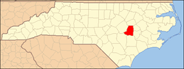 | |
| Towns | ||
| Village | ||
| CDPs | ||
| Unincorporated communities | ||
| Footnotes | ‡This populated place also has portions in an adjacent county or counties | |