Bristol, Maryland
| Bristol, Maryland | |
|---|---|
| Unincorporated community | |
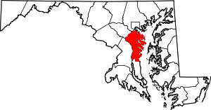
 Bristol, Maryland  Bristol, Maryland Location within the state of Maryland | |
| Coordinates: 38°47′30″N 76°40′20″W / 38.79167°N 76.67222°WCoordinates: 38°47′30″N 76°40′20″W / 38.79167°N 76.67222°W | |
| Country |
|
| State |
|
| County |
|
| Time zone | Eastern (EST) (UTC-5) |
| • Summer (DST) | EDT (UTC-4) |
Bristol is an unincorporated community in Anne Arundel County, Maryland, United States.[1] Jug Bay Wetlands Sanctuary (a stop on the Patuxent Water Trail)[2] and the colonial town of Pig Point (alternately referred to as Bristol Landing and Leon at times) are on the Patuxent River waterfront portion of Bristol. Pig Point saw War of 1812 action [3] and was the largest steamboat port on the Patuxent in the mid-19th century.[4] Pig Point is a very significant Native American Early Archaic Period archaeological site.[5][6]
The Chesapeake Beach Railway was completed in 1899 through the southern part of Bristol or "Pindell"; ruins of the Pindell Station and its general store remain.[7][8] The James Owens Farm, listed on the National Register of Historic Places,[9] and the southern terminus of the Stephanie Roper Highway portion of Maryland Route 4 are also located in Bristol.
In the mid-twentieth century, the segregated Bristol Elementary School was located in the northern part of town, just three-quarter mile southeast of Waysons Corner and a half mile south of the crossroad village of Drury. The school in 1953 published a history of Bristol (largely reprinting a 1927 Bristol town history from the Annapolis Capital newspaper).[10] The following year it would be enlarged and renovated, growing to 200 students (and four teachers and a heating and rodent problem) by 1969 [11] after the county was ordered to desegregate schools in 1966 [12]
References
- ↑ "Geographic Names Information System". Bristol (Populated Place). U.S. Geological Survey. 2009-01-29.
- ↑ "Patuxent Water Trail". Patuxent Riverkeeper. Retrieved 2013-02-20.
- ↑ "Star-Spangled History". National Park Service Star-Spangled Banner National Historic Trail. Retrieved 2013-02-20.
- ↑ "South County Draft Small Area Plan" (PDF). Anne Arundel County. Retrieved 2015-02-26.
- ↑ Al Luckenbach; et al. "Pig Point". Anne Arundel County. Retrieved 2013-02-20.
- ↑ Al Luckenbach; et al. "Archaic Period Triangular Points from Pig Point" (PDF). Journal of Middle Atlantic Archaeology Vol 26 2010. Retrieved 2013-02-20.
- ↑ "Nomination Form for National Register of Historic Places" (PDF). Maryland Historic Trust. Retrieved 2013-02-20.
- ↑ "Maryland and Delaware (map showing towns of Bristol and Pindell and the rail line)". C.S. Hammond and Co., NY. 1908. Retrieved 2015-02-26.
- ↑ National Park Service (2008-04-15). "National Register Information System". National Register of Historic Places. National Park Service.
- ↑ Fifth Grade class (1953). "Discovering Our School Community" (PDF). Anne Arundel County Board of Education. Retrieved 2015-02-26.
- ↑ Pat Melville (12 November 1996). "Grand Jury Inspection of Schools". The Archivist's Bulldog Vol. 10 No. 21. Maryland Archives. Retrieved 2015-02-26.
- ↑ Carol L. Bowers (12 February 1995). "Philip L. Brown has the long view of Anne Arundel's schools and racial integration". The Baltimore Sun. Retrieved 2015-02-26.