Brimington
Coordinates: 53°15′29″N 1°23′26″W / 53.2580°N 1.3905°W
| Brimington | |
 Methodist Church at Brimington. |
|
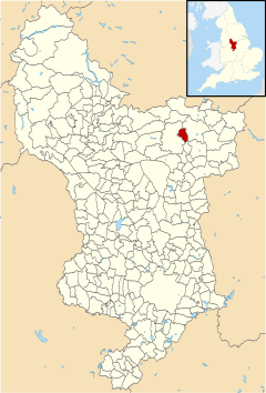 Brimington parish highlighted within Derbyshire |
|
| Population | 8,788 (2011) |
|---|---|
| OS grid reference | SK406736 |
| Civil parish | Brimington |
| District | Chesterfield |
| Shire county | Derbyshire |
| Ceremonial county | Derbyshire |
| Region | East Midlands |
| Country | England |
| Sovereign state | United Kingdom |
| Post town | CHESTERFIELD |
| Postcode district | S43 |
| Dialling code | 01246 |
| Police | Derbyshire |
| Fire | Derbyshire |
| Ambulance | East Midlands |
| EU Parliament | East Midlands |
| UK Parliament | Chesterfield |
|
|
Brimington is a civil parish within the borough of Chesterfield in north-east Derbyshire, England. The population of the civil parish including Hollingwood taken at the 2011 Census was 8,788.[1] The town of Staveley is to the east, and Hollingwood is nearby. The parish includes Brimington Common along the Calow Road, and New Brimington, a late 19th-century extension towards the Staveley Iron Works.
Information
The Parish Council is the level of local government in Chesterfield nearest to the people of Brimington. The old parishes were formed at a time when there was little difference, to the local people, between the Church and the State. A parish like Brimington usually formed around a village or other small community and used to be centred on the Parish Church. In the late 1800s Church and State separated but the same area is now represented as a local authority by the Brimington Parish Council and the Church of England by the Parochial Church Council.
Education
Brimington has two infant schools, Henry Bradley Infant School and Brimington Manor. Pupils generally feed into Brimington Junior School. Local secondary schools include Springwell Community College and Netherthorpe School.
Local amenities
Brimington has a small library, various businesses including a chemist, car garages and showrooms, shops and a petrol station.
There is an old pub called the Ark Tavern, next to what is now a care home. The building housing the care home used to be called Sutton Lodge (formerly Sutton Villa) and dates from about 1780-90. Other pubs in the centre of Brimington are The Red Lion, The Three Horseshoes, The Butchers Arms and the most recently built, The Corner House which has now been demolished and is part of the caravan store. Towards the lower end of Brimington, overlooking the Chesterfield Canal, is The Mill and along Brimington Common are The Miner's Arms and The Brickmakers Arms.
Brimington also has several takeaway businesses with foods ranging including Indian, Bangledeshi, Chinese, pizza, kebab and several traditional fish and chip shops.
The village has two churches, an education centre and a taxi rank.
Chesterfield's crematorium is in Brimington, on the road into Chesterfield. Built in 20 acres of ground bought in 1954, it was opened in 1959.[2] Sergeant Fred Greaves (1890-1973), a recipient of the Victoria Cross in the World War I, a resident of Brimington, was cremated here.[3]
Brimington's Memorial Gates commemorate the village soldiers of both World Wars and is situated on Manor Road. A website is dedicated to the men from the village who died in World War I.[4]
See also
References
- ↑ "civil parish population 2011". Neighbourhood Statistics. Office for National Statistics. Retrieved 18 March 2016.
- ↑ "Archived copy". Archived from the original on 2013-10-03. Retrieved 2013-08-04. Chesterfield local council website.
- ↑ Burial locations VC holders.
- ↑ www.brimington-memorial.co.uk