Brilliant, Alabama
| Brilliant, Alabama | |
|---|---|
| Town | |
 Location in Marion County and the state of Alabama | |
| Coordinates: 34°1′21″N 87°46′2″W / 34.02250°N 87.76722°W | |
| Country | United States |
| State | Alabama |
| County | Marion |
| Area | |
| • Total | 3.4 sq mi (8.9 km2) |
| • Land | 3.4 sq mi (8.9 km2) |
| • Water | 0 sq mi (0 km2) |
| Elevation | 620 ft (189 m) |
| Population (2000) | |
| • Total | 900 |
| • Density | 224.1/sq mi (85.6/km2) |
| Time zone | Central (CST) (UTC-6) |
| • Summer (DST) | CDT (UTC-5) |
| ZIP code | 35548 |
| Area code(s) | 205 |
| FIPS code | 01-09424 |
| GNIS feature ID | 0114918 |
| Website | http://www.brilliantal.org/ |
Brilliant is a town in Marion County, Alabama, United States. At the 2010 census the population was 900, up from 762 in 2000.
History
The present Town of Brilliant was incorporated in 1927[1] as Boston, Alabama and was named for the City of Boston, Massachusetts and in part for early settlers of the area, the Bostick family. In the late part of the 19th century, the discovery of coal led to the development of the Brilliant Coal Company, which was located adjacent to the town of Boston. The Brilliant Coal Company served as a catalyst for growth for the area and provided ample employment for more than 50 years. At the turn of the 20th century, the Brilliant and Boston area was the most densely populated part of Marion County. In 1957 due to declines in industry and population the post office at Boston, Alabama was absorbed into the Brilliant, Alabama post office. The history of Boston, Alabama changed forever with the passage of Act 284 by the Alabama Legislature, which changed the name of the town of Boston to Brilliant. By the end of the 1950s The Brilliant Coal Company had shuttered its mining operations, however several smaller mining operations were in business around the area until the early 1990s. From 1987 until 2000 the town was home to Brilliant Homes Ltd. a well known manufactured housing producer in the southeast and parts of the southwest. The company was acquired by American Homestar Corporation of League City, Texas in 1997, due to the declining manufactured housing industry the plant was closed on April 15, 2000, American Homestar Corporation subsequently filed for Chapter 11 bankruptcy later in 2001. The town is currently home to one garment manufacturing plant, Tullahoma Industries which produces garments for the U.S. Army.
The following is from the August 30, 1957, Winfield Journal article: Boston is Now Brilliant; Act Also Extends Corporate Limits
"It's official now. The municipality of Boston is no more. As of August 16, Governor James E. Folsom signed into law Act No. 284 which changed the name of the town from Boston to Brilliant and extended the boundary lines to take in approximately 40 more homes and bring the town's population to about 1,000 residents. Mayor Max A. Wood made the announcement earlier this week.In a straw vote election held on last April 23, 1956 citizens voted 120 for to 37 against to change the name of the town and extend the city limits.
For many years only a part of the Boston-Brilliant community has been incorporated. Boston was incorporated while the area consisting of Brilliant was not.
The town of Boston had its origins sometime in the latter part of the 19th century. Alfred Wates opened the first store and later as the community grew, an early settler named Lee Beauchamp named it Boston for the city of Boston, Massachusetts, and also because the name tied in somewhat with the pioneer Bostick family who settled in the area about the time of the Civil War. Both Boston and Brilliant owe most of their early development and progress to the mines of the Aldredge and Brilliant Coal Companies. Brilliant began with the opening of coal mines around 1897.
Mayor Wood said that the increase in population resulting from the extension of the corporate limits would mean more revenue from state sources as well as other advantages."
Geography
Brilliant is located at 34°1′22″N 87°46′3″W / 34.02278°N 87.76750°W (34.022764, -87.767372).[2]
According to the U.S. Census Bureau, the town has a total area of 3.4 square miles (8.8 km2), all land.
Demographics
| Historical population | |||
|---|---|---|---|
| Census | Pop. | %± | |
| 1930 | 522 | — | |
| 1940 | 591 | 13.2% | |
| 1950 | 700 | 18.4% | |
| 1960 | 749 | 7.0% | |
| 1970 | 726 | −3.1% | |
| 1980 | 871 | 20.0% | |
| 1990 | 751 | −13.8% | |
| 2000 | 762 | 1.5% | |
| 2010 | 900 | 18.1% | |
| Est. 2015 | 884 | [3] | −1.8% |
| U.S. Decennial Census[4] 2013 Estimate[5] | |||
As of the census[6] of 2000, there were 762 people, 343 households, and 220 families residing in the town. The population density was 221.7 people per square mile (85.5/km2). There were 402 housing units at an average density of 116.9 per square mile (45.1/km2). The racial makeup of the town was 99.61% White, 0.13% Native American, and 0.26% from two or more races. 0.66% of the population were Hispanic or Latino of any race.
There were 343 households out of which 27.7% had children under the age of 18 living with them, 48.7% were married couples living together, 12.2% had a female householder with no husband present, and 35.6% were non-families. 34.1% of all households were made up of individuals and 16.0% had someone living alone who was 65 years of age or older. The average household size was 2.22 and the average family size was 2.81.
In the town the population was spread out with 22.7% under the age of 18, 7.2% from 18 to 24, 25.1% from 25 to 44, 25.5% from 45 to 64, and 19.6% who were 65 years of age or older. The median age was 41 years. For every 100 females there were 91.5 males. For every 100 females age 18 and over, there were 85.8 males.
The median income for a household in the town was $18,224, and the median income for a family was $27,857. Males had a median income of $28,611 versus $15,703 for females. The per capita income for the town was $14,516. About 22.4% of families and 26.5% of the population were below the poverty line, including 37.3% of those under age 18 and 27.0% of those age 65 or over.
References
- ↑ http://www.encyclopediaofalabama.org/article/h-3490
- ↑ "US Gazetteer files: 2010, 2000, and 1990". United States Census Bureau. 2011-02-12. Retrieved 2011-04-23.
- ↑ "Annual Estimates of the Resident Population for Incorporated Places: April 1, 2010 to July 1, 2015". Retrieved July 2, 2016.
- ↑ "U.S. Decennial Census". Census.gov. Archived from the original on May 11, 2015. Retrieved June 6, 2013.
- ↑ "Annual Estimates of the Resident Population: April 1, 2010 to July 1, 2013". Retrieved June 3, 2014.
- ↑ "American FactFinder". United States Census Bureau. Archived from the original on 2013-09-11. Retrieved 2008-01-31.
External links
Coordinates: 34°01′22″N 87°46′03″W / 34.022764°N 87.767372°W
Municipalities and communities of Marion County, Alabama, United States | ||
|---|---|---|
| Cities | 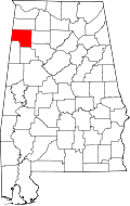 | |
| Towns | ||
| Unincorporated communities | ||
| Ghost town | ||
| Footnotes | ‡This populated place also has portions in an adjacent county or counties | |