Bridges of Pittsburgh
The Bridges of Pittsburgh play an important role in the city's transportation system. Without bridges, the Pittsburgh region would be a series of fragmented valleys, hillsides, river plains, and isolated communities.[1]
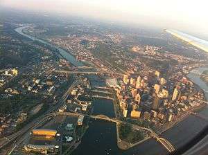
A 2006 study[2] determined that Pittsburgh has 446 bridges, and with its proximity to three major rivers and countless hills and ravines, Pittsburgh is known as "The City of Bridges". The city of Pittsburgh and Allegheny County are the largest owners of great bridges in the country, in proper proportion to their size, with the possible exception of the City of New York, which is built on an island and surrounded by large bodies of water.
According to a 2011 study by Transportation for America, 1,194 bridges in the Pittsburgh area—or 30.4%—were deficient, the highest proportion in the nation.[3][4]
History
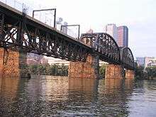
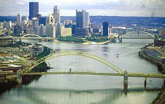
Pittsburgh's first river bridges, made of wood and long since replaced, opened in 1818 at Smithfield Street and 1819 at Sixth Street (then St. Clair Street). The city's oldest in-service bridge is the current Smithfield Street Bridge, which opened in 1883; it was designated a National Historic Landmark in 1976.[5] Pittsburgh waged a massive road and bridge building campaign from 1924 to 1940; most of Pittsburgh's oldest major bridges date from this period. The coming of the Interstate Highway System triggered more construction in the second half of the twentieth century, as vehicular speed and throughput requirements increased. The result of more than 100 years of bridge building is a collection of most of the major types of bridge (suspension, cantilever, arch, etc.), mostly built from locally produced steel, including about forty river spans.
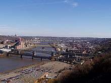
Many of the bridges in the Downtown area are colored Aztec Gold,[6] either constructed as such or painted afterward, to match the city's official colors of black and gold. A few old and out-of-service bridges, such as the Hot Metal Bridge (which stood dormant until reopening as a passenger bridge in the year 2000), are exceptions to this rule.
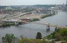
Major bridges
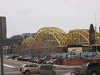
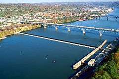
This table lists all bridges crossing the Allegheny, Monongahela and Ohio rivers in the City of Pittsburgh limits.


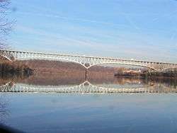


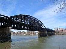
.jpg)


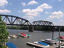


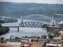
This table lists some other major bridges within the City of Pittsburgh limits.
| Bridge | Carries | Over | Image |
|---|---|---|---|
| Charles Anderson Memorial Bridge | Boulevard of the Allies | Junction Hollow, P&W Subdivision | .jpg) |
| Bloomfield Bridge | roadway | P&W Subdivision, East Busway, Pittsburgh Line |  |
| Brilliant Cutoff Viaduct | Brilliant Branch | .jpg) | |
| Larimer Avenue Bridge | Larimer Avenue |
Notable bridges

- The Fort Pitt Bridge is a steel bowstring arch bridge that spans the Monongahela River near its confluence with the Allegheny River at the point. It carries Interstate 376 between the Fort Pitt Tunnel and Point State Park.
- The Fort Duquesne Bridge is a steel tied arch bridge that spans the Allegheny River in Pittsburgh, Pennsylvania. It carries Pennsylvania Route 65 / Interstate 279 (North Shore Expressway), which runs through Downtown Pittsburgh's Golden Triangle towards Interstate 79.
- The West End Bridge is a large steel arch bridge which crosses the Ohio River. It is the first bridge on the Ohio River heading toward the Mississippi River. The bridge carries U.S. Route 19.
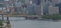
- The Liberty Bridge crosses over the Monongahela River, intersecting Interstate 579 at its southern terminus.
- The Three Sisters are three parallel, nearly identical self-anchored suspension bridges that cross the Allegheny River at 6th, 7th, and 9th streets. The bridges have been recently renamed for prominent Pittsburgh residents: Roberto Clemente Bridge, Andy Warhol Bridge, and Rachel Carson Bridge.
- The Smithfield Street Bridge is a lenticular truss bridge crossing the Monongahela River. Its two main lenticular spans make the bridge very recognizable. It is a National Historic Civil Engineering Landmark, according to a plaque on the bridge.
- The George Westinghouse Bridge crosses 240 feet above Turtle Creek Valley in East Pittsburgh.
See also
-
 Bridges portal
 -
 Pennsylvania portal
 -
 Pittsburgh portal
 - Crossings of the Ohio River in Pennsylvania
- Crossings of the Allegheny River in Pennsylvania
- Crossings of the Monongahela River in Pennsylvania
- List of bridges and tunnels in New York City
References
| Wikimedia Commons has media related to Bridges in Pittsburgh. |
- ↑ Kidney, Walter C. (1999). Pittsburgh's Bridges: Architecture and Engineering. Pittsburgh, PA: Pittsburgh History & Landmarks Foundation. ISBN 978-0916670214.
- ↑ "Just How Many Bridges Are There In Pittsburgh?". thePittsburghchannel.com. September 13, 2006. Retrieved January 30, 2010.
- ↑ Schmitz, Jon (October 19, 2011). "Bridges in Pittsburgh labeled the worst". Pittsburgh Post-Gazette. Retrieved November 28, 2011.
- ↑ "The Fix We're In For: The State of Our Nation's Busiest Bridges" (PDF). Metropolitan Bridge Rankings. Transportation for America. October 2011. Retrieved November 28, 2011.
- ↑ "Listing of National Historic Landmarks by State: Pennsylvania" (PDF). National Park Service. June 2013. p. 5. Retrieved August 7, 2013.
- ↑ http://www.pghcitypaper.com/pittsburgh/why-are-the-bridges-in-pittsburgh-painted-yellow/Content?oid=1335862
External links
- Bridges & Tunnels of Allegheny County and Pittsburgh, PA—Bruce S. Cridlebaugh's excellent, authoritative and exhaustive website
- Photos of Pittsburgh area bridges.—Extensive photo-documentation of several Pittsburgh bridges.
- "urbantraipsing.wordpress.com - pittsburgh bridges".—A documentation of walking many of the bridges of Pittsburgh.
| |||||||||||||||||||||||||||||||
| |||||||||||||||||||||||||||||||
| |||||||||||||||||||||||||||||||