Branscomb Glacier
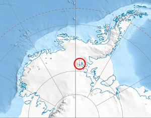
Location of Vinson Massif in Western Antarctica.
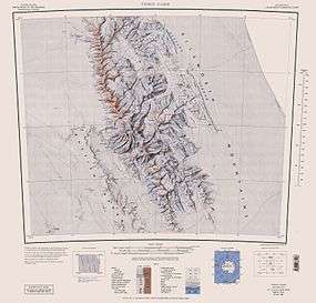
Central and southern Sentinel Range map.
The Branscomb Glacier (78°32′S 86°05′W / 78.533°S 86.083°WCoordinates: 78°32′S 86°05′W / 78.533°S 86.083°W) is an Antarctic glacier, 9.5 km (6 mi) long, flowing west from the north-west side of Vinson Massif (the highest point in Antarctica) into Nimitz Glacier, in the Sentinel Range of the Ellsworth Mountains. Its upper course receives ice influx from both Goodge Col and Jacobsen Valley, while the tributary Roché Glacier joins Branscomb Glacier just northwest of Príncipe de Asturias Peak.
The glacier was mapped by the USGS from surveys and USN aerial photographs between 1957 and 1960. It was named by US-ACAN after Lewis M. Branscomb, Chairman of the National Science Board from 1982 to 1984.
See also
Maps
- Vinson Massif. Scale 1:250 000 topographic map. Reston, Virginia: US Geological Survey, 1988.
- Antarctic Digital Database (ADD). Scale 1:250000 topographic map of Antarctica. Scientific Committee on Antarctic Research (SCAR), 1993–2016.
References
- SCAR Composite Gazetteer of Antarctica.
- U.S. Geological Survey Geographic Names Information System: Branscomb Glacier
This article is issued from Wikipedia - version of the 1/29/2016. The text is available under the Creative Commons Attribution/Share Alike but additional terms may apply for the media files.