Brahmanbaria
| Brahmanbaria, Bangladesh ব্রাহ্মণবাড়ীয়া | |
|---|---|
| city District Capital | |
|
Brahmanbaria city. | |
| Nickname(s): B-Baria | |
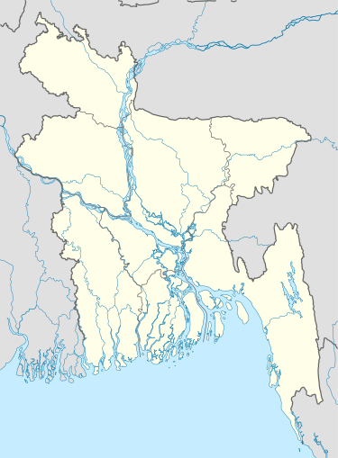 Brahmanbaria, Bangladesh Location in Brahmanbaria | |
| Coordinates: 23°57.9′N 91°6.5′E / 23.9650°N 91.1083°ECoordinates: 23°57.9′N 91°6.5′E / 23.9650°N 91.1083°E | |
| Country | Bangladesh |
| Division | Comilla Division |
| District | Brahmanbaria District |
| Establishment | Late 1700 CE |
| Municipality | 1769 |
| Administrative District | 1984 |
| Government | |
| • Type | Pourashava |
| • City Mayor | Hellal Uddin |
| Area[1] | |
| • city District Capital | 77 km2 (29.8 sq mi) |
| • Urban | 50 km2 (19.3 sq mi) |
| • Metro | 10 km2 (4.0 sq mi) |
| Elevation | 34 m (112 ft) |
| Population (2011) | |
| • city District Capital | 168,636 |
| • Density | 2,200/km2 (5,700/sq mi) |
| Demonym(s) | Beebarian |
| Time zone | Bangladesh Time (UTC+6) |
| Postal code | 3400[2] |
| National Calling Code | +880 |
| Local Calling Code | +88-0851 |

Brahmanbaria[3] (Bengali: ব্রাহ্মণবাড়ীয়া সিটি)[4] is a historic city of Bangladesh. It is the capital of Brahmanbaria District and second largest city after Comilla in eastern Bangladesh.[5] Brahmanbaria is one of the oldest municipalities in Bangladesh, and was established in 1769. Brahmanbaria was declared a district headquarters in 1984. Its municipality area has a population of 168,636 according to the 2011 Census. It was a part of greater Comilla District until 1984.
Geography & Climate

Brahmanbaria is located in the East-Central region of Bangladesh. Its nearby cities are Dhaka, Comilla, Narayanganj and Agartala. This city is in the bank of Titas River. Also there is Meghna River in the west of Brahmanbaria. The climate of Brahmanbaria is very similar to other cities of Bangladesh. During summer it is extremely hot. August is the hottest month and January is the coldest. Floods are a major concern for people in Brahmanbaria, as the city has suffered from flooding for four times in a decade. Tornados and the monsoon Kaalboishakhi jhor hit almost every year.
Brahmanbaria has a tropical wet and dry climate.
| Climate data for Brahmanbaria | |||||||||||||
|---|---|---|---|---|---|---|---|---|---|---|---|---|---|
| Month | Jan | Feb | Mar | Apr | May | Jun | Jul | Aug | Sep | Oct | Nov | Dec | Year |
| Average high °C (°F) | 25 (77) |
28 (82) |
32 (90) |
33 (91) |
33 (91) |
32 (90) |
32 (90) |
32 (90) |
32 (90) |
31 (88) |
29 (84) |
27 (81) |
auto (87) |
| Daily mean °C (°F) | 18 (64) |
22 (72) |
26 (79) |
28 (82) |
28 (82) |
29 (84) |
29 (84) |
29 (84) |
28 (82) |
27 (81) |
22 (72) |
22 (72) |
25 (77) |
| Average low °C (°F) | 10 (50) |
14 (57) |
19 (66) |
22 (72) |
23 (73) |
25 (77) |
25 (77) |
25 (77) |
24 (75) |
23 (73) |
17 (63) |
17 (63) |
20.3 (68.6) |
| Average precipitation mm (inches) | 14.4 (0.567) |
39.8 (1.567) |
72.8 (2.866) |
168.2 (6.622) |
315.4 (12.417) |
344.9 (13.579) |
367.9 (14.484) |
247.5 (9.744) |
197.6 (7.78) |
148.5 (5.846) |
30.4 (1.197) |
8.9 (0.35) |
auto (77.019) |
| Average precipitation days (≥ 0.1 mm) | 4 | 5 | 7 | 12 | 19 | 23 | 28 | 26 | 22 | 13 | 3 | 1 | auto |
| Source: Worldweatheronline[6] | |||||||||||||
-

Sunset at Titas.
-
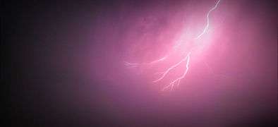
Lightning.
-

Evening at Titas.
Administration
Brahmanbaria was given city status in 1984. The city boundaries contain Sadar Municipality, 12 Wards, 78 Mahallas, and 36 villages.[7]
Metro neighborhoods
Some of the rich and busy neighborhoods of Brahmanbaria main town.
- Midtown
- Medda
- Paik Para
- College Para
- Kazi Para
- Modhya Para
- Ulcha Para
- Kandi Para
- Sarak Bazaar
- Parkside
- Shimrail Kandi
- Downtown
- Bijeshwor
Ethnicity and language
Brahmanbaria's official language is Bengali. This is popular city for Bengali. Having one of the largest Bhasha Shahitya Kendrow in the country. English is widely spoken within the city. There are many English schools here. This city has more than 95% Bengali people. Minorities are safely living in the city. [8]
Notable residents
-
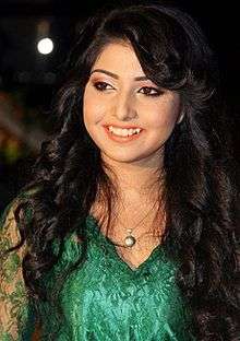
Porshi is Khude Gaan Raaj winner, most successful modern Bangladeshi singer.
-

Allauddin Khan, A Bengali shorodi and multi-instrumentalist, composer of the 20th century in Indian classical music.
-

Syed Shamsul Haque was a poet, novelist, writer and translator.
-

Anandamayi Ma, Hindu Saint.
-

Al Mahmud, poet, translator and writer.
Brahmanbaria also produced actresses like Zakia Bari Momo ,who won LUX Channel I Superstar. Alamgir is evergreen actor of Cinema of Bangladesh. He start working in mid '80s and he is still an actor.[9] His son Niloy Alamgir is also an actor. Brahmanbaria has other people like Al Mahmud, Abdul Kadir and Syed Shamsul Haque who are a poets. Nawaab Syed Shamsul Huda was a leader of the Muslim League. Shakil Ahmed was the director general of Border guard Bangladesh, who had heavily secured the borders of Bangladesh.
See also
Destinations
 |
Bhairab City | Habiganj | (India) | |
| Narsingdi | |
(Agartala, India) | ||
| ||||
| | ||||
| Comilla District | Comilla | Akhaura |
References
| Wikimedia Commons has media related to Brahmanbaria City. |
- ↑ "Area, Population and Literacy Rate by Paurashava −2001" (PDF). Bangladesh Bureau of Statistics. Retrieved 18 September 2009.
- ↑ www.geopostcodes.com,. "ZIP Code database of Bangladesh". Geopostcodes.com. Retrieved 11 June 2008.
- ↑ "Wikivoyage". Map Data OpenStreetMap. Retrieved 11 July 2011.
- ↑ "Government Official Name". Local government in Bangladesh.
- ↑ "NGA GeoNames Database". National Geospatial-Intelligence Agency. Retrieved 14 July 2008.
- ↑ "Brahmanbaria, Bangladesh Travel Weather Averages (Worldweather)". Worldweatheronline. Retrieved 3 October 2015.
- ↑ "National Web Portal of Bangladesh". Bangladesh National Web Portal.
- ↑ "Population Census Wing, BBS.". Archived from the original on 27 March 2005. Retrieved 10 November 2011.
- ↑ http://www.online-dhaka.com/english/29_735_26229_0-alamgir-celebrity-online-dhaka.html