Brézé
See also: Brézé (surname)
| Brézé | ||
|---|---|---|
|
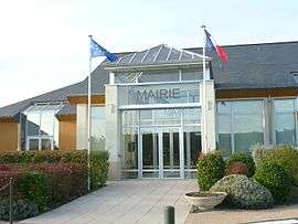
The town hall in Brézé | ||
| ||
 Brézé | ||
|
Location within Pays de la Loire region  Brézé | ||
| Coordinates: 47°10′19″N 0°03′25″W / 47.1719°N 0.0569°WCoordinates: 47°10′19″N 0°03′25″W / 47.1719°N 0.0569°W | ||
| Country | France | |
| Region | Pays de la Loire | |
| Department | Maine-et-Loire | |
| Arrondissement | Saumur | |
| Canton | Montreuil-Bellay | |
| Intercommunality | Saumur Loire Développement | |
| Government | ||
| • Mayor (2008–2014) | André Niort | |
| Area1 | 20.05 km2 (7.74 sq mi) | |
| Population (2009)2 | 1,316 | |
| • Density | 66/km2 (170/sq mi) | |
| Time zone | CET (UTC+1) | |
| • Summer (DST) | CEST (UTC+2) | |
| INSEE/Postal code | 49046 / 49260 | |
| Elevation |
26–104 m (85–341 ft) (avg. 46 m or 151 ft) | |
|
1 French Land Register data, which excludes lakes, ponds, glaciers > 1 km² (0.386 sq mi or 247 acres) and river estuaries. 2 Population without double counting: residents of multiple communes (e.g., students and military personnel) only counted once. | ||

Brézé is a commune in the Maine-et-Loire department in western France with the small, dry-moated castle Château de Brézé.
Population
| Historical population | ||
|---|---|---|
| Year | Pop. | ±% |
| 1793 | 880 | — |
| 1800 | 978 | +11.1% |
| 1806 | 1,021 | +4.4% |
| 1821 | 1,003 | −1.8% |
| 1831 | 983 | −2.0% |
| 1836 | 964 | −1.9% |
| 1841 | 999 | +3.6% |
| 1846 | 932 | −6.7% |
| 1851 | 936 | +0.4% |
| 1856 | 911 | −2.7% |
| 1861 | 911 | +0.0% |
| 1866 | 869 | −4.6% |
| 1872 | 854 | −1.7% |
| 1876 | 871 | +2.0% |
| 1881 | 878 | +0.8% |
| 1886 | 877 | −0.1% |
| 1891 | 895 | +2.1% |
| 1896 | 865 | −3.4% |
| 1901 | 863 | −0.2% |
| 1906 | 883 | +2.3% |
| 1911 | 862 | −2.4% |
| 1921 | 722 | −16.2% |
| 1926 | 714 | −1.1% |
| 1931 | 695 | −2.7% |
| 1936 | 680 | −2.2% |
| 1946 | 682 | +0.3% |
| 1954 | 748 | +9.7% |
| 1962 | 848 | +13.4% |
| 1968 | 841 | −0.8% |
| 1975 | 877 | +4.3% |
| 1982 | 1,207 | +37.6% |
| 1990 | 1,379 | +14.3% |
| 1999 | 1,300 | −5.7% |
| 2006 | 1,317 | +1.3% |
| 2009 | 1,316 | −0.1% |
Personalities
- Claire-Clémence de Maillé-Brézé, born here in 1628, Princess of Condé
See also
References
External links
| Wikimedia Commons has media related to Brézé. |
This article is issued from Wikipedia - version of the 11/10/2016. The text is available under the Creative Commons Attribution/Share Alike but additional terms may apply for the media files.