Boulia, Queensland
| Boulia Queensland | |||||||||||||
|---|---|---|---|---|---|---|---|---|---|---|---|---|---|
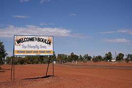 Entry into Boulia | |||||||||||||
 Boulia | |||||||||||||
| Coordinates | 22°54′40.7″S 139°54′37.6″E / 22.911306°S 139.910444°ECoordinates: 22°54′40.7″S 139°54′37.6″E / 22.911306°S 139.910444°E | ||||||||||||
| Population | 230 (2011 census)[1] | ||||||||||||
| Established | 1879 | ||||||||||||
| Postcode(s) | 4829 | ||||||||||||
| Elevation | 161.8 m (531 ft) | ||||||||||||
| Location |
| ||||||||||||
| LGA(s) | Boulia | ||||||||||||
| State electorate(s) | Mount Isa | ||||||||||||
| Federal Division(s) | Kennedy | ||||||||||||
| |||||||||||||
| |||||||||||||
Boulia /ˈbʊljə/ is a remote outback town and locality in the Shire of Boulia in Central West Queensland, Australia.[2][3] At the 2011 census, Boulia had a population of 230,[1] up from 205 in 2006.[4]
Geography
Boulia is located approximately 296 kilometres (184 mi) by road south of Mount Isa and is on the Outback Way billed as Australia's Longest Shortcut, a 2800 kilometre gravel and bitumen road which runs between Laverton in Western Australia and Winton, Queensland. Boulia lies on the Burke River, which was named after the explorer Robert O'Hara Burke who passed through the area with the Burke and Wills expedition in 1860. Boulia is the administrative centre of the Boulia Shire, population approximately 600, which covers an area of 61,176 square kilometres (23,620 sq mi).
Although it is contrary to the principles of defining a locality in Queensland,[5] Boulia is an "island" entirely surrounded by the locality of Wills.[6]
Extensive grazing of beef cattle is the predominant industry. Boulia is at the heart of the Channel Country of western Queensland where during rain events channels running between the rivers and creeks of the region fill with water and spread that water over expansive areas. When it does rain heavily the Mitchell grass plains respond magnificently and result in the Channel country around Boulia being among the finest beef producing country in Australia.
The area is best known for sightings of the Min Min lights,[7] mysterious shimmering lights that appear at night. The lights are said to be caused by atmospheric refraction that occurs when cold air is trapped below warmer air,[8] a phenomenon known as Fata Morgana.
Climate
The climate is very hot and dry, with on average over 200 days per year over 30 °C (86 °F). Although even in June and July the average maximum is a very warm 24 °C (75 °F), frosts are not unknown in the morning during these months. Annual rainfall is extraordinarily erratic: it has been as low as 24 millimetres (0.9 in) in 1905 and 51 millimetres (2 in) in 1963. However, when the monsoon is strong rainfall can be heavy: in January 1974 Boulia received 465 millimetres (18.3 in) of rain and in March 1950 346 millimetres (14 in). Maximum annual rainfall totals are 799 millimetres (31.5 in) in 1950 and 774 millimetres (30.5 in) in 1974, but the median annual rainfall is only 216 millimetres (9 in).[9]
| Climate data for Boulia | |||||||||||||
|---|---|---|---|---|---|---|---|---|---|---|---|---|---|
| Month | Jan | Feb | Mar | Apr | May | Jun | Jul | Aug | Sep | Oct | Nov | Dec | Year |
| Record high °C (°F) | 47.6 (117.7) |
48.3 (118.9) |
46.7 (116.1) |
41.1 (106) |
38.6 (101.5) |
35.0 (95) |
34.1 (93.4) |
37.9 (100.2) |
41.7 (107.1) |
43.9 (111) |
46.7 (116.1) |
47.8 (118) |
48.3 (118.9) |
| Average high °C (°F) | 38.5 (101.3) |
37.4 (99.3) |
35.4 (95.7) |
31.5 (88.7) |
26.7 (80.1) |
23.3 (73.9) |
22.9 (73.2) |
25.8 (78.4) |
30.2 (86.4) |
34.3 (93.7) |
36.9 (98.4) |
38.6 (101.5) |
31.8 (89.2) |
| Average low °C (°F) | 24.6 (76.3) |
24.0 (75.2) |
21.8 (71.2) |
17.1 (62.8) |
12.5 (54.5) |
8.9 (48) |
7.7 (45.9) |
9.5 (49.1) |
13.6 (56.5) |
17.9 (64.2) |
21.3 (70.3) |
23.5 (74.3) |
16.9 (62.4) |
| Record low °C (°F) | 11.1 (52) |
10.6 (51.1) |
10.2 (50.4) |
1.7 (35.1) |
0.0 (32) |
−0.8 (30.6) |
−1.1 (30) |
−1.4 (29.5) |
1.7 (35.1) |
5.6 (42.1) |
8.9 (48) |
10.0 (50) |
−1.4 (29.5) |
| Average rainfall mm (inches) | 47.8 (1.882) |
50.3 (1.98) |
36.5 (1.437) |
13.7 (0.539) |
12.9 (0.508) |
10.2 (0.402) |
9.9 (0.39) |
6.2 (0.244) |
7.4 (0.291) |
14.6 (0.575) |
21.4 (0.843) |
31.3 (1.232) |
262.2 (10.323) |
| Average rainy days (≥ 0.2 mm) | 4.7 | 4.4 | 3.2 | 1.6 | 1.7 | 1.6 | 1.3 | 1.1 | 1.6 | 2.5 | 2.9 | 3.3 | 29.9 |
| Source: Australian Bureau of Meteorology[10] | |||||||||||||
Events
The town hosts the Boulia Desert Sands Camel Races, one of the more important events on the Australian camel racing circuit. Each year at Easter the Boulia Racecourse reserve plays host to a rodeo, campdrafting and horse racing event which is a social highlight for the district. During August drag races are held at the Boulia Airport which attracts an enthusiastic crowd.
Facilities
Boulia has a range of public facilities open to the community. These include a public library, public hall, sports complex, racecourse, the Min Min encounter tourist centre, museum, visitor information centre and camel races.
An 18-hole golf course with sand greens is located on the Boulia Winton Road. Green fees are not charged for the use of this course and a clubhouse with bar facilities is available.[11]
Mars

The name Boulia is used as a name for a crater on the planet Mars, without specifically commemorating the town.[12]
History
The township was gazetted in 1879. Boulia Post Office opened on 1 July 1879.[13]
Heritage listings
Boulia has a number of heritage-listed sites, including:
- Pituri Street: Boulia Stone House[14]
See also
References
- 1 2 Australian Bureau of Statistics (31 October 2012). "Boulia (State Suburb)". 2011 Census QuickStats. Retrieved 10 May 2013.
- ↑ "Boulia (town) (entry 3993)". Queensland Place Names. Queensland Government. Retrieved 12 September 2015.
- ↑ "Boulia (locality) - 12 September 2015 (entry 42339)". Queensland Place Names. Queensland Government.
- ↑ Australian Bureau of Statistics (25 October 2007). "Boulia (L) (Urban Centre/Locality)". 2006 Census QuickStats. Retrieved 11 April 2011.
- ↑ "How places are named | Environment, land and water | Queensland Government". www.qld.gov.au. Retrieved 2015-09-12.
- ↑ "Queensland Globe". State of Queensland. Retrieved 12 September 2015.
- ↑ Tim the Yowie Man (2001). "Spook of the Min Min Light". The adventures of Tim the Yowie Man cryptonaturalist. Sydney, Australia: Random House Australia. p. 256. ISBN 174051078X.
- ↑ "Science logic spoils outback mystery". Canberra, Australia: The Canberra Times. 22 April 2003.
- ↑ Bureau of Meteorology
- ↑ "Climate statistics for Boulia". Australian Bureau of Meteorology. Retrieved 21 May 2014.
- ↑ "Boulia". Centre for the Government of Queensland. Retrieved 21 December 2011.
- ↑ Categories for Naming Features on Planets and Satellites, Gazetteer of Planetary Nomenclature, Astrogeology Research Program, NASA
- ↑ Premier Postal History. "Post Office List". Premier Postal Auctions. Retrieved 10 May 2014.
- ↑ "Boulia Stone House (entry 600039)". Queensland Heritage Register. Queensland Heritage Council. Retrieved 7 July 2013.
External links
| Wikimedia Commons has media related to Boulia, Queensland. |