Bosso, Niger
| Bosso | |
|---|---|
| Commune and village | |
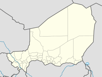 Bosso Location in Niger | |
| Coordinates: NE 13°41′49″N 13°18′37″E / 13.6969°N 13.3103°E | |
| Country |
|
| Region | Diffa Region |
| Department | Diffa Department |
| Elevation | 909 ft (277 m) |
| Population (2012) | |
| • Total | 65.022 |
| Time zone | WAT (UTC+1) |
Bosso is a village and rural commune in Niger.[1] As of 2011, the commune had a total population of 52,177 people.[2] It lies on the Nigerian border.
In June 2013, between 5,000 and 10,000 refugees arrived here, fleeing fighting between Boko Haram and the Nigerian Armed Forces in Borno State of Nigeria. Most blamed the military for the excessive violence and human rights violations.[3]
Climate
Köppen-Geiger climate classification system classifies its climate as hot desert (BWh).
| Climate data for Bosso, Niger | |||||||||||||
|---|---|---|---|---|---|---|---|---|---|---|---|---|---|
| Month | Jan | Feb | Mar | Apr | May | Jun | Jul | Aug | Sep | Oct | Nov | Dec | Year |
| Average high °C (°F) | 29.4 (84.9) |
32.4 (90.3) |
36.2 (97.2) |
38.8 (101.8) |
39.5 (103.1) |
38.2 (100.8) |
35 (95) |
33.1 (91.6) |
35.1 (95.2) |
36.5 (97.7) |
33.4 (92.1) |
30.1 (86.2) |
34.81 (94.66) |
| Daily mean °C (°F) | 21 (70) |
23.5 (74.3) |
27.6 (81.7) |
30.5 (86.9) |
31.8 (89.2) |
31.3 (88.3) |
29.3 (84.7) |
27.8 (82) |
28.8 (83.8) |
28.6 (83.5) |
25 (77) |
21.6 (70.9) |
27.23 (81.02) |
| Average low °C (°F) | 12.7 (54.9) |
14.7 (58.5) |
19.1 (66.4) |
22.3 (72.1) |
24.2 (75.6) |
24.4 (75.9) |
23.7 (74.7) |
22.6 (72.7) |
22.6 (72.7) |
20.8 (69.4) |
16.6 (61.9) |
13.1 (55.6) |
19.73 (67.53) |
| Average precipitation mm (inches) | 0 (0) |
0 (0) |
0 (0) |
1 (0.04) |
6 (0.24) |
15 (0.59) |
70 (2.76) |
119 (4.69) |
30 (1.18) |
4 (0.16) |
0 (0) |
0 (0) |
245 (9.66) |
| Source: Climate-Data.org (altitude: 287m)[4] | |||||||||||||
References
- ↑ Loi n° 2002-014 du 11 JUIN 2002 portant création des communes et fixant le nom de leurs chefs-lieux. Includes list of 213 communes rurales and seats, 52 Communes urbaines and seats
- ↑ "Annuaires_Statistiques" (PDF). Institut National de la Statistique. Retrieved 2 May 2013.
- ↑ Nossiter, Adam (5 June 2013). "In Nigeria, 'Killing People Without Asking Who They Are'". New York Times. Retrieved 6 June 2013.
- ↑ "Climate: Bosso - Climate graph, Temperature graph, Climate table". Climate-Data.org. Retrieved 2014-02-20.
Coordinates: 13°41′49″N 13°18′37″E / 13.6969°N 13.3103°E
This article is issued from Wikipedia - version of the 7/3/2016. The text is available under the Creative Commons Attribution/Share Alike but additional terms may apply for the media files.