Boorowa Shire
| Boorowa Shire New South Wales | |||||||||||||
|---|---|---|---|---|---|---|---|---|---|---|---|---|---|
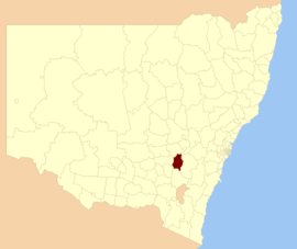 Location in New South Wales | |||||||||||||
| Coordinates | 34°26′S 148°43′E / 34.433°S 148.717°ECoordinates: 34°26′S 148°43′E / 34.433°S 148.717°E | ||||||||||||
| Population | 2,558 (2013 est)[1] | ||||||||||||
| • Density | 0.9919/km2 (2.5689/sq mi) | ||||||||||||
| Abolished | 12 May 2016 | ||||||||||||
| Area | 2,579 km2 (995.8 sq mi) | ||||||||||||
| Mayor | Wendy Tuckerman | ||||||||||||
| Council seat | Boorowa[2] | ||||||||||||
| Region | South West Slopes, Southern Tablelands | ||||||||||||
| State electorate(s) | Goulburn | ||||||||||||
| Federal Division(s) | Hume | ||||||||||||
| Website | Boorowa Shire | ||||||||||||
| |||||||||||||
Boorowa Shire was a local government area in the South West Slopes region of New South Wales, Australia. The shire was located adjacent to the Lachlan Valley Way and included Boorowa and the small towns of Rye Park, Rugby, Frogmore and Reids Flat.
On 12 May 2016, the Boorowa Shire was abolished and merged with the Harden and Young shires to establish the Hilltops Council.[3]
The last Mayor of Boorowa Shire Council was Cr. Wendy Tuckerman, an independent politician.
Council
Composition and election method
Boorowa Council was composed of nine Councillors elected proportionally as one entire ward. All Councillors were elected for a fixed four-year term of office. The Mayor was elected by the Councillors at the first meeting of the Council. The last election was held on 8 September 2012, and the makeup of the Council was as follows:[4]
| Party | Councillors | |
|---|---|---|
| Independents and Unaligned | 9 | |
| Total | 9 | |
The final Council, elected in 2012, in order of election, was:[4]
| Councillor | Party | Notes | |
|---|---|---|---|
| Wendy Tuckerman | Independent | Mayor | |
| Peter Sykes | Unaligned | ||
| Christopher Corcoran | Unaligned | Deputy Mayor | |
| Jack Ryan | Unaligned | ||
| Tim McGrath | Unaligned | ||
| Robert Gledhill | Unaligned | ||
| David Evans | Independent | ||
| Andrew Southwell | Unaligned | ||
| Gus Clements | Unaligned | ||
Amalgamation
A 2015 review of local government boundaries recommended that Boorowa Shire merge with adjoining councils. The NSW Government considered two proposals. The first proposed a merger between the Boorowa, Harden and Young shires to form a new council with an area of 7,139 square kilometres (2,756 sq mi) and support a population of approximately 19,000.[5] Following the lodging of an alternate proposal by Harden Shire on 28 February 2016 to amalgamate the Cootamundra, Gundagai and Harden shires,[6] the NSW Minister for Local Government proposed a merger between the Boorowa and Young shires.[7] Boorowa Shire was abolished on 12 May 2016 and along with Harden Shire and Young Shire, the area was included in the new Hilltops Council local government area.[3]
References
- ↑ "3218.0 Regional Population Growth, Australia. Table 1. Estimated Resident Population, Local Government Areas, New South Wales". 3 April 2014. Retrieved 11 September 2014.
- ↑ "Boorowa Council". New South Wales Division of Local Government. Retrieved 1 December 2006.
- 1 2 "Hilltops Council". Stronger Councils. Government of New South Wales. 12 May 2016. Retrieved 14 May 2016.
- 1 2 "Boorowa Council: Summary of First Preference Votes for each Candidate". Local Government Elections 2012. Electoral Commission of New South Wales. 13 September 2012. Retrieved 7 October 2012.
- ↑ "Merger proposal: Boorowa Council, Harden Shire Council, Young Shire Council" (PDF). Government of New South Wales. January 2016. p. 7. Retrieved 8 March 2016.
- ↑ Harden Shire Council (28 February 2016). "Fit For Future: Alternate Merger Proposal - Harden Shire Council" (PDF). Government of New South Wales. Retrieved 8 March 2016.
- ↑ Toole, Paul (March 2016). "Boorowa and Young Shire councils Proposal" (PDF). Minister for Local Government. Government of New South Wales. Retrieved 8 March 2016.