Bomê County
| Bomê County 波密县 • སྤོ་མེས་རྫོང་། | |
|---|---|
| County | |
|
Gangxiang Nature Reserve | |
.png) Location of Bomê County within Tibet | |
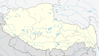 Bomê County Location in Tibet | |
| Coordinates: 30°48′04″N 95°44′32″E / 30.80111°N 95.74222°E | |
| Country | China |
| Province | Tibet |
| Prefecture | Nyingchi Prefecture |
| Capital | Zhamo |
| Time zone | China Standard (UTC+8) |

Bomê County (Tibetan: སྤོ་མེས་རྫོང།སྤོ་སྨད་རྫོང་, Wylie: sPo mes rDzong , Chinese: 波密县; Pinyin: Bōmì Xiàn) is a county of the Nyingchi Prefecture in the south-east of the Tibet Autonomous Region.
The population was 27,169 in 1999.
Bomai (sPo smad) or Boyü (sPo yul) (Pome or Poyul in Western accounts) was the seat of a quasi-independent kingdom until the early 20th century when troops of the Dalai Lama's Lhasa government integrated it forcefully into the central Tibetan realm.
The kingdom of sPo bo, or sPo yul (“country of sPo”) was an offshoot of the ancient dynasty of the first Tibetan kings of the Yarlung Valley. Its inhabitants had a reputation as fearsome savages which meant most travellers kept clear of it and so it was one of the least known areas in the Tibetan traditional feudal establishment.
Its isolation was also enhanced by the belief by a great number of Tibetans that in its borders was one of the 'hidden lands' or beyul (Standard Tibetan: sbas-yul) referred to in the prophecies of Guru Rinpoche. sPo ba’s area of control far exceeded the boundaries of Bomê County. The kingdom acted as a protecting power from the Klo pa tribes for the streams of Tibetan pilgrims searching for this Promised Land in the East Himalayas from the mid-seventeenth century. Its power extended south over the Doshong La pass, to include the location of one of these earthly paradises called Padma bkod (written variously Pema köd, Pemakö and Pemako), literally 'Lotus Array', a region in the North-Eastern Province of Upper Siang of Arunachal Pradesh. Accounts of this terrestrial paradise influenced James Hilton's Shangri-La. A period of instability overtook the kingdom after Chinese incursions in 1905 and 1911. By 1931 the Lhasa government had expelled the last Ka gnam sde pa ('king') and established two garrisons.
Settlements
Transport
External links

Coordinates: 30°48′04″N 95°44′32″E / 30.80111°N 95.74222°E