Bogue, Kansas
| Bogue, Kansas | |
|---|---|
| City | |
 Location within Graham County and Kansas | |
 KDOT map of Graham County (legend) | |
| Coordinates: 39°21′35″N 99°41′18″W / 39.35972°N 99.68833°WCoordinates: 39°21′35″N 99°41′18″W / 39.35972°N 99.68833°W | |
| Country | United States |
| State | Kansas |
| County | Graham |
| Area[1] | |
| • Total | 0.26 sq mi (0.67 km2) |
| • Land | 0.26 sq mi (0.67 km2) |
| • Water | 0 sq mi (0 km2) |
| Elevation | 2,037 ft (621 m) |
| Population (2010)[2] | |
| • Total | 143 |
| • Estimate (2015)[3] | 144 |
| • Density | 550/sq mi (210/km2) |
| Time zone | Central (CST) (UTC-6) |
| • Summer (DST) | CDT (UTC-5) |
| ZIP code | 67625 |
| Area code(s) | 785 |
| FIPS code | 20-07825 [4] |
| GNIS feature ID | 0472360 [5] |
Bogue is a city in Graham County, Kansas, United States. As of the 2010 census, the city population was 143.[6]
History
Bogue was established in 1888 as a railroad town. It originally was named Wild Horse but the Union Pacific Railroad changed the name to honor Virgil Gay Bogue, a civil engineer working for the railroad and the founder of the city.[7][8]
The first post office in Bogue was established in September 1888.[9]
Geography
Bogue is located at 39°21′35″N 99°41′18″W / 39.359648°N 99.688282°W (39.359648, -99.688282).[10] According to the United States Census Bureau, the city has a total area of 0.26 square miles (0.67 km2), all of it land.[1]
Bogue is located on K-18, south of U.S. Route 24, on the South Fork Solomon River.
Climate
The climate in this area is characterized by hot, humid summers and generally mild to cool winters. According to the Köppen Climate Classification system, Bogue has a humid subtropical climate, abbreviated "Cfa" on climate maps.[11]
Demographics
| Historical population | |||
|---|---|---|---|
| Census | Pop. | %± | |
| 1940 | 157 | — | |
| 1950 | 211 | 34.4% | |
| 1960 | 234 | 10.9% | |
| 1970 | 257 | 9.8% | |
| 1980 | 197 | −23.3% | |
| 1990 | 150 | −23.9% | |
| 2000 | 179 | 19.3% | |
| 2010 | 143 | −20.1% | |
| Est. 2015 | 144 | [3] | 0.7% |
| U.S. Decennial Census | |||
2010 census
As of the census[2] of 2010, there were 143 people, 75 households, and 43 families residing in the city. The population density was 550.0 inhabitants per square mile (212.4/km2). There were 89 housing units at an average density of 342.3 per square mile (132.2/km2). The racial makeup of the city was 93.7% White, 2.8% African American, 2.1% Asian, and 1.4% from two or more races. Hispanic or Latino of any race were 1.4% of the population.
There were 75 households of which 13.3% had children under the age of 18 living with them, 54.7% were married couples living together, 1.3% had a female householder with no husband present, 1.3% had a male householder with no wife present, and 42.7% were non-families. 36.0% of all households were made up of individuals and 14.6% had someone living alone who was 65 years of age or older. The average household size was 1.91 and the average family size was 2.42.
The median age in the city was 54.3 years. 10.5% of residents were under the age of 18; 4.2% were between the ages of 18 and 24; 18.2% were from 25 to 44; 32.2% were from 45 to 64; and 35% were 65 years of age or older. The gender makeup of the city was 48.3% male and 51.7% female.
2000 census
As of the census[4] of 2000, there were 179 people, 77 households, and 55 families residing in the city. The population density was 685.0 people per square mile (265.8/km2). There were 88 housing units at an average density of 336.8 per square mile (130.7/km2). The racial makeup of the city was 97.77% White, 1.68% African American, 0.56% from other races. Hispanic or Latino of any race were 1.68% of the population.
There were 77 households out of which 27.3% had children under the age of 18 living with them, 66.2% were married couples living together, 6.5% had a female householder with no husband present, and 27.3% were non-families. 26.0% of all households were made up of individuals and 18.2% had someone living alone who was 65 years of age or older. The average household size was 2.32 and the average family size was 2.79.
In the city the population was spread out with 24.0% under the age of 18, 3.4% from 18 to 24, 26.3% from 25 to 44, 17.9% from 45 to 64, and 28.5% who were 65 years of age or older. The median age was 43 years. For every 100 females there were 105.7 males. For every 100 females age 18 and over, there were 88.9 males.
The median income for a household in the city was $26,458, and the median income for a family was $33,750. Males had a median income of $31,250 versus $15,000 for females. The per capita income for the city was $14,403. About 10.3% of families and 10.3% of the population were below the poverty line, including 20.0% of those under the age of eighteen and none of those sixty five or over.
References
- 1 2 "US Gazetteer files 2010". United States Census Bureau. Archived from the original on 2012-01-24. Retrieved 2012-07-06.
- 1 2 "American FactFinder". United States Census Bureau. Retrieved 2012-07-06.
- 1 2 "Annual Estimates of the Resident Population for Incorporated Places: April 1, 2010 to July 1, 2015". Retrieved July 2, 2016.
- 1 2 "American FactFinder". United States Census Bureau. Archived from the original on 2013-09-11. Retrieved 2008-01-31.
- ↑ "US Board on Geographic Names". United States Geological Survey. 2007-10-25. Retrieved 2008-01-31.
- ↑ "2010 City Population and Housing Occupancy Status". U.S. Census Bureau. Archived from the original on July 21, 2011. Retrieved September 14, 2011.
- ↑ Rydjord, John (1972). Kansas Place-Names. University of Oklahoma Press, Norman. p. 452. ISBN 0-8061-0994-7.
- ↑ LeSage, Alan. "History of Bogue". Bogue, Kansas. Solomon Valley/Highway 24 Heritage Alliance. Retrieved 5 April 2012.
- ↑ "Kansas Post Offices, 1828-1961 (archived)". Kansas Historical Society. Archived from the original on October 9, 2013. Retrieved 10 June 2014.
- ↑ "US Gazetteer files: 2010, 2000, and 1990". United States Census Bureau. 2011-02-12. Retrieved 2011-04-23.
- ↑ Climate Summary for Bogue, Kansas
External links
- City
- Schools
- USD 281, local school district
- Maps
- Bogue City Map, KDOT
Municipalities and communities of Graham County, Kansas, United States | ||
|---|---|---|
| Cities | 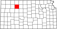 | |
| Unincorporated communities | ||
| Ghost towns | ||
| Townships | ||