Bly, Oregon
| Bly | |
|---|---|
| Unincorporated community | |
|
The Christian and Missionary Alliance church in Bly | |
 Bly  Bly Location within the state of Oregon | |
| Coordinates: 42°23′52″N 121°2′26″W / 42.39778°N 121.04056°WCoordinates: 42°23′52″N 121°2′26″W / 42.39778°N 121.04056°W | |
| Country | United States |
| State | Oregon |
| County | Klamath |
| unincorporated community | 1873 |
| Elevation | 4,360 ft (1,330 m) |
| Population (2000) | |
| • Total | 486 |
| Time zone | Pacific (PST) (UTC-8) |
| • Summer (DST) | PDT (UTC-7) |

| Historical population | |||
|---|---|---|---|
| Census | Pop. | %± | |
| 1910 | 100 | — | |
| 1920 | 100 | 0.0% | |
| 1940 | 800 | — | |
| 1950 | 800 | 0.0% | |
| 1960 | 600 | −25.0% | |
| 1970 | 500 | −16.7% | |
| 1980 | 750 | 50.0% | |
| 1990 | 750 | 0.0% | |
| source:[1] | |||
Bly is an unincorporated community in Klamath County, Oregon, United States. By highway, it is about 50 miles (80 km) east of Klamath Falls. As of 2000, the population was 486.
Geography
Bly is in southeastern Klamath County, slightly west of Lake County, along Oregon Route 140. By highway, it is about 37 miles (60 km) west of Lakeview and 50 miles (80 km) east of Klamath Falls.[2][3]
Fish Hole Creek, which flows through the community, meets the South Fork Sprague River slightly north of Bly. Fremont National Forest surrounds Bly except on the northwest. Gearhart Mountain Wilderness is about 10 miles (16 km) northeast of Bly.[2][3]
Climate
This region experiences warm (but not hot) and dry summers, with no average monthly temperatures above 71.6 °F. According to the Köppen Climate Classification system, Bly has a warm-summer Mediterranean climate, abbreviated "Csb" on climate maps.[4]
History
The name Bly comes from the Klamath word p'lai, meaning "up" or "high", referring to its location up the Sprague River.[5] A post office called Sprague River was established in the area in 1873, and the name was changed to Bly in 1883.[5] At that time, the community was near the east end of the Klamath Indian Reservation.[6] The 21st century community of Sprague River is downstream and west of Bly and Beatty.[3]
Around 1900, Bly had two general stores, two hotels, and a saloon.[6] A history published in 1905 referred to the surrounding area as the "precinct" or the "valley" and estimated its total population at 750.[6] The chief products of the valley at that time included cattle, horses, mules, and a few sheep as well as oats, clover, and hay.[6]
In 1935, the United States Forest Service acquired a 4-acre (16,000 m2) site in Bly for a district ranger station to manage the western part of the Fremont National Forest. The Forest Service paid $625 for the property. The ranger station was built by Civilian Conservation Corps workers under the supervision of Forest Service district ranger Perry Smith. The seven original buildings at the Bly Ranger Station were constructed between 1936 and 1942. A modern administrative headquarters building was added to the compound in the 1960s. The ranger station compound was listed on the National Register of Historic Places in 1981.[7][8]
_(lakDA0010).jpg)
World War II
Bly is also the site of the only fatalities of World War II in the mainland United States due to enemy attack.[5] On May 5, 1945, a Japanese balloon bomb exploded as it was being pulled from the woods by curious picnickers.[5] Killed in the explosion were: Elsie Mitchell, 26, wife of minister Archie E. Mitchell; Edward Engen, 13; Richard Patzke, 14; Jay Gifford, 13; Sherman Shoemaker, 11; and Joan Patzke, 13.[9] Rev. Mitchell heard the explosion and discovered the bodies. Victims were compensated by the government. A memorial was erected at what today is called the Mitchell Recreation Area
Terrorist training camp
In 2002, Bly attracted national attention when Earnest James Ujaama was indicted and arrested for, in part, conspiring to set up a terrorist training camp on a ranch near Bly between October and December 1999. The indictment claimed that Ujaama was a follower of Abu Hamza al-Masri, and had ties to al-Qaeda and the Taliban.[10] Ujaama pleaded guilty in 2007 to a single count of providing material support to the Taliban although the charge of attempting to set up a training camp in Bly was dropped.[11] Abu Hamza al-Masri was convicted of this and other charges in 2014.[12] In May 2009, Oussama Kassir was convicted for conspiring to assist in the camp's creation, based in part on testimony from Ujaama.[13]
Parks and recreation
The OC&E Woods Line State Trail, the longest linear state park in Oregon, passes through Bly. The 100-mile (160 km) rail trail was built on the roadbed of the former Oregon, California and Eastern Railway, which ran from Klamath Falls to Sycan Marsh.[14]
References
- ↑ Moffatt, Riley Moore (1996). Population History of Western U.S. Cities and Towns, 1850–1990. Lanham, Maryland: Scarecrow Press. p. 206. ISBN 978-0-8108-3033-2.
- 1 2 The Road Atlas. Chicago: Rand McNally. 2013. pp. 84–85. ISBN 978-052-80062-2-7.
- 1 2 3 Oregon Atlas & Gazetteer (7th ed.). Yarmouth, Maine: DeLorme. 2008. pp. 64, 84. ISBN 978-0-89933-347-2.
- ↑ Climate Summary for Bly, Oregon
- 1 2 3 4 McArthur, Lewis A.; McArthur, Lewis L. (2003) [1928]. Oregon Geographic Names (7th ed.). Portland, Oregon: Oregon Historical Society Press. p. 94. ISBN 978-0875952772.
- 1 2 3 4 Shaver, F. A.; et al. (1905). An Illustrated History of Central Oregon Embracing Wasco, Sherman, Gilliam, Wheeler, Crook, Lake and Klamath Counties. Spokane, Washington: Western Publishing Co. p. 982. OCLC 5436491. Retrieved August 19, 2013.
- ↑ Joslin, Les (1995). Uncle Sam’s Cabins: A Visitors Guide to Historic U.S. Forest Service Ranger Stations of the West. Bend, Oregon: Wilderness Association. pp. 210–11. ISBN 978-0-9647167-1-1. Retrieved August 18, 2013.
- ↑ Throop, E. Gail (April 1, 1980). "Bly Ranger Station, National Register of Historic Places Nomination Form" (PDF). National Park Service. Retrieved August 18, 2013.
- ↑ "Japanese Balloon Bomb". Herald & News. Retrieved 2005-05-05.
- ↑ McMahon, Patrick (September 4, 2002). "Jihad camp case questioned". USA Today.
- ↑ "American Muslim pleads guilty to aiding al-Qaeda". Sydney Morning Herald. April 15, 2003.
- ↑ "Abu Hamza found guilty of terror charges in US court". BBC. May 19, 2014. Retrieved May 19, 2014.
- ↑ Neumeister, Larry (May 12, 2009). "Man convicted in NY of trying to start terror camp". Associated Press.
- ↑ "OC and E Woods Line State Trail". Oregon Parks and Recreation Department. 2013. Retrieved August 18, 2013.
Municipalities and communities of Klamath County, Oregon, United States | ||
|---|---|---|
| Cities | 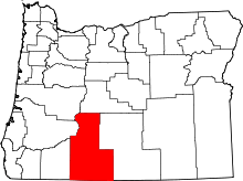 | |
| CDP | ||
| Unincorporated communities | ||