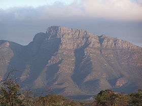
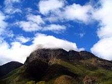
Bluff Knoll
| Bluff Knoll | |
|---|---|
 | |
| Highest point | |
| Elevation | 1,099 m (3,606 ft) [1] |
| Prominence | 650 m (2,130 ft) |
| Coordinates | 34°22′32″S 118°15′22″E / 34.37556°S 118.25611°ECoordinates: 34°22′32″S 118°15′22″E / 34.37556°S 118.25611°E [1] |
| Geography | |
 Bluff Knoll | |
| Parent range | Stirling Range |
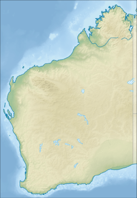
Bluff Knoll is a peak in the Stirling Range in the Great Southern region of Western Australia (WA). It is 1,099 metres (3,606 ft) above sea level,[1] and is one of only a few places to experience regular snowfalls in Western Australia, with some snow reported in most years. The last heavy snowfall was on 6 October 1992 when 20 centimetres of snow was recorded and light snow was seen at the base, 450 metres (1,480 ft). Although Bluff Knoll is sometimes claimed to be the highest point in WA, the highest peak is actually Mount Meharry in Karijini National Park in the Hamersley Range, which is 1,249 metres (4,098 ft) above sea level.
Local Aboriginal people, from the Qaaniyan and Koreng groups (or tribes), who wore kangaroo skin cloaks in cold weather, called the mountain Pualaar Miial, meaning "great many-faced hill".[2] The mountain is often shrouded in a mist which curls around the peaks and floats into the gullies. Local people believed this to be a spirit named Noatch (literally meaning "dead body" or "corpse").[2]
Climbing Bluff Knoll, a round trip of about 6 kilometres (3.7 mi), takes three to four hours,[2] and can be achieved by anyone with a reasonable level of fitness. It is important to be well prepared for the trek, especially in the colder months as many people have been exposed to the cold weather during climbs. Water is essential during summer as dehydration is a common problem for hikers. Many rescues have been performed by local State Emergency Service (SES) units. Hikers who fall and injure themselves may be unable to return to the base unaided. They may also become fatigued or fall victim to the elements. It is possible to ascend the face of the bluff with rock climbing equipment, or abseil down it, though it is very dangerous and preparation is vital.
The view from the summit encompasses the Stirling and Porongurup mountain ranges, as well as the coast near Albany.
See also
Footnotes
- 1 2 3 "Bluff Knoll". Gazetteer of Australia online. Geoscience Australia, Australian Government.
- 1 2 3 Brad Barber (13 November 2002). "Climbing Bluff Knoll". ABC South Coast WA. Australian Broadcasting Corporation. Archived from the original on 3 February 2008. Retrieved 25 November 2010.