Bluff Island (Andaman)
 Bluff Island Location of Bluff Island | |
| Geography | |
|---|---|
| Location | Bay of Bengal |
| Coordinates | 12°14′49″N 92°41′53″E / 12.247°N 92.698°ECoordinates: 12°14′49″N 92°41′53″E / 12.247°N 92.698°E |
| Archipelago | Andaman Islands |
| Adjacent bodies of water | Indian Ocean |
| Total islands | 1 |
| Major islands |
|
| Area | 0.21 km2 (0.081 sq mi)[1] |
| Length | 0.8 km (0.5 mi) |
| Width | 0.4 km (0.25 mi) |
| Coastline | 2.27 km (1.411 mi) |
| Highest elevation | 30 m (100 ft)[2] |
| Administration | |
| District | North and Middle Andaman |
| Island group | Andaman Islands |
| Island sub-group | West Baratang Group |
| Taluk | Rangat Taluk |
| Demographics | |
| Demonym | Hindi |
| Population | 0 (2016) |
| Pop. density | 0.00 /km2 (0 /sq mi) |
| Ethnic groups | Hindu, Andamanese |
| Additional information | |
| Time zone | |
| PIN | 744202[3] |
| Telephone code | 031927 [4] |
| Official website |
www |
| ISO Code | IN-AN-00[5] |
| Literacy | 84.4% |
| Avg. summer temperature | 30.2 °C (86.4 °F) |
| Avg. winter temperature | 23.0 °C (73.4 °F) |
| Sex ratio | 1.2♂/♀ |
| unit_pref | Metric |
| Census Code | 35.639.0004 |
| Official Languages | Hindi, English |
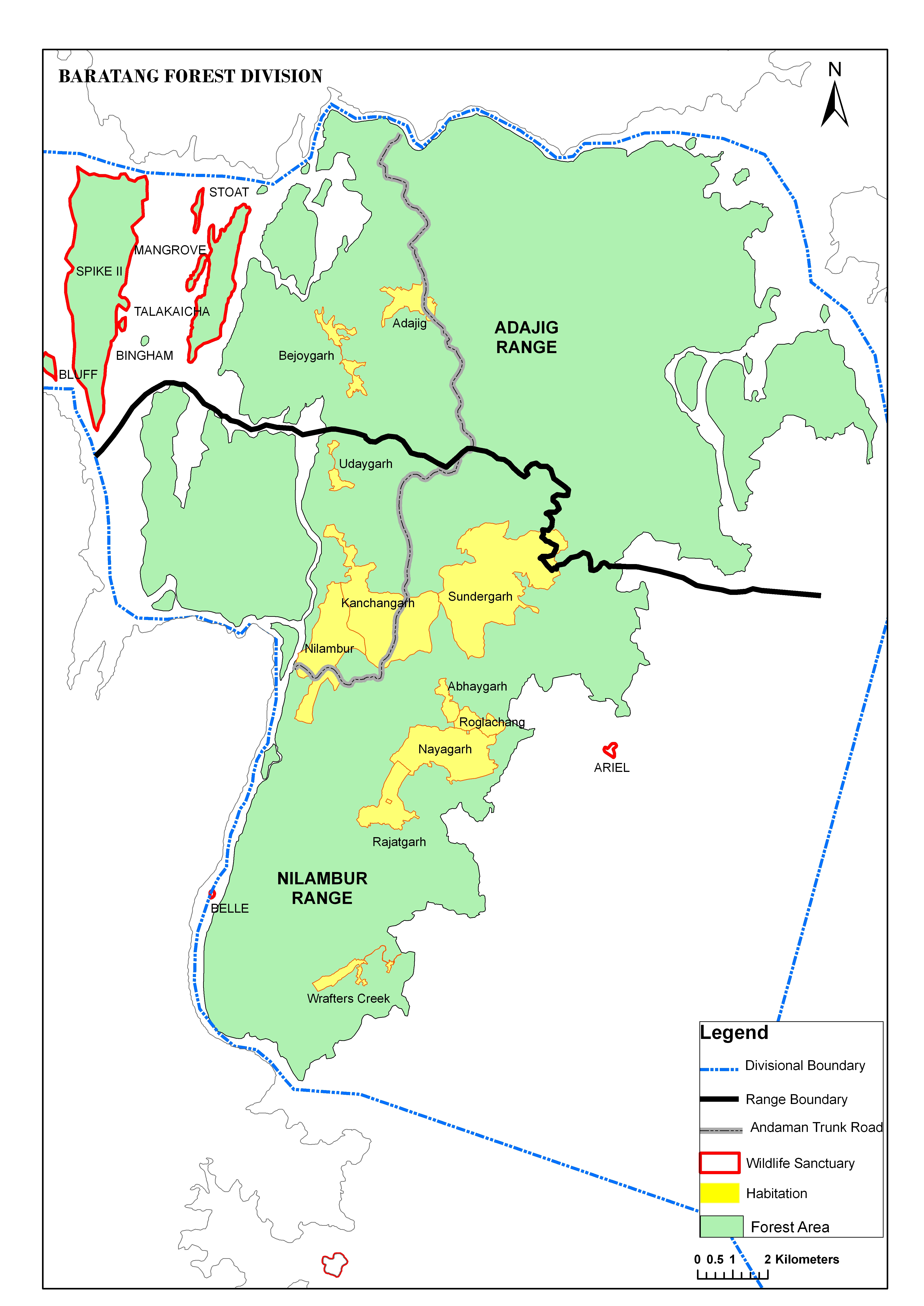
Bluff Island is an island of the Andaman Islands. It belongs to the North and Middle Andaman administrative district, part of the Indian union territory of Andaman and Nicobar Islands.[6] the island is lying 64 km (40 mi) north from Port Blair.
Geography
The island belongs to the West Baratang Group and lies south of Spike Island. The island is separated from South Andaman to the south by narrow channel, 500 m wide.
Administration
Politically, Bluff Island, along neighboring Baratang Islands, is part of Rangat Taluk.[7]
Transportation
you can travel by Dinghy through Port Anson from Mayabuner, on demand.[8]
Demographics
The island was previously inhabited. In 1949, the few surviving Great Andamanese people were relocated to this island to protect them from diseases and other threats.[9] On this island their population reached the all-time low of 19 individuals in 1961. In 1969 they were relocated to the slightly larger Strait Island.[9]
Fauna
Bluff island and the surrounding waters are a wildlife sanctuary of India, initiated in 1987 as a nature preserve.[10] with an area of km2.[10]
References
- ↑ "Islandwise Area and Population - 2011 Census" (PDF). Government of Andaman.
- ↑ "Sailing Directions (enroute) | India and the Bay of Bengal" (PDF) (173). National Geospatial-intelligence Agency, United States Government. 2014. Retrieved 2016-09-23.
- ↑ "A&N Islands - Pincodes". 22 September 2016. Archived from the original on 23 March 2014. Retrieved 22 September 2016.
- ↑ "STD Codes of Andaman and Nicobar". allcodesindia.in. Retrieved 2016-09-23.
- ↑ Registration Plate Numbers added to ISO Code
- ↑ "Village Code Directory: Andaman & Nicobar Islands" (PDF). Census of India. Retrieved 2011-01-16.
- ↑ "DEMOGRAPHIC – A&N ISLANDS" (PDF). andssw1.and.nic.in. Retrieved 2016-09-23.
- ↑ map
- 1 2 Rann Singh Mann (2005), Andaman and Nicobar Tribes Restudied: Encounters and Concerns, page 149. Mittal Publications. ISBN 81-8324-010-0
- 1 2 Wildlife Institute of India (2000), Andaman and Nicobar Islands section of Directory of Wildlife Protected Areas in India. Accessed on 2012-07-12.
- Geological Survey of India
 Andaman and Nicobar Islands travel guide from Wikivoyage