Blooming Valley, Pennsylvania
| Blooming Valley, Pennsylvania | |
|---|---|
| Borough | |
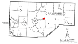 Location of Blooming Valley in Crawford County | |
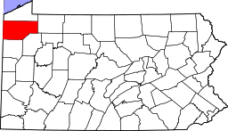
 Blooming Valley Location of Blooming Valley in Pennsylvania | |
| Coordinates: 41°40′49″N 80°2′32″W / 41.68028°N 80.04222°WCoordinates: 41°40′49″N 80°2′32″W / 41.68028°N 80.04222°W | |
| Country | United States |
| State | Pennsylvania |
| County | Crawford County |
| Founded | 1845 |
| Area | |
| • Total | 1.97 sq mi (5.09 km2) |
| • Land | 1.94 sq mi (5.03 km2) |
| • Water | 0.02 sq mi (0.06 km2) |
| Elevation | 1,285 ft (392 m) |
| Population (2010) | |
| • Total | 337 |
| • Density | 170/sq mi (66/km2) |
| Time zone | EST (UTC-4) |
| • Summer (DST) | EDT (UTC-5) |
| Area code(s) | 814 |
Blooming Valley is a borough in Crawford County, Pennsylvania, United States. The population was 337 at the 2010 census.[1]
Geography
Blooming Valley is located near the geographic center of Crawford County at 41°40′49″N 80°2′32″W / 41.68028°N 80.04222°W (41.680217, -80.042107).[2] It is bordered to the north and west by Woodcock Township, to the east by Richmond and Randolph townships, and to the south by East Mead Township.
Pennsylvania Routes 77 and 198 intersect in the center of town. PA 77 leads southwest 6 miles (10 km) to Meadville, the county seat, and northeast 30 miles (48 km) to Corry. PA 198 leads northwest 7 miles (11 km) to Saegertown and southeast 6 miles (10 km) to Guys Mills.
According to the United States Census Bureau, the borough has a total area of 1.97 square miles (5.09 km2), of which 1.94 square miles (5.03 km2) is land and 0.02 square miles (0.06 km2), or 1.13%, is water.[1]
Demographics
| Historical population | |||
|---|---|---|---|
| Census | Pop. | %± | |
| 1870 | 209 | — | |
| 1880 | 232 | 11.0% | |
| 1890 | 206 | −11.2% | |
| 1900 | 177 | −14.1% | |
| 1910 | 150 | −15.3% | |
| 1920 | 141 | −6.0% | |
| 1930 | 195 | 38.3% | |
| 1940 | 218 | 11.8% | |
| 1950 | 256 | 17.4% | |
| 1960 | 296 | 15.6% | |
| 1970 | 358 | 20.9% | |
| 1980 | 374 | 4.5% | |
| 1990 | 391 | 4.5% | |
| 2000 | 378 | −3.3% | |
| 2010 | 337 | −10.8% | |
| Est. 2015 | 331 | [3] | −1.8% |
| Sources:[4][5][6] | |||
As of the census[5] of 2000, there were 378 people, 144 households, and 109 families residing in the borough. The population density was 194.5 people per square mile (75.2/km²). There were 156 housing units at an average density of 80.3 per square mile (31.0/km²). The racial makeup of the borough was 98.94% White, 0.79% African American, and 0.26% from two or more races.
There were 144 households, out of which 35.4% had children under the age of 18 living with them, 65.3% were married couples living together, 9.0% had a female householder with no husband present, and 24.3% were non-families. 20.8% of all households were made up of individuals, and 9.0% had someone living alone who was 65 years of age or older. The average household size was 2.63 and the average family size was 3.05.
In the borough the population was spread out, with 27.5% under the age of 18, 3.7% from 18 to 24, 28.3% from 25 to 44, 24.6% from 45 to 64, and 15.9% who were 65 years of age or older. The median age was 38 years. For every 100 females there were 108.8 males. For every 100 females age 18 and over, there were 101.5 males.
The median income for a household in the borough was $46,944, and the median income for a family was $48,750. Males had a median income of $40,139 versus $21,458 for females. The per capita income for the borough was $17,334. About 1.8% of families and 3.1% of the population were below the poverty line, including 1.4% of those under age 18 and none of those age 65 or over.
References
- 1 2 "Geographic Identifiers: 2010 Census Summary File 1 (G001): Blooming Valley borough, Pennsylvania". U.S. Census Bureau, American Factfinder. Retrieved June 2, 2015.
- ↑ "US Gazetteer files: 2010, 2000, and 1990". United States Census Bureau. 2011-02-12. Retrieved 2011-04-23.
- ↑ "Annual Estimates of the Resident Population for Incorporated Places: April 1, 2010 to July 1, 2015". Retrieved July 2, 2016.
- ↑ "Census of Population and Housing". U.S. Census Bureau. Archived from the original on 11 May 2015. Retrieved 11 December 2013.
- 1 2 "American FactFinder". United States Census Bureau. Archived from the original on 2013-09-11. Retrieved 2008-01-31.
- ↑ "Incorporated Places and Minor Civil Divisions Datasets: Subcounty Resident Population Estimates: April 1, 2010 to July 1, 2012". Population Estimates. U.S. Census Bureau. Archived from the original on 17 June 2013. Retrieved 11 December 2013.