Blankenheim, North Rhine-Westphalia
| Blankenheim | ||
|---|---|---|
|
| ||
| ||
 Blankenheim | ||
Location of Blankenheim within Euskirchen district 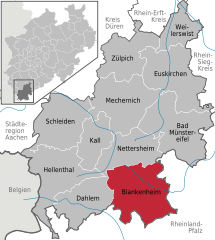
 | ||
| Coordinates: 50°25′59″N 06°39′00″E / 50.43306°N 6.65000°ECoordinates: 50°25′59″N 06°39′00″E / 50.43306°N 6.65000°E | ||
| Country | Germany | |
| State | North Rhine-Westphalia | |
| Admin. region | Köln | |
| District | Euskirchen | |
| Government | ||
| • Mayor | Rolf Hartmann (CDU) | |
| Area | ||
| • Total | 148.62 km2 (57.38 sq mi) | |
| Population (2015-12-31)[1] | ||
| • Total | 8,471 | |
| • Density | 57/km2 (150/sq mi) | |
| Time zone | CET/CEST (UTC+1/+2) | |
| Postal codes | 53945 | |
| Dialling codes | 02449 & 02697 | |
| Vehicle registration | EU | |
| Website | www.blankenheim-ahr.de | |
Blankenheim is a municipality in the district of Euskirchen in the state of North Rhine-Westphalia, Germany.
Geography
Source of Ahr in Blankenheim.
Blankenheim is located in the Eifel hills, approx. 27 km south-west of Euskirchen. The river Ahr has its source in the centre of Blankenheim, in the cellar of a half timbered house.
History
In the year 721 Blankenheim is mentioned for the first time as "Blancio" in a document. Today the municipality is called in Eifel dialect as "Blangem" and has got a long carnival tradition.
References
- ↑ "Amtliche Bevölkerungszahlen". Landesbetrieb Information und Technik NRW (in German). 18 July 2016.
External links
- Official website (German)
- Tourist info
- Eifel Museum Blankenheim (German)
| Wikimedia Commons has media related to Blankenheim (Ahr). |
Towns and municipalities in Euskirchen (district) | ||
|---|---|---|
This article is issued from Wikipedia - version of the 11/4/2016. The text is available under the Creative Commons Attribution/Share Alike but additional terms may apply for the media files.