Black Rock Gardens Historic District
|
Black Rock Gardens Historic District | |
|
Haddon Street apartment blocks | |
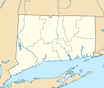  | |
| Location | Bounded by Fairfield St., Brewster St. and Nash Ln., including Rowsley and Haddon Sts., Bridgeport, Connecticut |
|---|---|
| Coordinates | 41°9′27″N 73°13′30″W / 41.15750°N 73.22500°WCoordinates: 41°9′27″N 73°13′30″W / 41.15750°N 73.22500°W |
| Area | 7 acres (2.8 ha)[1] |
| Architect | R. Clipston Sturgis; Skinner & Walker |
| Architectural style | Colonial Revival |
| MPS | Wartime Emergency Housing in Bridgeport MPS |
| NRHP Reference # | 90001430[2] |
| Added to NRHP | September 26, 1990 |
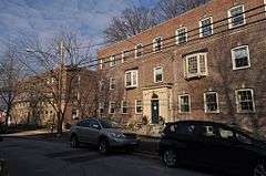
The Black Rock Gardens Historic District is a historic district in the Black Rock neighborhood of Bridgeport, Connecticut. It consists of 12 three-story red brick Colonial Revival buildings, clustered on Fairfield Avenue, Nash Lane, and Haddon Street, and set around small quadrangle-like parks. The complex was built between 1916 and 1920 by the United States Housing Corporation to provide war-time emergency housing for workers in war-related factories, during World War I.[1]
The district was listed on the National Register of Historic Places in 1990.[2]
See also
- History of Bridgeport, Connecticut
- Black Rock Historic District
- National Register of Historic Places listings in Bridgeport, Connecticut
References
- 1 2 Steven Bedford and Nora Lucas (June 30, 1989). "National Register of Historic Places Registration: Black Rock Gardens Historic District / Black Rock Gardens / Black Rock Development" (PDF). National Park Service.
- 1 2 National Park Service (2009-03-13). "National Register Information System". National Register of Historic Places. National Park Service.
| Topics | |
|---|---|
| Lists by states |
|
| Lists by insular areas | |
| Lists by associated states | |
| Other areas | |
| |
This article is issued from Wikipedia - version of the 11/26/2016. The text is available under the Creative Commons Attribution/Share Alike but additional terms may apply for the media files.