Birchville, California
| Birchville | |
|---|---|
| Former settlement | |
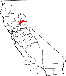
 Birchville Location in California | |
| Coordinates: 39°19′40″N 121°08′36″W / 39.32778°N 121.14333°WCoordinates: 39°19′40″N 121°08′36″W / 39.32778°N 121.14333°W | |
| Country |
|
| State |
|
| County | Nevada County |
| Elevation[1] | 1,765 ft (538 m) |
Birchville (also, Birchy; until 1853, Johnson's Diggings)[2] is a former settlement in Nevada County, California. Birchville is located 2 miles (3.2 km) north-northeast of French Corral.[2] It was situated at an elevation of 1,765 ft (538 m) above sea level.[3]
In 1880, the population was 50.[4]
History
Birchville was located 6 mi (9.7 km) from the Nevada City mine,[5] along the thoroughfare of the first long-distance telephone line.[6]
The name Johnson's Diggings commemorates David Johnson, the site's first prospector.[2] The name Birchville is from L. Birch Adsit.[2]
References
- ↑ U.S. Geological Survey Geographic Names Information System: Birchville, California
- 1 2 3 4 Durham, David L. (1998). California's Geographic Names: A Gazetteer of Historic and Modern Names of the State. Clovis, Calif.: Word Dancer Press. p. 451. ISBN 1-884995-14-4.
- ↑ "NEVADA COUNTY, CALIFORNIA". calsign.com. Archived from the original on 2009-01-06. Retrieved 2009-05-28.
- ↑ "Nevada County GenWeb Nevada County History". cagenweb.com. Retrieved 2009-05-31.
- ↑ Lindgren, Waldemar (1896). The gold-quartz veins of Nevada City and Grass Valley Districts, California. Government printing office.
- ↑ Hoover, Mildred Brooke; Douglas E. Kyle; Hero Rensch (2002). Historic spots in California. Stanford University Press. p. 260. ISBN 0-8047-4482-3.
External links
This article is issued from Wikipedia - version of the 11/3/2016. The text is available under the Creative Commons Attribution/Share Alike but additional terms may apply for the media files.