Biddenham Pit
| Site of Special Scientific Interest | |
 | |
| Area of Search | Bedfordshire |
|---|---|
| Grid reference | TL022503 |
| Interest | Geological |
| Area | 0.4 hectares |
| Notification | 1988 |
| Location map | Magic Map |
Biddenham Pit is a gravel pit and Site of Special Scientific Interest[1] (SSSI), 0.41 hectares in size located in Biddenham, Bedfordshire.[2] The pit was notified to Bedford Borough Council and Bedfordshire County Council under the Wildlife and Countryside Act (1981) in 1988,[2] and is also a Geological Conservation Review site.[3] The site is owned by Persimmon Homes and Kier Homes, with management advice given by Natural England.[4]
The pit provides an intact and visually inspectable terrace gravel, both silty and clayey, which has been laid down by the River Great Ouse.[2] Several features of scientific interest have been identified in the deposits - interglacial mollusca and mammalian remains have been found, possible microfossil material as well as evidence of a prolific Paleolithic industry in the lowest layers of the gravel.[2] Its last official inspection by a Natural England staff member found the whole site[5] and more specifically the gravel feature inside it to be in a 'Favourable' condition.[6]
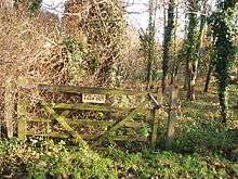
There is access by a footpath from Malcote Close.[4]
References
- ↑ "SSSI information". Sites of Special Scientific Interest. Natural England. Archived from the original on 28 November 2013. Retrieved 28 November 2013.
- 1 2 3 4 "Notification to Bedford Borough Council and Bedfordshire County Council regarding the application" (PDF). Natural England. Archived from the original (PDF) on 28 November 2013. Retrieved 28 November 2013.
- ↑ "GCR Site Details - Biddenham Pit (Quaternary of East Anglia)". Joint Nature Conservation Committee. Archived from the original on 28 November 2013. Retrieved 28 November 2013.
- 1 2 Whiteley, Martin (February 2011). "Geology on your doorstep" (PDF). Bedford Geology Group Newsletter - Winter 2010/2011. Bedfordshire Geology Group. Archived from the original (PDF) on 28 November 2013. Retrieved 28 November 2013.
- ↑ "SSSI condition summary". Natural England. 1 November 2013. Archived from the original on 28 November 2013. Retrieved 28 November 2013.
- ↑ "Condition of SSSI units". Natural England. 1 November 2013. Archived from the original on 28 November 2013. Retrieved 28 November 2013.
Coordinates: 52°08′31″N 0°30′25″W / 52.142°N 0.507°W