Bheemunipatnam
| Bheemunipatnam భీమునిపట్నం Bheemili | |
|---|---|
| Neighborhood | |
|
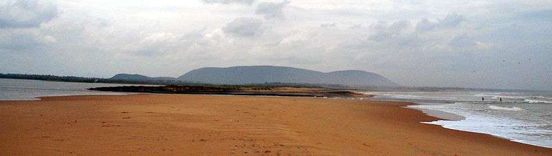
Hill-top view of Bheemunipatnam town | |
 Bheemunipatnam Location in Andhra Pradesh, India | |
| Coordinates: 17°53′11″N 83°26′50″E / 17.886385°N 83.447109°ECoordinates: 17°53′11″N 83°26′50″E / 17.886385°N 83.447109°E | |
| Country | India |
| State | Andhra Pradesh |
| District | Visakhapatnam |
| Area[1] | |
| • Total | 18.88 km2 (7.29 sq mi) |
| Population (2011)[1] | |
| • Total | 52,110 |
| • Density | 2,800/km2 (7,100/sq mi) |
| Languages | |
| • Official | Telugu |
| Time zone | IST (UTC+5:30) |
| PIN | 531 xxx |
| Vehicle registration | AP–31 |
| Sex ratio | 1:1 ♂/♀ |
| Website | Bheemunipatnam Municipality |

Bheemunipatnam (also known as Bheemili[2]) is a neighborhood of Visakhapatnam in the Indian state of Andhra Pradesh. Anakapalle and Bheemili municipality was merged in 2012 with Greater Visakhapatnam Municipal Corporation.[3]

History
Buddhism

Historical evidences of Buddhist Culture have been noticed at Bheemunipatnam dating back to 3rd century BCE on the hillock Pavurallakonda[4] (also known as Narsimhaswami konda locally) in the town. Buddhist remains were found during the excavations here along with Relic caskets. Both the schools of Buddhism Hinayana and Mahayana were propagated in this land and also to the far east lands from the port of River Gosthani. See pavurallakonda page for more details.
Narasimha temple
There is a Hindu temple dedicated to Lord Narasimha on the eastern side of Pavurallakonda facing the sea. As per the historical evidences the temple is constructed around 14th century by Mindi[5] Kings. There are two more temples in the town of Bhimili, which date back to the times of Chola's as Bheemeswaralayam and Choleswaralayam.
Dutch settlements
Known to the Dutch as Bimilipatnam, Bheemunipatnam was one among the major Dutch settlements[6] of the Dutch Coromandel coast in the 17th century. There are remnants of the Dutch East India Company trading post when the town was a port. The town contains one of the oldest Christian cemeteries on the coast.[7] Bhimili also had a currency mint[8] during the times of Dutch.
East India Company
The British East India Company made Bheemunipatnam their main trading base of the east coast. The Bhimili port used to operate passenger vessels to Madras and Calcutta during the British Raj. The big clock tower in the town was built by British.
Geography
Bheemunipatnam is located at 17.53N 83.26E.[9] It has an average elevation of 51 meters (170 feet).
Demographics
According to Imperial Gazetteer of India,[10] Bimlipatam tahsil had an area of 207 square miles (540 km2) with 117 villages. The population in 1901 was 126,354 compared with 114,834 in 1891. It was entirely Zamindari land belonging to the Vizianagram estate.
As of 2001 India census,[11] Bheemunipatnam had a population of 44,156. Males constitute 49% of the population and females 51%. Bheemunipatnam has an average literacy rate of 60%, higher than the national average of 59.5%; with male literacy of 67% and female literacy of 54%. 11% of the population is under 6 years of age.
Landmarks
There is an old Church dated back to 1850s called "The Red Church". Another church, 'The Andhra Baptist' has a rich history of more than 130 years. The lighthouse dated to 1868 was built during Dutch settlement on the shores of Bheemili Beach.[2] Some of the Buddhist sites are Bojjannakonda, Bavikonda, Lingalakonda, Pavurallakonda, Salihundam and Thotlakonda.
Education
The primary and secondary school education is imparted by government, aided and private schools, under the School Education Department of the state.[12][13] The medium of instruction followed by different schools are English, Telugu.
References
- 1 2 "Basic Information of Municipality". Commissioner & Director of Municipal Administration. Retrieved 23 August 2014.
- 1 2 "Bhimili lighthouse to be demolished". The Hindu. 1 February 2013. Retrieved 7 June 2016.
- ↑ "Two municipalities merged in GVMC". Visakhapatnam: Deccan Chronicle. 31 July 2013. Retrieved 18 February 2015.
- ↑ "Dept. of Archaeology & Museums". Museums.ap.nic.in. Archived from the original on February 9, 2012. Retrieved 2012-10-24.
- ↑ Sudhakar (2008-06-25). "Incredible India: Bhimili". Vishakapatnamonline.blogspot.in. Retrieved 2012-10-24.
- ↑ "It is a ruin of colonial legacy | BayNews | The New Voice Of Vizag". Baynews.in. 2010-09-24. Retrieved 2012-10-24.
- ↑ "Andhra Pradesh / Visakhapatnam News : Bhimili: lost in time and tide". The Hindu. 2007-04-12. Retrieved 2012-10-24.
- ↑ Ramani M. "The History of Vizag: copper coins". Heavydutytravel.blogspot.in. Retrieved 2012-10-24.
- ↑ Falling Rain Genomics.Bhimunipatnam
- ↑ Bimlipatnam tahsil in Imperial Gazetteer of India, Vol. 8; pp: 238.
- ↑ "Census of India 2001: Data from the 2001 Census, including cities, villages and towns (Provisional)". Census Commission of India. Archived from the original on 2004-06-16. Retrieved 2008-11-01.
- ↑ "School Eduvation Department" (PDF). School Education Department, Government of Andhra Pradesh. Retrieved 7 November 2016.
- ↑ "The Department of School Education - Official AP State Government Portal | AP State Portal". www.ap.gov.in. Retrieved 7 November 2016.
External links
| Wikimedia Commons has media related to Bheemunipatnam. |