Bharatpur district
Bharatpur District is a district of Rajasthan state in western India. The town of Bharatpur is the district headquarters. Bharatpur District is a part of National Capital Region (NCR).
History
When Bharatpur was a princely state, it was the only political entity ever to have a chartreuse colored flag.[1]
Geography
The district has an area of 5,066 km2. It is bounded by Gurgaon district of Haryana on the north, Mathura and Agra districts of Uttar Pradesh on the east, and the district of Dholpur on the south, Karauli on the southwest, Dausa on the west and Alwar district in the north-west.
Three rivers, the Ban Ganga, Rooparel, and Gambhir, cross the district. The Ban Ganga originates in Jaipur District, passes through Dausa and Bharatpur districts to meet the Yamuna River in Uttar Pradesh. The Gambhir River starts from Pachana Dam of Karauli District, and meets the Ban Ganga in Bayana Tehsil. The Rooparel River starts from hills of Alwar District and enters the district in Kaman Tehsil.
Divisions
Bharatpur District has ten revenue subdivisions and eleven tehsils. They have the same names and borders, except that Weir Subdivision is divided into Weir Tehsil and Bhusawar Tehsil. The other nine tehsils are: Bayana, Bharatpur, Deeg, Kaman, Kumher, Nadbai, Nagar, Pahari, and Roopwas (Rupbas).[2]
| Subdivision | Land Record Circles (ILRCs) |
Patwar Circles | Villages Occupied |
Villages Abandoned |
Villages Total |
|---|---|---|---|---|---|
| Bayana | 6 | 51 | 181 | 16 | 197 |
| Bharatpur | 6 | 57 | 185 | 21 | 206 |
| Deeg | 8 | 56 | 130 | 12 | 142 |
| Kaman | 6 | 46 | 119 | 13 | 132 |
| Kumher | 5 | 47 | 128 | 7 | 135 |
| Nadbai | 5 | 47 | 121 | 4 | 125 |
| Nagar | 6 | 49 | 166 | 9 | 175 |
| Pahari | 5 | 43 | 135 | 4 | 139 |
| Roopwas | 5 | 49 | 148 | 16 | 164 |
| Weir | 5 | 51 | 154 | 8 | 162 |
Demographics
In the 2011 census, the Bharatpur District had a population of 2,549,121,[3] roughly equal to the nation of Kuwait[4] or the US state of Nevada.[5] This gave it a ranking of 166th among districts of India (out of a total of 640).[3] The district had a population density of 503 inhabitants per square kilometre (1,300/sq mi).[3] Its population growth rate over the decade 2001-2011 was 21.32%.[3] Bharatpur had a sex ratio of 877 females for every 1000 males,[3] and a literacy rate of 71.16%.[3]
Culture
Notable personalities
- Acharya Rajendrasuri (1826–1906), Jain reformer was born in Bharatpur.
- Natwar Singh (born 1931), ex-Foreign Minister
- Jagannath Pahadia (born 1932), former Chief Minister of Rajasthan and former Governor of Haryana.
Points of interest
Bharatpur District is famous for Keoladeo National Park, a major wintering area for migratory birds. Established as a duck-hunting reserve by the Maharajas of Bharatpur, it was known as the best duck shooting resort in the British Empire. The site was declared a bird sanctuary in 1956 and later upgraded to National Park. UNESCO has listed it as a world heritage site. Keoladeo National Park attracts 364 species of birds, including many from India, but also from Afghanistan, Turkmenistan, Siberia, China and Tibet, including the rare Siberian crane. As the monsoons arrive and the wetlands and marshes start to fill with water, birds start pouring into the park.
References
- ↑ Baratpur—Indian Princely State—the only political entity ever to have a chartreuse colored flag: Archived February 11, 2009, at the Wayback Machine.
- 1 2 "Administrative Setup". Bharatpur District.
- 1 2 3 4 5 6 "District Census 2011". Census2011.co.in. 2011. Retrieved 2011-09-30.
- ↑ US Directorate of Intelligence. "Country Comparison:Population". Retrieved 2011-10-01.
Kuwait 2,595,62
- ↑ "2010 Resident Population Data". U. S. Census Bureau. Archived from the original on 2013-10-19. Retrieved 2011-09-30.
Nevada 2,700,551
External links
- Official website
- Bharatpur History
- "District Bharatpur: Gram Panchayat, Samiti and Ward Map". Excise Department, Government of Rajasthan.
 |
Mewat district, Haryana | Mathura district, Uttar Pradesh | | |
| Alwar district | |
Agra district, Uttar Pradesh | ||
| ||||
| | ||||
| Dausa district | Karauli district | Dhaulpur district |
| Outline | 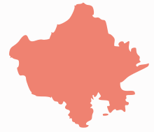 | ||||||||||||||||||||||||||
|---|---|---|---|---|---|---|---|---|---|---|---|---|---|---|---|---|---|---|---|---|---|---|---|---|---|---|---|
| Governance | |||||||||||||||||||||||||||
| Divisions and Districts |
| ||||||||||||||||||||||||||
| Major cities | |||||||||||||||||||||||||||
| Related templates |
| ||||||||||||||||||||||||||
Coordinates: 27°13′12″N 77°30′00″E / 27.22000°N 77.50000°E