Bhangara, Nepal
For other uses, see Bhangra (disambiguation).
| Bhangara, Nepal Village of Amar Gopal (Nepal) | |
|---|---|
| Village development committee | |
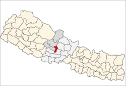
 Bhangara, Nepal Location in Nepal | |
| Coordinates: 28°09′N 83°43′E / 28.15°N 83.71°ECoordinates: 28°09′N 83°43′E / 28.15°N 83.71°E | |
| Country |
|
| Zone | Dhawalagiri Zone |
| District | Parbat District |
| Population (1991) | |
| • Total | 2,242 |
| Time zone | Nepal Time (UTC+5:45) |
Bhangara, Nepal is a village development committee of the Parbat District of the Dhawalagiri Zone in central Nepal. It is located approximately 75 km from Pokhara City and 15 km from the district headquarters Kusma. At the time of the 1991 Nepal census, it had a population of 2242 people living in 421 households.[1]
Bhangara has one high school, Gramodaya High School, and five secondary schools: Majktera, Ulleri, Kaule, Sirubari and Betehani.
The residents of Bhangara are of numerous castes, most notably members of the Gurung, Bahun, Chhetri, Magar, Sharki, Damai, and Kami. They are Hindu, Buddhists and Christians.
References
- ↑ "Nepal Census 2001", Nepal's Village Development Committees, Digital Himalaya, archived from the original on 12 October 2008, retrieved 15 November 2009.
External links
This article is issued from Wikipedia - version of the 11/1/2016. The text is available under the Creative Commons Attribution/Share Alike but additional terms may apply for the media files.