Bhairabkunda
| Bhairabkunda | |
|---|---|
| city | |
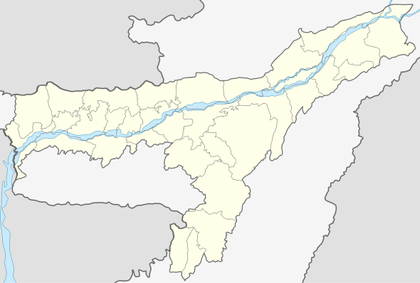 Bhairabkunda  Bhairabkunda Location in Assam, India | |
| Coordinates: 26°53′24″N 92°06′54″E / 26.8900°N 92.1150°ECoordinates: 26°53′24″N 92°06′54″E / 26.8900°N 92.1150°E | |
| Country |
|
| State | Assam |
| District | Udalguri |
| Elevation | 703 m (2,306 ft) |
| Languages | |
| • Official | Assamese |
| Time zone | IST / BST (UTC+5:30) |
| Vehicle registration | AS |
Bhairabkunda is a popular picnic spot in Udalguri district in the State of Assam, India. It is situated on the border of Bhutan and Arunachal Pradesh, near the Bhutanese town of Daifam.

The Jampani River, originating in Bhutan, and Bhairabi River merge here to form Dhanshiri River. Dhanshiri river is a major tributary of Brahmaputra river. An irrigation project was constructed on Dhanshiri river at Bhairabkunda. A guide dam was constructed inside Bhutan for this project. The construction of the project took much more time than planned due to strong currents and terrorism. The Project is situated in Udalguri District within jurisdiction of Bodoland Territorial Autonomous District (B.T.A.D.) aimed to provide assured irrigation to an area of 41.683 hectares (103.00 acres) in five development blocks viz. Udalguri, Rowta, Kalaigaon, Mazbat and Bechimari under Udalguri Civil Sub-Division.
The Project generates 20 MW of electricity out of 5 No. falls per 9 metres (30 ft) drop. The revised estimated cost of the project is 401.24 crores. As of 2009 70% of the work had been completed and targeted to complete the balance work by 2010.

Geography
Bhairabkunda is located at , and has an average elevation of 703 metre.