Bezhanitsky District
| Bezhanitsky District Бежаницкий район (Russian) | |
|---|---|
.svg.png) Location of Bezhanitsky District in Pskov Oblast | |
| Coordinates: 56°58′N 29°53′E / 56.967°N 29.883°ECoordinates: 56°58′N 29°53′E / 56.967°N 29.883°E | |
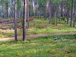 Bezhanitskaya Upland in Bezhanitsky District | |
.png) | |
|
| |
| Location | |
| Country | Russia |
| Federal subject | Pskov Oblast[1] |
| Administrative structure (as of April 2011) | |
| Administrative center | work settlement of Bezhanitsy[2] |
| Inhabited localities:[2] | |
| Urban-type settlements[3] | 2 |
| Rural localities | 466 |
| Municipal structure (as of April 2011) | |
| Municipally incorporated as | Bezhanitsky Municipal District[2] |
| Municipal divisions:[2] | |
| Urban settlements | 1 |
| Rural settlements | 8 |
| Statistics | |
| Area | 3,535 km2 (1,365 sq mi)[4] |
| Population (2010 Census) | 13,264 inhabitants[5] |
| • Urban | 40.4% |
| • Rural | 59.6% |
| Density | 3.75/km2 (9.7/sq mi)[6] |
| Time zone | MSK (UTC+03:00)[7] |
| Official website | |
| Bezhanitsky District on WikiCommons | |
Bezhanitsky District (Russian: Бежа́ницкий райо́н) is an administrative[1] and municipal[2] district (raion), one of the twenty-four in Pskov Oblast, Russia. It is located in the central and eastern parts of the oblast and borders with Dedovichsky District in the north, Poddorsky and Kholmsky Districts of Novgorod Oblast in the east, Loknyansky District in the south, Novosokolnichesky, Pustoshkinsky, and Opochetsky Districts in the southwest, and with Novorzhevsky District in the west. The area of the district is 3,535 square kilometers (1,365 sq mi).[4] Its administrative center is the urban locality (a work settlement) of Bezhanitsy.[2] Population: 13,264 (2010 Census);[5] 17,547 (2002 Census);[8] 22,784 (1989 Census).[9] The population of Bezhanitsy accounts for 32.7% of the district's total population.[5]
Geography

The district is elongated from southeast to northwest. The divide between the basins of the Narva and Neva Rivers crosses the district from south to north. The northwestern part of the district lies the basin of the Polist River, with both the Polist and its major right tributary, the Porusya, having their sources within the district. The Polist flows into the Lovat River and thus belongs to the basin of the Neva. The Loknya River, a left tributary of the Lovat, makes up a stretch of the border with Loknyansky District. Some areas in the south of the district are in the basin of the Loknya. The western part of the district belongs to the basin of the Velikaya River. The rivers in the northwest of the district drain into the Sorot, a major right tributary of the Velikaya, and into the Lsta, a left tributary of the Sorot. The southwest of the district belongs to the basin of the Alolya River, another right tributary of the Velikaya.
There are many lakes in the district, with the largest ones being Lakes Polisto, Alyo, Tsevlo, Kamennoye, and Dubets. 27.6% of the district's territory is covered by forests, predominantly deciduous. Further 44% is occupied by agricultural lands.
The Polistovsky Nature Reserve, located mostly in the drainage basin of the Polist in the northwest of the district, is one of the first wetland preserves in Russia, founded in 1994. It was created to protect the raised bog landscapes of the Polist-Lovat Swamp System.
History
In the course of the administrative reform carried out in 1708 by Peter the Great, the area was included into Ingermanland Governorate (known since 1710 as Saint Petersburg Governorate). In 1727, separate Novgorod Governorate was split off, and in 1772, Pskov Governorate (which between 1777 and 1796 existed as Pskov Viceroyalty) was established. The area was a part of Pustorzhevsky Uyezd, which in 1777 was renamed Novorzhevsky Uyezd of Pskov Viceroyalty. In 1796, when the viceroyalty was abolished, the uyezd was abolished as well; however, it was re-established in 1802. In the mid-18th century, Bezhanitsy, which was located on the road connecting Porkhov and Velikiye Luki, quickly developed as a center of yam (state-sponsored transportation).[10][11]
On August 1, 1927, the uyezds were abolished, and Bezhanitsky District was established, with the administrative center in the selo of Bezhanitsy. It included parts of former Novorzhevsky Uyezd. The governorates were abolished as well, and the district became a part of Pskov Okrug of Leningrad Oblast. On July 23, 1930, the okrugs were also abolished, and the districts were directly subordinated to the oblast. On January 29, 1935, the district was transferred to Kalinin Oblast, and on February 5 of the same year, Bezhanitsky District became a part of Velikiye Luki Okrug of Kalinin Oblast, one of the okrugs abutting the state boundaries of the Soviet Union. On May 11, 1937, the district was transferred to Opochka Okrug. On May 4, 1938, the district was directly subordinated to Kalinin Oblast. Between 1941 and 1944, Bezhanitsky District was occupied by German troops. On August 22, 1944, the district was transferred to newly established Velikiye Luki Oblast. On October 2, 1957, Velikiye Luki Oblast was abolished, and the district was transferred to Pskov Oblast.[12]
On August 28, 1958, Krasny Luch was granted work settlement status, and on August 7, 1961, Bezhanitsy followed.[12]
On August 1, 1927, Chikhachyovsky District was established as well, with the administrative center in the selo of Chikhachyovo. It included parts of former Novorzhevsky and Porkhovsky Uyezds. The district was a part of Pskov Okrug of Leningrad Oblast. On January 1, 1932, the district was abolished and split between Dedovichsky and Bezhanitsky Districts.[12]
Another district established on August 1, 1927 was Kudeversky District with the administrative center in the selo of Kudever. It included parts of former Novorzhevsky Uyezd. The district was a part of Pskov Okrug of Leningrad Oblast. On September 20, 1931, Kudeversky District was abolished and merged into Novorzhevsky District. On March 5, 1935, it was re-established as a part of Velikiye Luki Okrug of Kalinin Oblast; on May 11, 1937, the district was transferred to Opochka Okrug. On August 22, 1944, the district was transferred to Velikiye Luki Oblast. On October 2, 1957, Velikiye Luki Oblast was abolished, and Kudeversky District was transferred to Pskov Oblast. On January 14, 1958, Kudeversky District was abolished and split between Bezhanitsky, Novorzhevsky, Opochetsky, and Pustoshkinsky Districts.[12]
On June 1, 1936, Ashevsky District with the administrative center in the selo of Chikhachyovo was established. It included parts of Bezhanitsky and Loknyansky Districts. The district was a part of Velikiye Luki Okrug of Kalinin Oblast. On May 11, 1937, the district was transferred to Opochka Okrug. On May 4, 1938, the district was directly subordinated to Kalinin Oblast. Between 1941 and 1944, Ashevsky District was occupied by German troops. On August 23, 1944, it was included into newly established Pskov Oblast. On February 1, 1963, the district was abolished and merged into Bezhanitsky District.[12]
Economy
Industry
The largest industrial enterprise of the district is Krasny Luch Glass-Works, which is one of the oldest glass-works. The works produces light glass, consumer goods, and decorative glass items. It is located in the urban-type settlement of Krasny Luch.[13]
Agriculture
Agriculture forms the basis of the district's economy and employs over 22% of the population. The main product is dairy, with growing and processing of flax also being important.[14]
Transportation
The railway connecting St. Petersburg and Vitebsk crosses the district from north to south.
Bezhanitsy is connected by road with Porkhov, Velikiye Luki (via Loknya), and Novorzhev. There are also local roads with bus traffic originating from Bezhanitsy.
Culture and recreation
The district contains four cultural heritage monuments of federal significance and additionally twenty-two objects classified as cultural and historical heritage of local significance.[15] The federally protected monuments are two churches and two archeological sites.
The major places of interest in the district are:
- Philosophovs Historical and Cultural Center, placed in the noble family estate of the Philosophovs (late 19th century)
- St. Nicholas Church, 1822, in the village of Dvortsy
- Church of the Tikhvin Mother of God, 1799–1807, in the village of Dobryvichi;
- an ancient settlement site, first half of the 2d millennium AD, the village of Gorodok, northeast of Lake Tsevlo
- an ancient settlement site, 10-15th centuries, southeast of the village of Podorzhevka
References
Notes
- 1 2 Law #833-oz
- 1 2 3 4 5 6 Law #420-oz
- ↑ The count of urban-type settlements may include the work settlements, the resort settlements, the suburban (dacha) settlements, as well as urban-type settlements proper.
- 1 2 О районе (in Russian). Портал муниципальных образований Псковской области. Retrieved August 7, 2012.
- 1 2 3 Russian Federal State Statistics Service (2011). "Всероссийская перепись населения 2010 года. Том 1" [2010 All-Russian Population Census, vol. 1]. Всероссийская перепись населения 2010 года (2010 All-Russia Population Census) (in Russian). Federal State Statistics Service. Retrieved June 29, 2012.
- ↑ The value of density was calculated automatically by dividing the 2010 Census population by the area specified in the infobox. Please note that this value is only approximate as the area specified in the infobox does not necessarily correspond to the area of the entity proper or is reported for the same year as the population.
- ↑ Правительство Российской Федерации. Федеральный закон №107-ФЗ от 3 июня 2011 г. «Об исчислении времени», в ред. Федерального закона №271-ФЗ от 03 июля 2016 г. «О внесении изменений в Федеральный закон "Об исчислении времени"». Вступил в силу по истечении шестидесяти дней после дня официального опубликования (6 августа 2011 г.). Опубликован: "Российская газета", №120, 6 июня 2011 г. (Government of the Russian Federation. Federal Law #107-FZ of June 31, 2011 On Calculating Time, as amended by the Federal Law #271-FZ of July 03, 2016 On Amending Federal Law "On Calculating Time". Effective as of after sixty days following the day of the official publication.).
- ↑ Russian Federal State Statistics Service (May 21, 2004). "Численность населения России, субъектов Российской Федерации в составе федеральных округов, районов, городских поселений, сельских населённых пунктов – районных центров и сельских населённых пунктов с населением 3 тысячи и более человек" [Population of Russia, Its Federal Districts, Federal Subjects, Districts, Urban Localities, Rural Localities—Administrative Centers, and Rural Localities with Population of Over 3,000] (XLS). Всероссийская перепись населения 2002 года [All-Russia Population Census of 2002] (in Russian). Retrieved August 9, 2014.
- ↑ Demoscope Weekly (1989). "Всесоюзная перепись населения 1989 г. Численность наличного населения союзных и автономных республик, автономных областей и округов, краёв, областей, районов, городских поселений и сёл-райцентров" [All Union Population Census of 1989: Present Population of Union and Autonomous Republics, Autonomous Oblasts and Okrugs, Krais, Oblasts, Districts, Urban Settlements, and Villages Serving as District Administrative Centers]. Всесоюзная перепись населения 1989 года [All-Union Population Census of 1989] (in Russian). Институт демографии Национального исследовательского университета: Высшая школа экономики [Institute of Demography at the National Research University: Higher School of Economics]. Retrieved August 9, 2014.
- ↑ История района (in Russian). Портал муниципальных образований Псковской области. Retrieved July 25, 2012.
- ↑ История (in Russian). Портал муниципальных образований Псковской области. Retrieved August 7, 2012.
- 1 2 3 4 5 Герасимёнок, Т. Е.; Н. В. Коломыцева; И. С. Пожидаев; С. М. Фёдоров; К. И. Карпов (2002). Территориальное деление Псковской области (in Russian). Pskov. ISBN 5-94542-031-X.
- ↑ Промышленность (in Russian). Портал муниципальных образований Псковской области. Retrieved August 7, 2012.
- ↑ Сельское хозяйство (in Russian). Портал муниципальных образований Псковской области. Retrieved August 7, 2012.
- ↑ Памятники истории и культуры народов Российской Федерации (in Russian). Russian Ministry of Culture. Retrieved 2 June 2016.
Sources
- Псковское областное Собрание депутатов. Закон №833-оз от 5 февраля 2009 г. «Об административно-территориальном устройстве Псковской области». Вступил в силу со дня официального опубликования. Опубликован: "Псковская правда", №20, 10 февраля 2009 г. (Pskov Oblast Council of Deputies. Law #833-oz of February 5, 2009 On the Administrative-Territorial Structure of Pskov Oblast. Effective as of the official publication date.).
- Псковское областное Собрание депутатов. Закон №420-оз от 28 февраля 2005 г. «Об установлении границ и статусе вновь образуемых муниципальных образований на территории Псковской области», в ред. Закона №1542-ОЗ от 5 июня 2015 г. «О внесении изменений в Закон Псковской области "Об установлении границ и статусе вновь образуемых муниципальных образований на территории Псковской области"». Вступил в силу со дня официального опубликования. Опубликован: "Псковская правда", №41–43, №44–46, №49–51, 4 марта 2005 г., 5 марта 2005 г., 11 марта 2005 г. (Pskov Oblast Council of Deputies. Law #420-oz of February 28, 2005 On Establishing the Borders and the Status of the Newly Formed Municipal Formations on the Territory of Pskov Oblast, as amended by the Law #1542-OZ of June 5, 2015 On Amending the Law of Pskov Oblast "On Establishing the Borders and the Status of the Newly Formed Municipal Formations on the Territory of Pskov Oblast". Effective as of the official publication date.).
| Cities and towns | ||
|---|---|---|
| Districts | ||