Bevier, Missouri
| Bevier, Missouri | |
|---|---|
| City | |
 Location of Bevier, Missouri | |
| Coordinates: 39°44′57″N 92°33′50″W / 39.74917°N 92.56389°WCoordinates: 39°44′57″N 92°33′50″W / 39.74917°N 92.56389°W | |
| Country | United States |
| State | Missouri |
| County | Macon |
| Area[1] | |
| • Total | 1.03 sq mi (2.67 km2) |
| • Land | 1.03 sq mi (2.67 km2) |
| • Water | 0 sq mi (0 km2) |
| Elevation | 791 ft (241 m) |
| Population (2010)[2] | |
| • Total | 718 |
| • Estimate (2012[3]) | 716 |
| • Density | 697.1/sq mi (269.2/km2) |
| Time zone | Central (CST) (UTC-6) |
| • Summer (DST) | CDT (UTC-5) |
| ZIP code | 63532 |
| Area code(s) | 660 |
| FIPS code | 29-05266[4] |
| GNIS feature ID | 0714120[5] |
Bevier is a city in Macon County, Missouri, United States. The population was 718 at the 2010 census.
History
Bevier was laid out and platted in 1858 along a new railroad line.[6][7] The community was named for Kentucky native Col. Robert Bevier, who afterward became a leader of the Confederate army.[8] A post office called Bevier has been in operation since 1858.[9]
Geography
Bevier is located at 39°44′57″N 92°33′50″W / 39.74917°N 92.56389°W (39.749126, -92.563902).[10]
According to the United States Census Bureau, the city has a total area of 1.03 square miles (2.67 km2), all of it land.[1]
Demographics
| Historical population | |||
|---|---|---|---|
| Census | Pop. | %± | |
| 1870 | 833 | — | |
| 1880 | 867 | 4.1% | |
| 1890 | 876 | 1.0% | |
| 1900 | 1,808 | 106.4% | |
| 1910 | 1,900 | 5.1% | |
| 1920 | 1,868 | −1.7% | |
| 1930 | 1,229 | −34.2% | |
| 1940 | 1,105 | −10.1% | |
| 1950 | 838 | −24.2% | |
| 1960 | 781 | −6.8% | |
| 1970 | 806 | 3.2% | |
| 1980 | 733 | −9.1% | |
| 1990 | 643 | −12.3% | |
| 2000 | 723 | 12.4% | |
| 2010 | 718 | −0.7% | |
| Est. 2015 | 703 | [11] | −2.1% |
2010 census
As of the census[2] of 2010, there were 718 people, 287 households, and 191 families residing in the city. The population density was 697.1 inhabitants per square mile (269.2/km2). There were 341 housing units at an average density of 331.1 per square mile (127.8/km2). The racial makeup of the city was 97.4% White, 1.3% African American, 0.4% Asian, and 1.0% from two or more races. Hispanic or Latino of any race were 0.1% of the population.
There were 287 households of which 35.9% had children under the age of 18 living with them, 46.0% were married couples living together, 15.3% had a female householder with no husband present, 5.2% had a male householder with no wife present, and 33.4% were non-families. 29.6% of all households were made up of individuals and 14.6% had someone living alone who was 65 years of age or older. The average household size was 2.50 and the average family size was 3.07.
The median age in the city was 40.1 years. 26.2% of residents were under the age of 18; 8.1% were between the ages of 18 and 24; 23.5% were from 25 to 44; 27% were from 45 to 64; and 15.2% were 65 years of age or older. The gender makeup of the city was 48.2% male and 51.8% female.
2000 census
As of the census[4] of 2000, there were 723 people, 303 households, and 195 families residing in the city. The population density was 838.6 people per square mile (324.6/km²). There were 342 housing units at an average density of 396.7/sq mi (153.5/km²). The racial makeup of the city was 97.65% White, 0.83% Native American, 0.41% Asian, and 1.11% from two or more races. Hispanic or Latino of any race were 0.14% of the population.
There were 303 households out of which 32.3% had children under the age of 18 living with them, 49.2% were married couples living together, 12.2% had a female householder with no husband present, and 35.6% were non-families. 32.3% of all households were made up of individuals and 15.5% had someone living alone who was 65 years of age or older. The average household size was 2.39 and the average family size was 3.02.
In the city the population was spread out with 26.4% under the age of 18, 8.2% from 18 to 24, 27.8% from 25 to 44, 20.2% from 45 to 64, and 17.4% who were 65 years of age or older. The median age was 37 years. For every 100 females there were 96.5 males. For every 100 females age 18 and over, there were 90.0 males.
The median income for a household in the city was $28,250, and the median income for a family was $34,479. Males had a median income of $25,078 versus $17,284 for females. The per capita income for the city was $13,099. About 1.6% of families and 7.6% of the population were below the poverty line, including 5.9% of those under age 18 and 11.0% of those age 65 or over.
Notable people
- John V. Cox (born 1930), Major General (ret) United States Marine Corps.
References
- 1 2 "US Gazetteer files 2010". United States Census Bureau. Archived from the original on 2012-07-14. Retrieved 2012-07-08.
- 1 2 "American FactFinder". United States Census Bureau. Retrieved 2012-07-08.
- ↑ "Population Estimates". United States Census Bureau. Archived from the original on 2013-06-17. Retrieved 2013-05-30.
- 1 2 "American FactFinder". United States Census Bureau. Archived from the original on 2013-09-11. Retrieved 2008-01-31.
- ↑ "US Board on Geographic Names". United States Geological Survey. 2007-10-25. Retrieved 2008-01-31.
- ↑ Earngey, Bill (1995). Missouri Roadsides: The Traveler's Companion. University of Missouri Press. p. 17.
- ↑ "Macon County Place Names, 1928–1945". The State Historical Society of Missouri. Archived from the original on June 24, 2016. Retrieved October 30, 2016.
- ↑ Eaton, David Wolfe (1916). How Missouri Counties, Towns and Streams Were Named. The State Historical Society of Missouri. p. 191.
- ↑ "Post Offices". Jim Forte Postal History. Retrieved 30 October 2016.
- ↑ "US Gazetteer files: 2010, 2000, and 1990". United States Census Bureau. 2011-02-12. Retrieved 2011-04-23.
- ↑ "Annual Estimates of the Resident Population for Incorporated Places: April 1, 2010 to July 1, 2015". Retrieved July 2, 2016.
- ↑ "Census of Population and Housing". Census.gov. Archived from the original on May 11, 2015. Retrieved June 4, 2015.
External links
- Historic maps of Bevier in the Sanborn Maps of Missouri Collection at the University of Missouri
Municipalities and communities of Macon County, Missouri, United States | ||
|---|---|---|
| Cities | 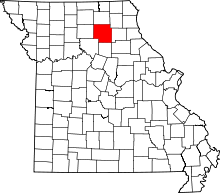 | |
| Townships | ||
| CDP | ||
| Other unincorporated communities | ||
| Ghost towns | ||