Beuzeville-la-Grenier
| Beuzeville-la-Grenier | ||
|---|---|---|
| ||
 Beuzeville-la-Grenier | ||
|
Location within Normandy region  Beuzeville-la-Grenier | ||
| Coordinates: 49°35′35″N 0°25′38″E / 49.5931°N 0.4272°ECoordinates: 49°35′35″N 0°25′38″E / 49.5931°N 0.4272°E | ||
| Country | France | |
| Region | Normandy | |
| Department | Seine-Maritime | |
| Arrondissement | Le Havre | |
| Canton | Bolbec | |
| Intercommunality | Caux-Vallée de Seine | |
| Area1 | 6.19 km2 (2.39 sq mi) | |
| Population (2006)2 | 1,038 | |
| • Density | 170/km2 (430/sq mi) | |
| Time zone | CET (UTC+1) | |
| • Summer (DST) | CEST (UTC+2) | |
| INSEE/Postal code | 76090 / 76210 | |
| Elevation |
94–127 m (308–417 ft) (avg. 114 m or 374 ft) | |
|
1 French Land Register data, which excludes lakes, ponds, glaciers > 1 km² (0.386 sq mi or 247 acres) and river estuaries. 2 Population without double counting: residents of multiple communes (e.g., students and military personnel) only counted once. | ||
Beuzeville-la-Grenier is a commune in the Seine-Maritime department in the Haute-Normandie region in northern France.
Geography
A farming village situated in the Pays de Caux, some 13 miles (21 km) northeast of Le Havre, at the junction of the D910 and the D112 roads. Junction 7 of the A29 autoroute forms the commune’s southern border.
Heraldry
 |
The arms of Beuzeville-la-Grenier are blazoned : Vert, a tower argent overall 2 leopards gules. |
Population
| Year | 1962 | 1968 | 1975 | 1982 | 1990 | 1999 | 2006 |
|---|---|---|---|---|---|---|---|
| Population | 753 | 773 | 704 | 868 | 1014 | 1035 | 1038 |
| From the year 1962 on: No double counting—residents of multiple communes (e.g. students and military personnel) are counted only once. | |||||||
Places of interest
- The church of St.Martin, dating from the eleventh century.
- A manorhouse and chateau of the 16th century.
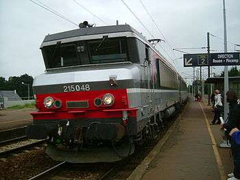
SNCF Class BB locomotive at Bréauté-Beuzeville station
See also
References
External links
| Wikimedia Commons has media related to Beuzeville-la-Grenier. |
This article is issued from Wikipedia - version of the 11/1/2016. The text is available under the Creative Commons Attribution/Share Alike but additional terms may apply for the media files.