Beulah Valley, Colorado
| Beulah Valley, Colorado | |
|---|---|
| CDP | |
 Location in Pueblo County and the State of Colorado | |
| Coordinates: 38°4′20″N 104°57′48″W / 38.07222°N 104.96333°WCoordinates: 38°4′20″N 104°57′48″W / 38.07222°N 104.96333°W | |
| Country |
|
| State |
|
| County | Pueblo County |
| Government | |
| • Type | unincorporated community |
| Area | |
| • Total | 110.2 sq mi (285.5 km2) |
| • Land | 110.2 sq mi (285.5 km2) |
| • Water | 0 sq mi (0 km2) |
| Elevation | 6,171 ft (1,881 m) |
| Population (2010) | |
| • Total | 556 |
| • Density | 10.6/sq mi (4.1/km2) |
| Time zone | MST (UTC-7) |
| • Summer (DST) | MDT (UTC-6) |
| FIPS code | 08-06602 |
| GNIS feature ID | 1852838 |
For unincorporated town see Beulah, Colorado
Beulah Valley is a census-designated place (CDP) in Pueblo County, Colorado, United States. It is part of the Pueblo, Colorado Metropolitan Statistical Area. The population was 556 at the 2010 census.[1]
Geography
Beulah Valley is located at 38°4′20″N 104°57′48″W / 38.07222°N 104.96333°W (38.072174, -104.963322).[2]
According to the United States Census Bureau, the CDP has a total area of 110.2 square miles (285 km2), all of it land.
Demographics
As of the census[3] of 2000, there were 1,164 people, 497 households, and 356 families residing in the CDP. The population density was 10.6 people per square mile (4.1/km²). There were 718 housing units at an average density of 6.5 per square mile (2.5/km²). The racial makeup of the CDP was 95.96% White, 0.26% African American, 0.77% Native American, 1.46% from other races, and 1.55% from two or more races. Hispanic or Latino of any race were 6.01% of the population.
There were 497 households out of which 23.5% had children under the age of 18 living with them, 64.4% were married couples living together, 4.2% had a female householder with no husband present, and 28.2% were non-families. 23.7% of all households were made up of individuals and 8.0% had someone living alone who was 65 years of age or older. The average household size was 2.34 and the average family size was 2.77.
In the CDP the population was spread out with 21.0% under the age of 18, 4.0% from 18 to 24, 22.7% from 25 to 44, 37.2% from 45 to 64, and 15.1% who were 65 years of age or older. The median age was 46 years. For every 100 females there were 102.1 males. For every 100 females age 18 and over, there were 102.2 males.
The median income for a household in the CDP was $46,369, and the median income for a family was $58,259. Males had a median income of $37,031 versus $33,750 for females. The per capita income for the CDP was $23,252. About 1.6% of families and 6.5% of the population were below the poverty line, including 7.2% of those under age 18 and none of those age 65 or over.
Bishop Castle, constructed by Jim Bishop, otherwise known as a "one man castle", is located between Beulah and San Isabel, Colorado.
See also
References
- ↑ Colorado Trend Report 2: State and Complete Places (Sub-state 2010 Census Data). Missouri Census Data Center. Accessed 2011-02-25.
- ↑ "US Gazetteer files: 2010, 2000, and 1990". United States Census Bureau. 2011-02-12. Retrieved 2011-04-23.
- ↑ "American FactFinder". United States Census Bureau. Archived from the original on 2013-09-11. Retrieved 2008-01-31.
External links
| Wikimedia Commons has media related to Beulah Valley, Colorado. |
Municipalities and communities of Pueblo County, Colorado, United States | ||
|---|---|---|
| City | 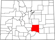 | |
| Towns | ||
| CDPs | ||
| Unincorporated communities | ||
| Ghost town | ||