Bethungra
| Bethungra New South Wales | |
|---|---|
 Entering Bethungra | |
|
Bethungra | |
| Coordinates | 34°46′0″S 147°51′0″E / 34.76667°S 147.85000°ECoordinates: 34°46′0″S 147°51′0″E / 34.76667°S 147.85000°E |
| Population | 414 (2011 census)[1] |
| Postcode(s) | 2590 |
| Elevation | 310 m (1,017 ft) |
| Location |
|
| LGA(s) | Junee Shire |
| County | Clarendon |
| State electorate(s) | Cootamundra |
| Federal Division(s) | Riverina |
Bethungra is a locality in Junee Shire in the South West Slopes region of New South Wales, Australia situated on the Olympic Way about 13 kilometres northeast of Illabo and 24 kilometres southwest of Cootamundra.[3]
Bethungra Post Office opened on 1 December 1875.[4]
Just to the north of the town lies the Bethungra Spiral, a rail spiral built on the Main South railway line to ease the gradients when the line was duplicated between 1941 and 1946. A railway station was located in the town between 1878 and the 1980s, and has now been demolished.[5]
In 1885, an accident occurred near Bethungra when a train derailed at a washed away culvert, killing five persons.
Gallery
-

Bethungra Hotel aka Hotel Shirley
-

Bethungra Spiral
-
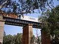
Overpass just south of Bethungra Spiral
References
- ↑ Australian Bureau of Statistics (31 October 2012). "Bethungra (State Suburb)". 2011 Census QuickStats. Retrieved 2 April 2015.
- ↑ Travelmate Archived March 25, 2007, at the Wayback Machine.
- ↑ "Bethungra". Geographical Names Register (GNR) of NSW. Geographical Names Board of New South Wales. Retrieved 20 January 2010.
- ↑ Premier Postal History. "Post Office List". Retrieved 2009-06-11.
- ↑ Bethungra station. NSWrail.net, accessed 29 August 2009.
External links
![]() Media related to Bethungra at Wikimedia Commons
Media related to Bethungra at Wikimedia Commons
| Preceding station | NSW Main lines | Following station | ||
|---|---|---|---|---|
towards Albury | Main Southern Line | towards Sydney |