Bethlehem, Georgia
| Bethlehem, Georgia | |
|---|---|
| Town | |
| Motto: "The little town under the star" | |
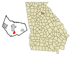 Location in Barrow County and the state of Georgia | |
| Coordinates: 33°56′11″N 83°42′38″W / 33.93639°N 83.71056°WCoordinates: 33°56′11″N 83°42′38″W / 33.93639°N 83.71056°W | |
| Country | United States |
| State | Georgia |
| County | Barrow |
| Area | |
| • Total | 2.3 sq mi (6.0 km2) |
| • Land | 2.3 sq mi (6.0 km2) |
| • Water | 0 sq mi (0 km2) |
| Elevation | 860 ft (262 m) |
| Population (2010) | |
| • Total | 601 |
| • Density | 258/sq mi (99.8/km2) |
| Time zone | Eastern (EST) (UTC-5) |
| • Summer (DST) | EDT (UTC-4) |
| ZIP code | 30620 |
| Area code(s) | 770; 404; 678 |
| FIPS code | 13-07612[1] |
| GNIS feature ID | 0331150[2] |
| Website |
www |
Bethlehem is a town in Barrow County, Georgia, United States. As of the 2010 census, it had a population of 601.[3]
Despite its small population, the town is very well known for its name, which comes from the community's original church, namesake of the biblical town of Bethlehem. According to WSB-TV's Georgia's Hidden Treasures, the local post office postmarked nearly 200,000 Christmas cards and other pieces of mail prior to Christmas in 2009.
Geography
Bethlehem is located in southern Barrow County at 33°56′11″N 83°42′38″W / 33.93639°N 83.71056°W (33.936492, -83.710481),[4] 4 miles (6 km) south of Winder, the county seat.
According to the United States Census Bureau, the town has a total area of 2.3 square miles (6.0 km2), all land.[5]
Demographics
| Historical population | |||
|---|---|---|---|
| Census | Pop. | %± | |
| 1910 | 209 | — | |
| 1920 | 246 | 17.7% | |
| 1930 | 209 | −15.0% | |
| 1940 | 242 | 15.8% | |
| 1950 | 240 | −0.8% | |
| 1960 | 297 | 23.8% | |
| 1970 | 304 | 2.4% | |
| 1980 | 281 | −7.6% | |
| 1990 | 348 | 23.8% | |
| 2000 | 716 | 105.7% | |
| 2010 | 601 | −16.1% | |
| Est. 2015 | 671 | [6] | 11.6% |
As of the census[1] of 2000, there were 716 people, 254 households, and 199 families residing in the town. The population density was 331.8 people per square mile (128.0/km²). There were 265 housing units at an average density of 122.8 per square mile (47.4/km²). The racial makeup of the town was 85.61% White, 14.75% African American, 0.14% Native American, 2.93% Asian, 6.01% from other races, and 0.56% from two or more races. Hispanic or Latino of any race were 7.54% of the population.
There were 254 households out of which 40.6% had children under the age of 18 living with them, 69.7% were married couples living together, 5.9% had a female householder with no husband present, and 21.3% were non-families. 18.9% of all households were made up of individuals and 11.0% had someone living alone who was 65 years of age or older. The average household size was 2.82 and the average family size was 3.19.
In the town the population was spread out with 29.2% under the age of 18, 8.4% from 18 to 24, 35.2% from 25 to 44, 17.5% from 45 to 64, and 9.8% who were 65 years of age or older. The median age was 31 years. For every 100 females there were 106.9 males. For every 100 females age 18 and over, there were 99.6 males.
The median income for a household in the town was $47,500, and the median income for a family was $50,625. Males had a median income of $35,714 versus $25,163 for females. The per capita income for the town was $17,214. About 3.4% of families and 3.5% of the population were below the poverty line, including 3.2% of those under age 18 and 24.1% of those age 65 or over.
References
- 1 2 "American FactFinder". United States Census Bureau. Archived from the original on 2013-09-11. Retrieved 2008-01-31.
- ↑ "US Board on Geographic Names". United States Geological Survey. 2007-10-25. Retrieved 2008-01-31.
- ↑ http://factfinder2.census.gov/faces/tableservices/jsf/pages/productview.xhtml?pid=DEC_10_SF1_GCTP2.ST13&prodType=table
- ↑ "US Gazetteer files: 2010, 2000, and 1990". United States Census Bureau. 2011-02-12. Retrieved 2011-04-23.
- ↑ "Geographic Identifiers: 2010 Demographic Profile Data (G001): Bethlehem town, Georgia". U.S. Census Bureau, American Factfinder. Retrieved October 30, 2013.
- ↑ "Annual Estimates of the Resident Population for Incorporated Places: April 1, 2010 to July 1, 2015". Retrieved July 2, 2016.
- ↑ "Census of Population and Housing". Census.gov. Archived from the original on May 11, 2015. Retrieved June 4, 2015.
External links
- Town of Bethlehem official website
- Bethlehem United Methodist Church historical marker
Municipalities and communities of Barrow County, Georgia, United States | ||
|---|---|---|
| City | 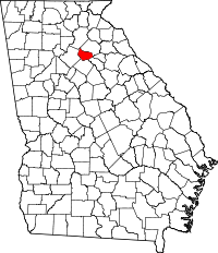 | |
| Towns | ||
| CDP | ||
| Footnotes | ‡This populated place also has portions in an adjacent county or counties | |