Bethel Acres, Oklahoma
| Bethel Acres, Oklahoma | |
|---|---|
| Town | |
 Location of Bethel Acres, Oklahoma | |
| Coordinates: 35°18′41″N 97°1′39″W / 35.31139°N 97.02750°WCoordinates: 35°18′41″N 97°1′39″W / 35.31139°N 97.02750°W | |
| Country | United States |
| State | Oklahoma |
| County | Pottawatomie |
| Area | |
| • Total | 28.2 sq mi (73.1 km2) |
| • Land | 28.2 sq mi (73.1 km2) |
| • Water | 0.0 sq mi (0.0 km2) |
| Elevation | 1,125 ft (343 m) |
| Population (2000) | |
| • Total | 2,735 |
| • Density | 96.9/sq mi (37.4/km2) |
| Time zone | Central (CST) (UTC-6) |
| • Summer (DST) | CDT (UTC-5) |
| FIPS code | 40-05800[1] |
| GNIS feature ID | 1102929[2] |
Bethel Acres is a town in Pottawatomie County, Oklahoma, United States. The population was 2,895 at the 2010 census, an increase of 5.9 percent from 2,735 at the 2000 census.[3] It is primarily a bedroom community for people who work in three nearby larger cities of Shawnee, Tecumseh and Oklahoma City.
History
The area comprising the present Bethel Acres was opened to non-Indian settlement September 22, 1891. The people who settled here established the Bethel school district. Bethel Acres was not incorporated until April 24, 1962, when the residents feared annexation by Shawnee, Tecumseh, Oklahoma or Oklahoma City. They wanted to protect their rural lifestyle, especially to be free to keep livestock on their property.[4]
In 1970, Bethel Acres had 1,083 residents. The number jumped to 2,314 in 1980 and has continued to increase through the 2010 census. Over 97 percent of the employed residents commute to work in Oklahoma City, Shawnee and Tecumseh.[4]
On May 19, 2013, A EF3 tornado tore through Northwest Bethel Acres, and a mobile home park sustained a direct from this tornado, killing one person and injuring six others, two critically. This was apart of the May 18–21, 2013 tornado outbreak.
Geography
Bethel Acres is located at 35°18′41″N 97°1′39″W / 35.31139°N 97.02750°W (35.311381, -97.027550).[5] It is 4 miles (6.4 km) west of Shawnee.[4]
According to the United States Census Bureau, the town has a total area of 28.2 square miles (73 km2), of which, 28.2 square miles (73 km2) of it is land and 0.04 square miles (0.10 km2) of it (0.07%) is water.
Schools
Four schools make up Bethel Public Schools, including upper elementary, lower elementary, middle school and high school. Jerry M. Johnson is the Superintendent.[6]
The Bethel Public Schools website is http://www.bethel.k12.ok.us/district/.
Demographics
| Historical population | |||
|---|---|---|---|
| Census | Pop. | %± | |
| 1910 | 388 | — | |
| 1970 | 1,083 | — | |
| 1980 | 2,314 | 113.7% | |
| 1990 | 2,505 | 8.3% | |
| 2000 | 2,735 | 9.2% | |
| 2010 | 2,895 | 5.9% | |
| Est. 2015 | 3,101 | [7] | 7.1% |
As of the census[1] of 2000, there were 2,735 people, 985 households, and 816 families residing in the town. The population density was 96.9 people per square mile (37.4/km²). There were 1,104 housing units at an average density of 39.1 per square mile (15.1/km²). The racial makeup of the town was 88.56% White, 0.51% African American, 5.92% Native American, 0.33% Asian, 0.04% Pacific Islander, 0.44% from other races, and 4.20% from two or more races. Hispanic or Latino of any race were 1.32% of the population.
There were 985 households out of which 37.0% had children under the age of 18 living with them, 70.9% were married couples living together, 7.9% had a female householder with no husband present, and 17.1% were non-families. 15.2% of all households were made up of individuals and 5.6% had someone living alone who was 65 years of age or older. The average household size was 2.72 and the average family size was 3.01.
In the town the population was spread out with 27.7% under the age of 18, 6.9% from 18 to 24, 27.5% from 25 to 44, 25.2% from 45 to 64, and 12.7% who were 65 years of age or older. The median age was 38 years. For every 100 females there were 103.0 males. For every 100 females age 18 and over, there were 97.9 males.
The median income for a household in the town was $43,961, and the median income for a family was $45,000. Males had a median income of $37,390 versus $24,185 for females. The per capita income for the town was $18,826. About 5.3% of families and 6.3% of the population were below the poverty line, including 9.1% of those under age 18 and 6.4% of those age 65 or over.
Notable People
- Wade Hayes, singer, was born April 20, 1969 in Bethel Acres.[4]
References
- 1 2 "American FactFinder". United States Census Bureau. Archived from the original on 2013-09-11. Retrieved 2008-01-31.
- ↑ "US Board on Geographic Names". United States Geological Survey. 2007-10-25. Retrieved 2008-01-31.
- ↑ CensusViewer:Population of the City of Bethel Acres, Oklahoma
- 1 2 3 4 Linda D. Wilson, "Bethel Acres," Encyclopedia of Oklahoma History and Culture. Accessed May 23, 2015
- ↑ "US Gazetteer files: 2010, 2000, and 1990". United States Census Bureau. 2011-02-12. Retrieved 2011-04-23.
- ↑ "Bethel Public Schools". Bethel Public Schools. Retrieved 2012-03-06.
- ↑ "Annual Estimates of the Resident Population for Incorporated Places: April 1, 2010 to July 1, 2015". Retrieved July 2, 2016.
- ↑ "Census of Population and Housing". Census.gov. Archived from the original on May 11, 2015. Retrieved June 4, 2015.
External links
Municipalities and communities of Pottawatomie County, Oklahoma, United States | ||
|---|---|---|
| Cities | 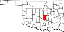 | |
| Towns | ||
| CDP | ||
| Other unincorporated communities |
| |
| Ghost towns | ||
| Footnotes | ‡This populated place also has portions in an adjacent county or counties | |